 I am fortunate enough to spend time each year in some beautiful parts of the world but when people ask me which is my favourite home I have no doubts on my reply.
Despite the attractions of Vancouver and beautiful British Columbia, historic Staunton and the Blue Ridge Mountains, cosmopolitan London or tropical Thailand, it is when I am based in the beautiful mountain village of Murren in Switzerland’s famed Bernese Oberland that I most feel at ‘home’ and at one with myself.
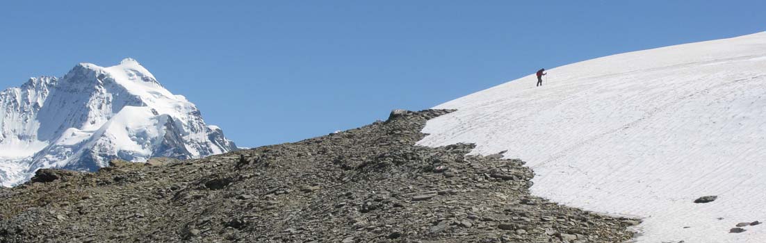
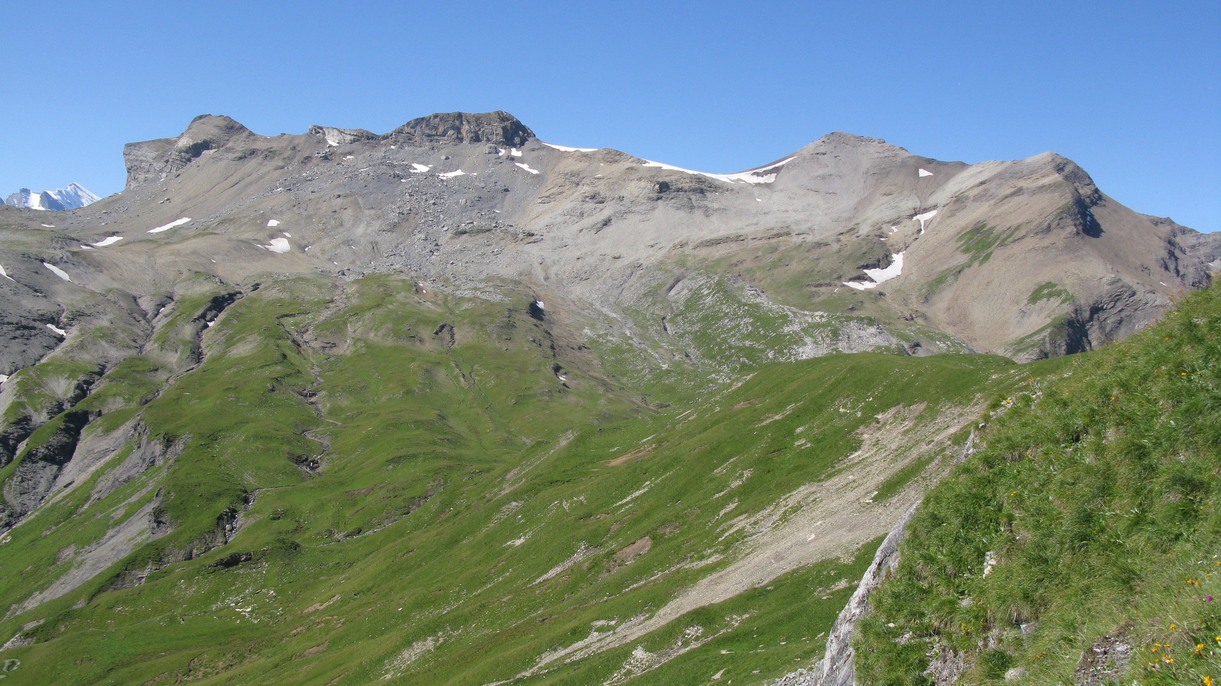
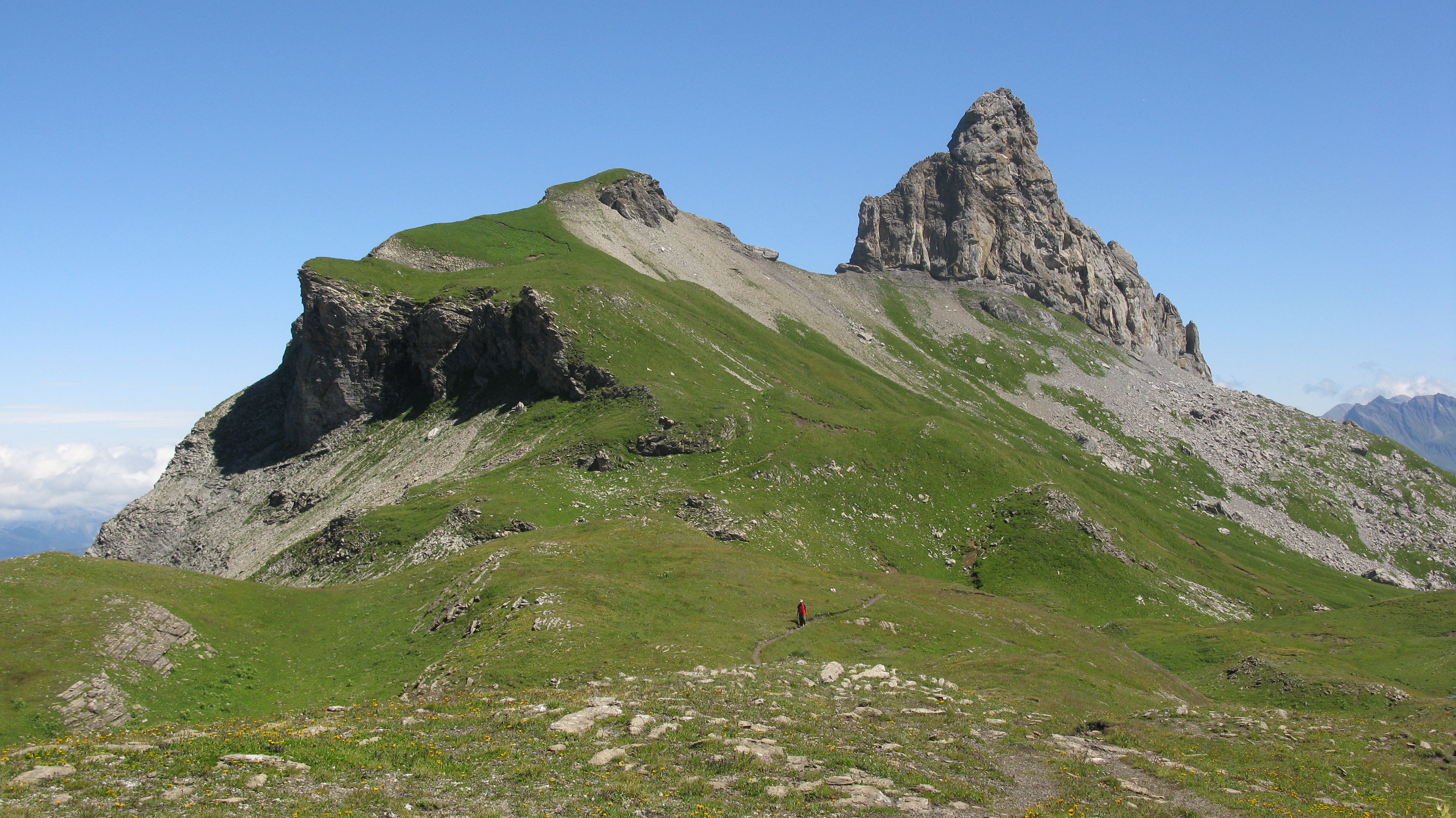
The magical Soustal Valley dominated by the Spaltenhorn with with the Schilthorn distant left and Chilchflue distant right.
Murren with its population of circa 350 has had a long love affair and association with the British and played a pivotal role in the development of downhill skiing. But I am not a skier and I have been coming to Murren every year since 1990 because of its magnificent mountain scenery and indeed there is not another village in the Alps that is quite so spectacularly located on a shelf high above the Lauterbrunnen Valley and facing the three Oberland giants – the Eiger, Monch and Jungfrau.
When I tell people we have a home high in the mountains I think they perhaps think we live in a town like Fort William in Scotland, Chamonix in the French Alps, Banff in Canada or the Mile High City of Denver in the Rocky Mountains but this is not the case.
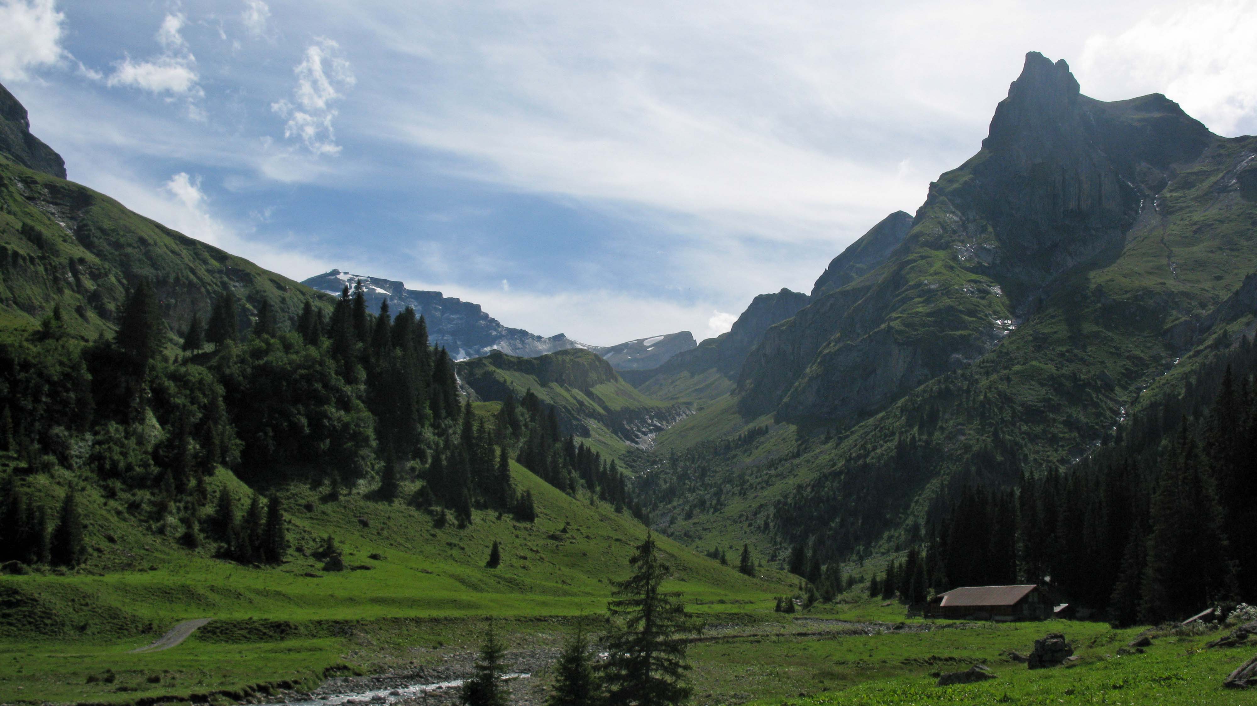
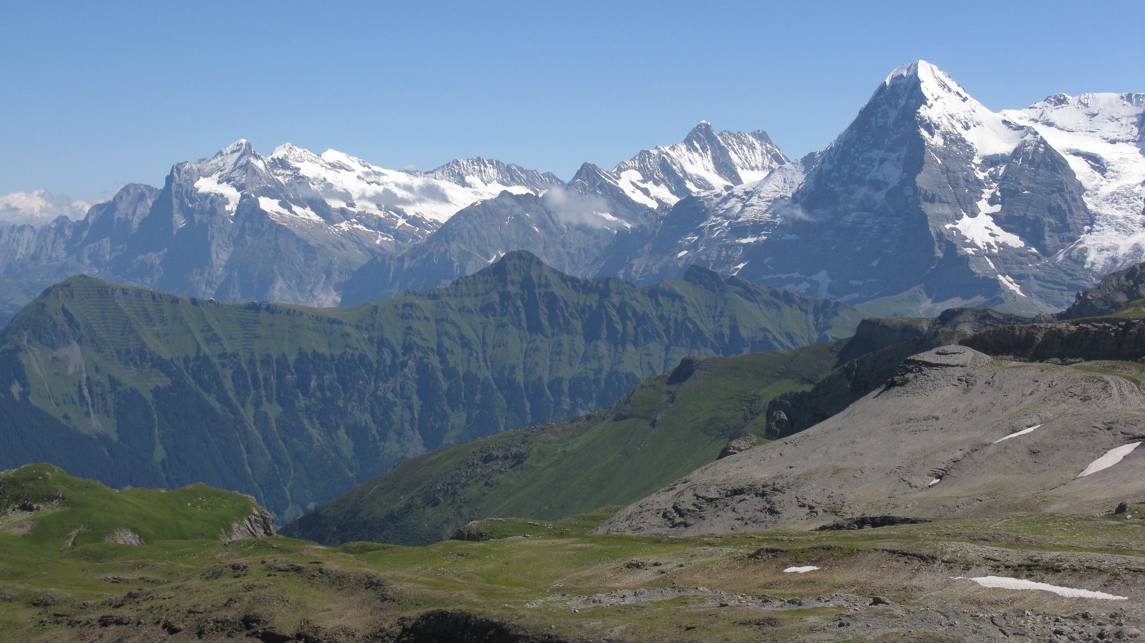
En route to the Lobhorn Hut with the Eiger behind
For Murren think instead of Namche Bazaar in Nepal (although Murren is much smaller), a village high up, surrounded by mountains and in Murren’s case one that is not accessible by road so we are not talking about a Swiss village or town like Grindelwald, Zermatt, Verbier or St Moritz with cars, dozens of shops and dozens (and in some cases hundreds) of hotels.
Murren is a small village with a post office, 10 hotels, two restaurants, three food shops including a wonderful co-op and three souvenir shops. It is located at an elevation of 1650 metres or 5400 ft and the only way in other than on foot is by cable car from Stechelberg or by a second cable car to Grutschalp which links with perhaps Switzerland’s most spectacular mountain railway for the 15 minute ride to Murren – and if you are quick enough you can sit next to the driver!
Our apartment complex with just 49 units (one resident and 48 holiday homes!) is located on the edge of this small village and within minutes of leaving the back door I am on a trail overlooking the village, ascending a stream coming down from the Schilthorn or climbing up through a forest where I am often likely to surprise a chamois or ibex.
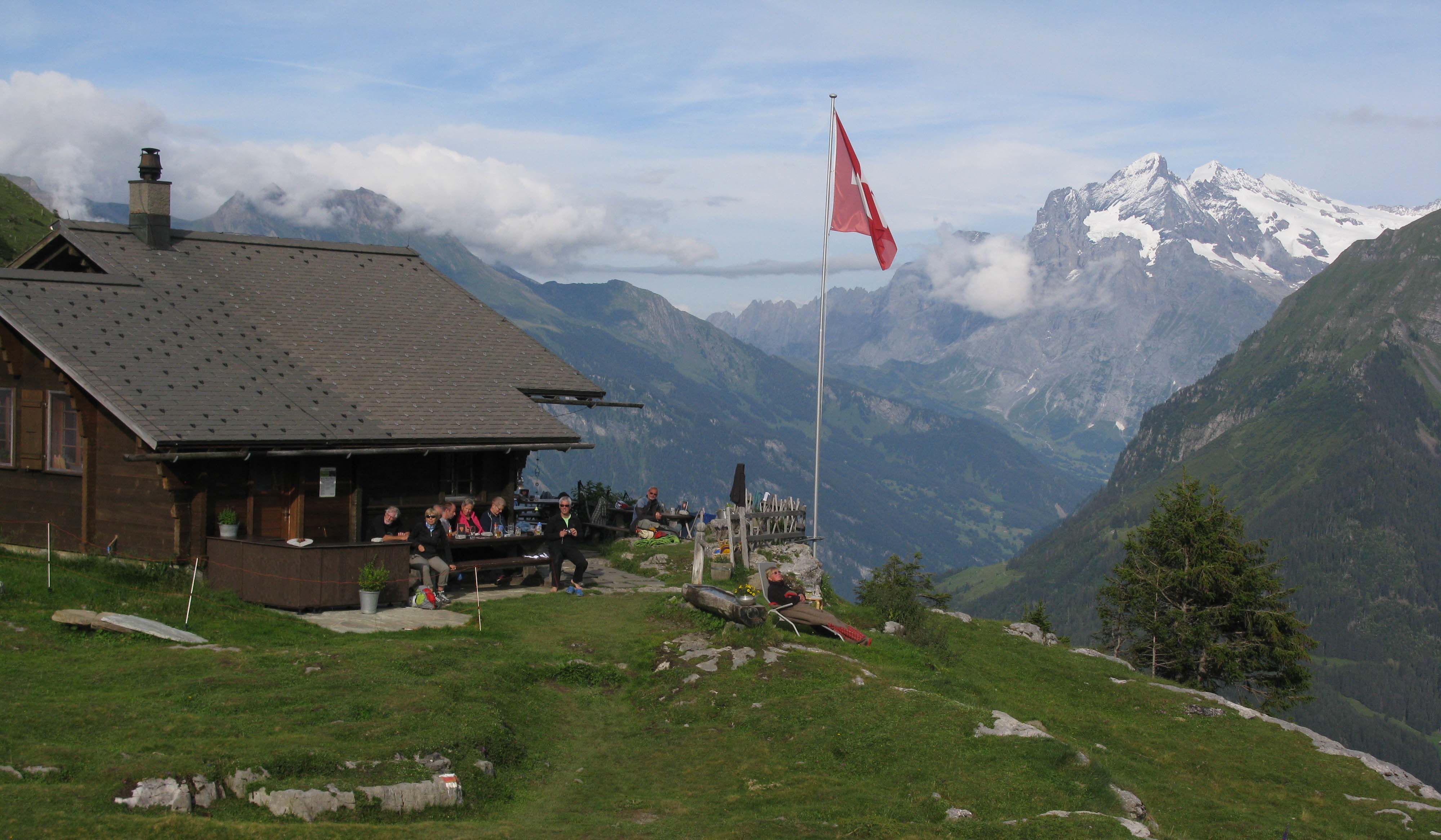
The Lobhorn Hut has a stunning location.
I have always said that when I come to Murren and start walking I can hear the solitude – because it is the sounds of water, cowbells and ice falls from the glaciers hanging off the surrounding peaks that one hears rather than people or vehicles.
It is a place I love and in truth the only place I always feel genuinely content, happy and appreciative of the wonders that surround me.
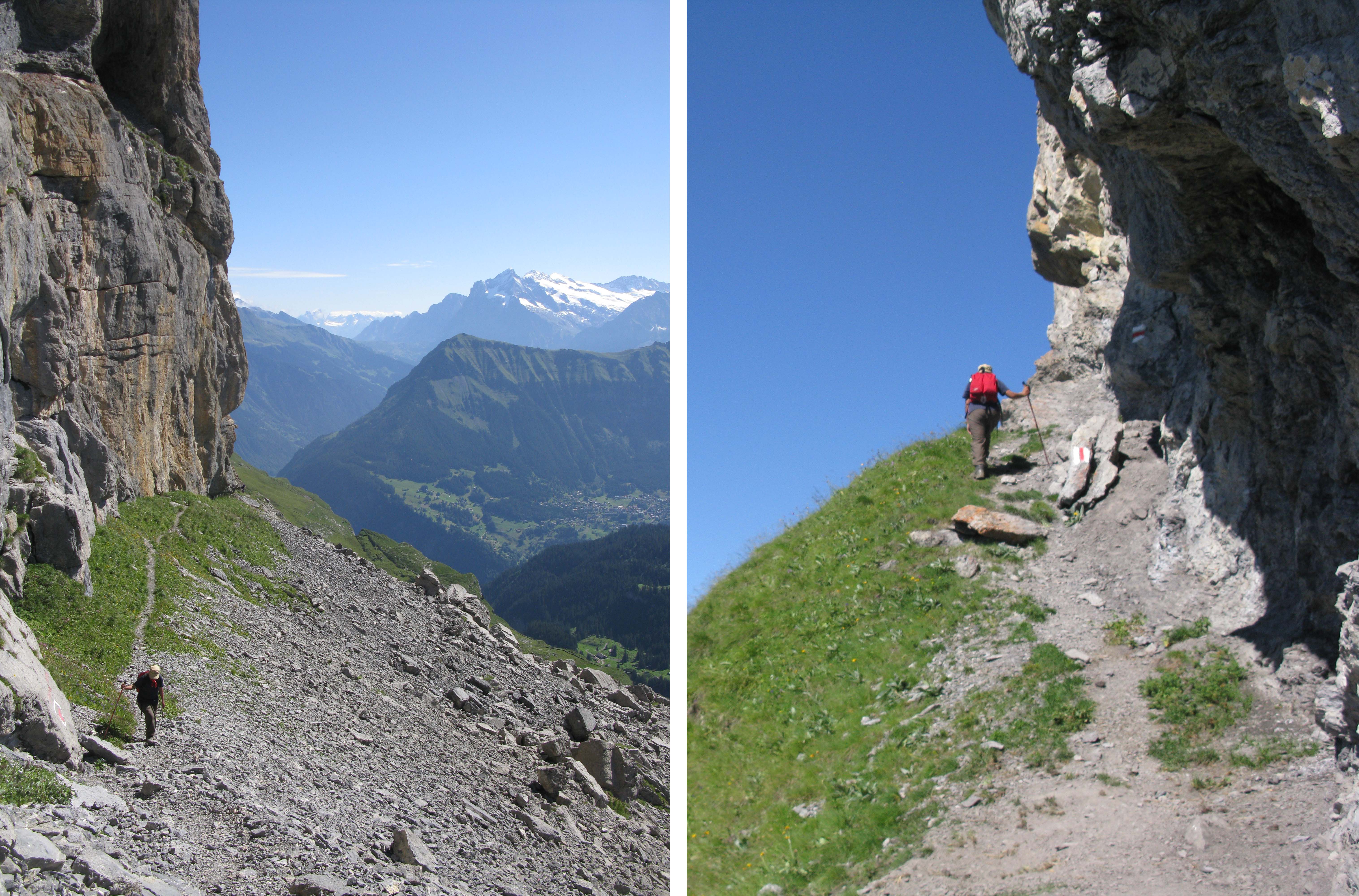
Indeed the mountains are Himalayan in scale. In the Lauterbrunnen Valley one is at 850 metres and one can view the peaks of the Eiger, Monch, Ebnefluh, Grosshorn and Breithorn which are all just over or under 4,000 metres. The summit of the mighty Jungfrau reaches 4158 metres (13,640 feet) and it is only the lower flanks of the mountain which obscure the summit so we are talking of a differential of 3,300 metres.
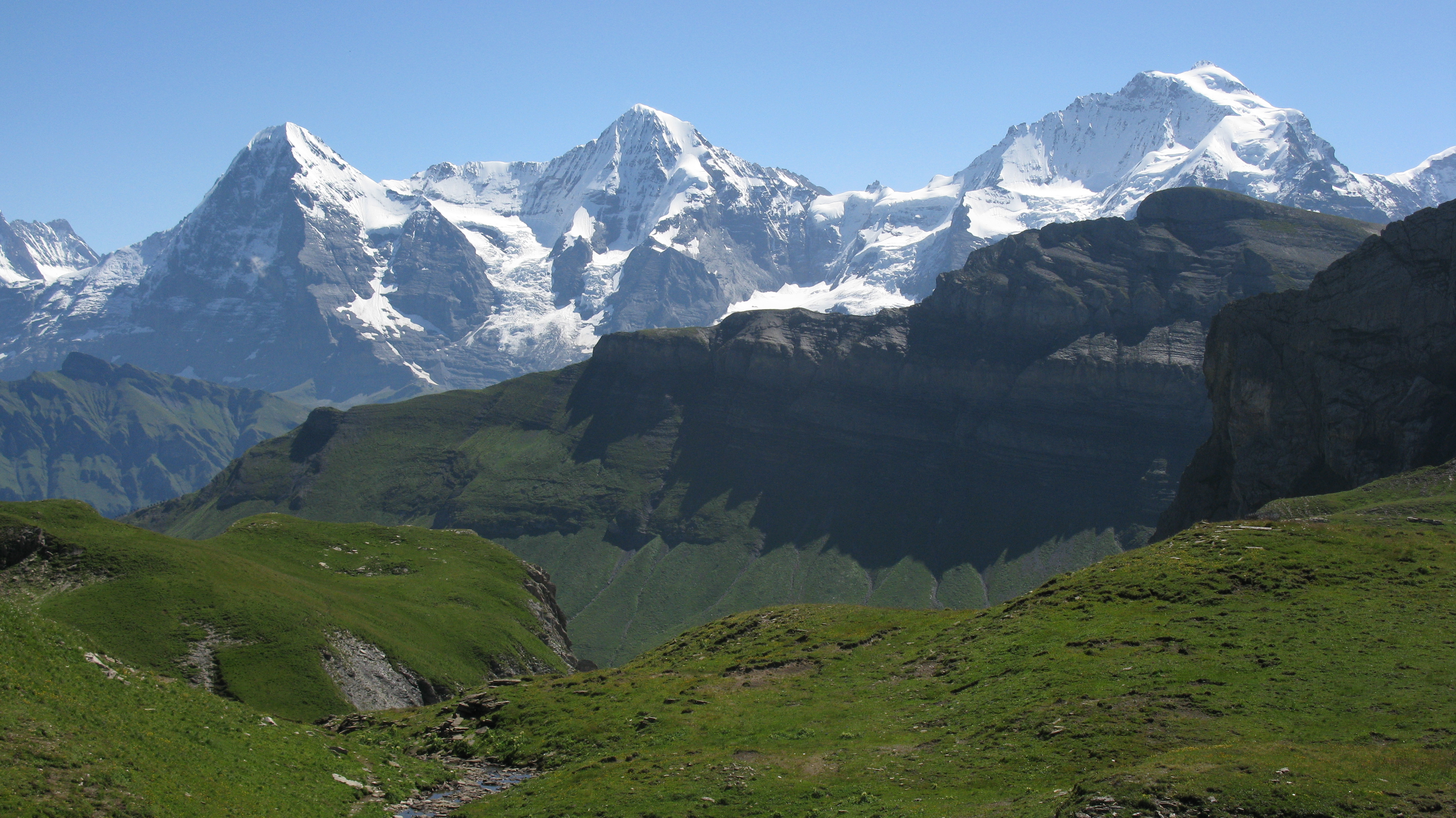
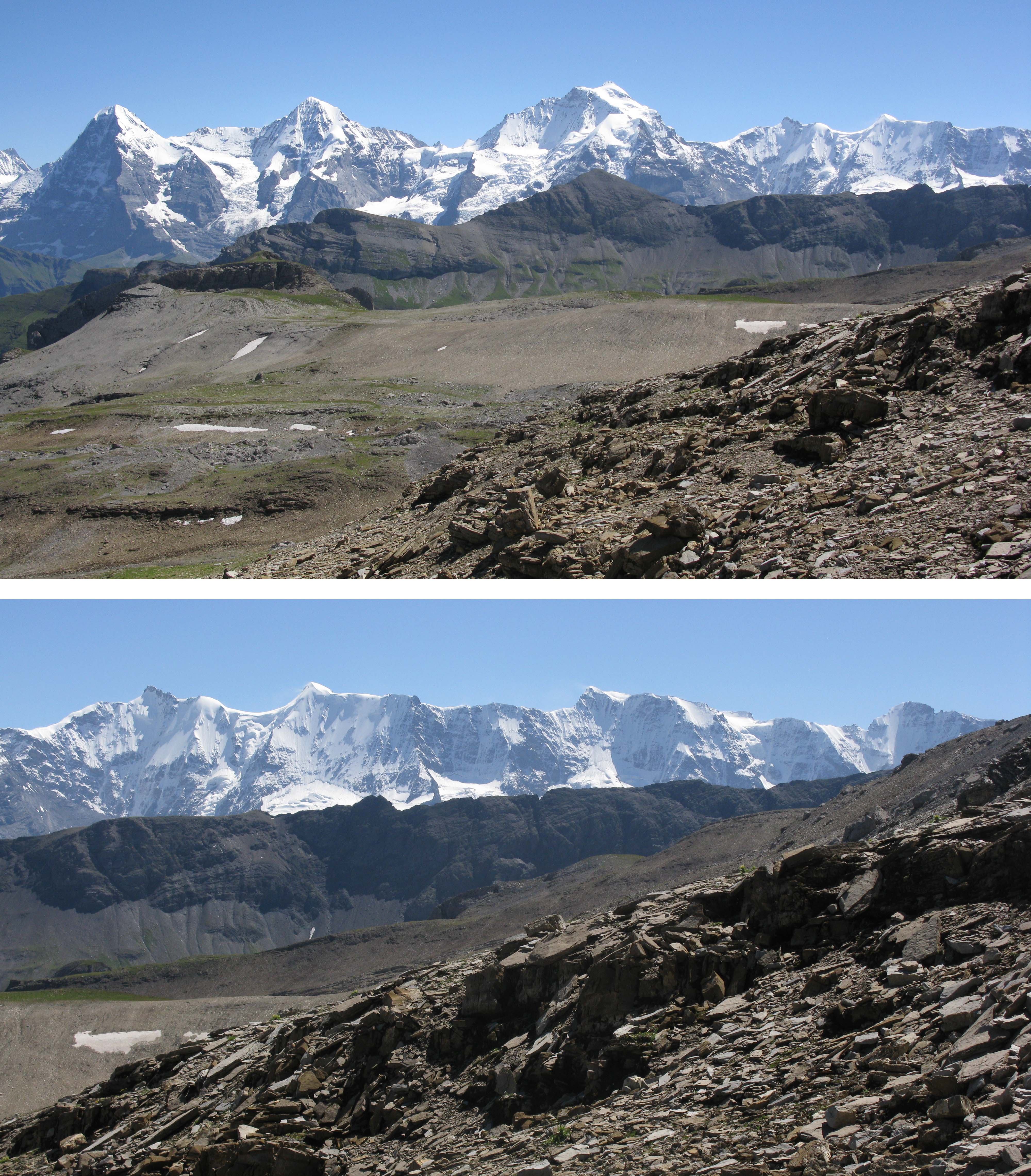
The Eiger, Monch and Jungrau from the Lobhorn Hut.
By comparison when one is close to Everest Base Camp at 5,400 metres it is just possible to view Everest’s summit at 8,848 metres above which is a differential of 3,400 metres – virtually the same, and this is why the Bernese Alps are rightly considered one of the most magnificent and spectacular range of mountains in the world.
I am not a climber but an enthusiastic hiker who has walked to the base of Everest 5 times and on its flanks once. I have walked to the summit of Kilimanjaro and completed many of the world’s well-known long-distance trails but the area I love the most are the spectacular trails of the Bernese Oberland and after coming to this area annually for 25 years I feel I know the trails of this part of the Bernese Oberland as well as any non-Swiss.
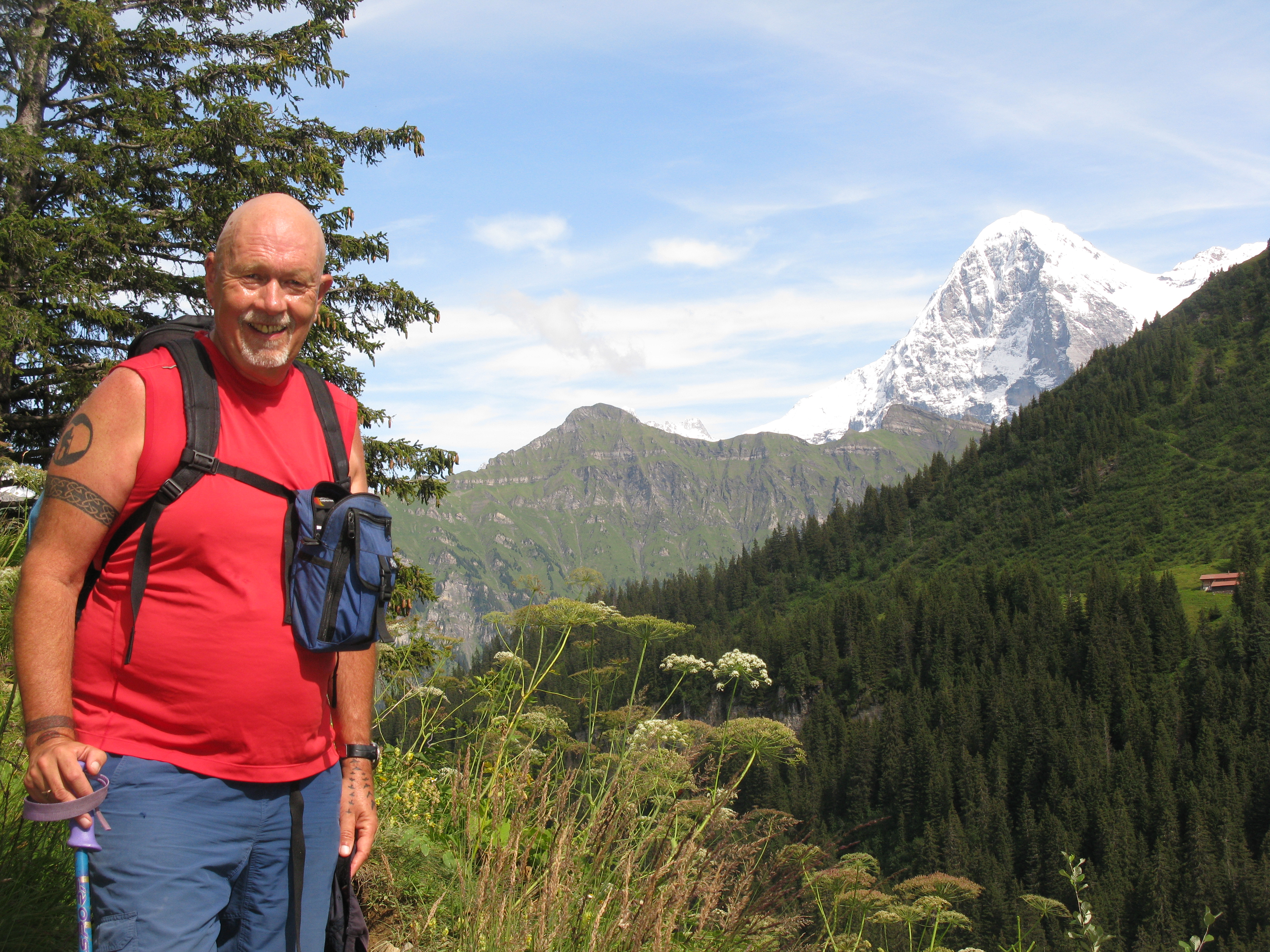
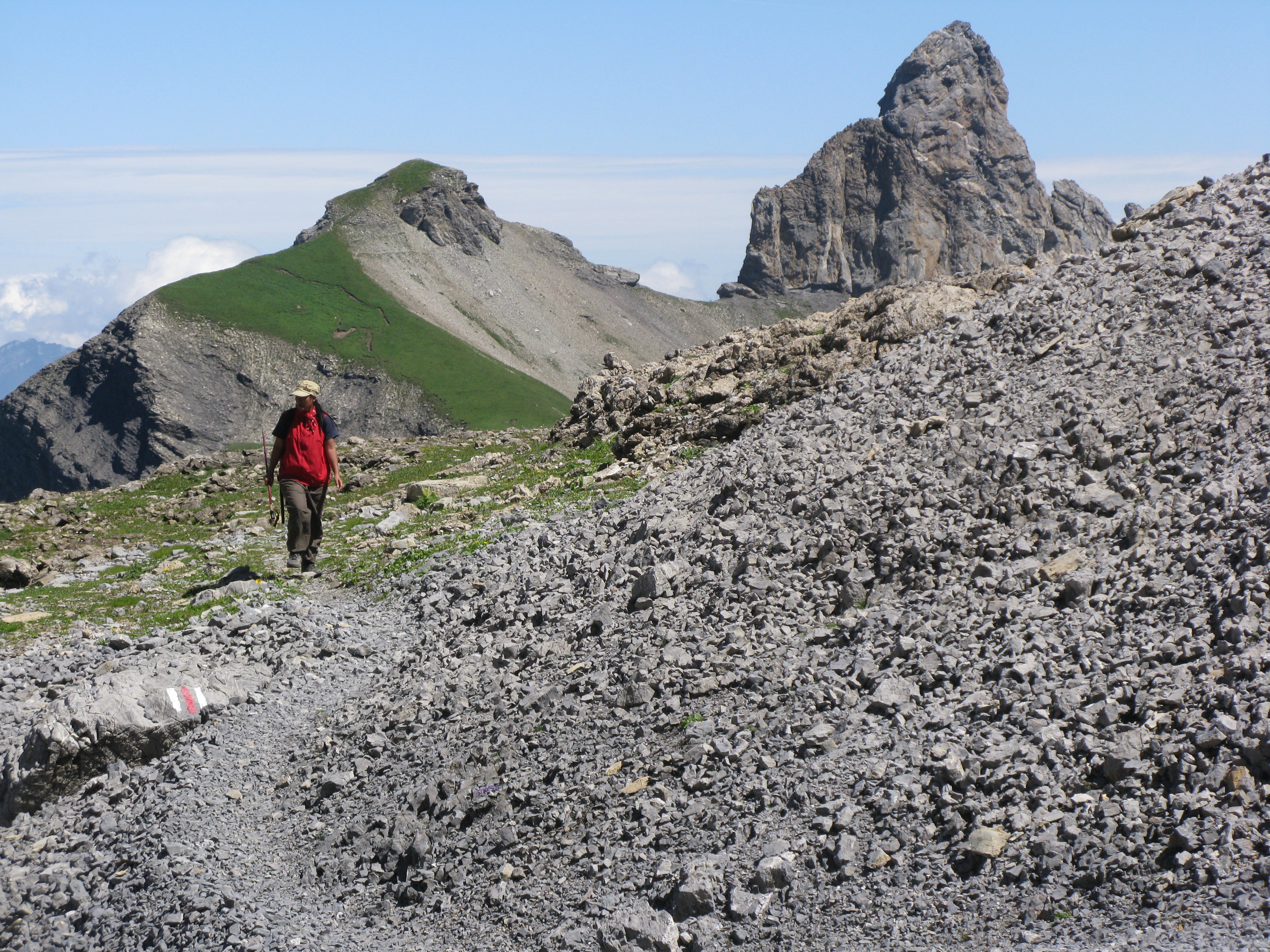
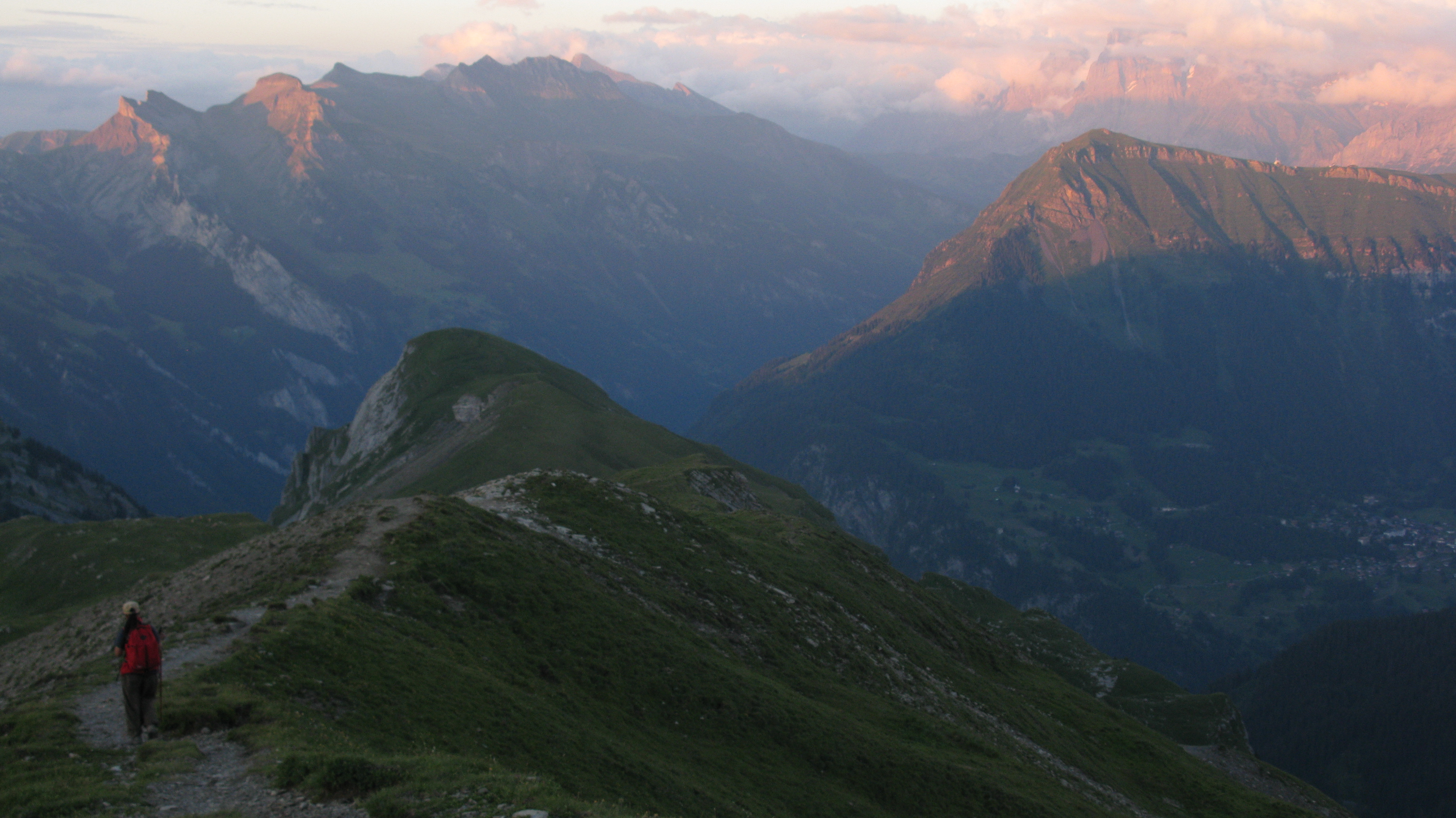
Setting off for the Lobhorn. Our route took us up the grassy valley to the left, up the knoll and along the ridge rather than taking the long ridge on the right.
Many of the trails like the unrelenting climb from the Sefinental Valley to Busenalp and Tanzbodeli are like old friends who I revisit every year – they do not grow older but I measure my aging by the time it takes me to ascend from the valley to the Alp. There are innumerable easy walks that afford spectacular views and there are those that for various reasons one puts off until another year and then aghast realise 20 years have passed and they are still on the To Do List that I pasted on our kitchen wall in 1999!
This year I planned to be in Murren for two months and with a variety of visitors I was clearly going to do some of the easier trails a number of times to give friends an introduction to the area. And I also planned to complete at least two of the four more challenging hikes that were still outstanding on my To Do list.
As it was my longest ever stay in Murren coincided with the worst, coldest and wettest summer in recent memory which was not so good for my visitors but somehow I managed to get out for 31 hikes on 30 separate days during the 8 weeks I was based in Murren which is not too shabby for a 65-year-old with a recently recalibrated heart (my second cardioversion taking place 3 days before I arrived in Murren!). I also got as wet as I can remember on a few occasions!

Looking down into the upper Soustal Valley with the Schilthorn right of centre.
Blue sky days where there is hardly a cloud in the sky from dawn to late afternoon were at a premium (just four all summer!) and most sunny mornings ended up with rain in the afternoon just as forecast by Swiss Meteo. I was amazed at how accurate their forecasting was and for any location in Switzerland they will forecast the temperature and hourly rainfall for each of the next 12 hours. Unbelievable and if not 100% fool proof their forecasts were still remarkably accurate and in mid-August Swiss Meteo were confidently forecasting two days with no cloud and no rain on August 17-18 and so I decided on an excursion to Schwalmere.
Now Schwalmere is one of those peaks beloved by the Victorians during the Golden Age of Travel because it has a fairly easy final ascent and rewards those who make the effort to get to the mountain with a an expansive 360-degree view. Perhaps the most famous of these peaks in Switzerland are Pilatus near Lucerne and the Schilthorn located behind Murren which in good weather is climbed by dozens of hikers daily from Murren and Gimmelwald.

Approaching the Lobhorn.
However although a (relatively) neighbouring peak to the Schilthorn, Schwalmere is far more isolated and difficult to access with no cable car or nearby village. It is situated almost half way between the Thunersee (Lake Thun) and the highest peaks of the Bernese Alps both about 4 miles distant and the nearest access point is the railway stations at Grutschalp from whence the summit is about a 4 – 5-hour hike. It is far more popular as a winter ski touring destination than a summer hiking option which was to be proven as we saw very few hikers, just three individuals in the vicinity of the mountain and one other party on the approach.
Rather than the 5-hour hike from Grutschalp to the summit of Schwalmere I thought we would stay overnight at the Lobhorn Hut – A Swiss Alpine Club Mountain Hut primarily used by hikers and rock climbers heading for the Lobhorn, a very striking and near vertical rocky outcrop on the northern side of the Soustal Valley.
Contouring beneath the Lobhorn.
As it was Sunday August 17 also coincided with the last day of a 3-day visit by James (my daughter Lisa’s boyfriend) and three of his mates from Australia who were en route to a conference in Neuchatel. They had arrived the late afternoon of the previous Friday and I had taken them on a 3-hour hike to Sprutz waterfall and we got wet or rather very wet. On the Saturday we had hiked from Murren to the Soustal Valley via Marchegg beneath low clouds and showers and then through the forest to Grutschalp.
But as the Sunday was set to be a blue sky day we took the first cable car up to Birg at 0740 to admire the views of all the Bernese peaks in front of us and then descended the 1000 metres (3280 feet) back to Murren fairly rapidly so by late morning they could be on their way to Neuchatel having finally sampled some of the magnificent scenery that Switzerland has to offer as well as the rain and clouds.
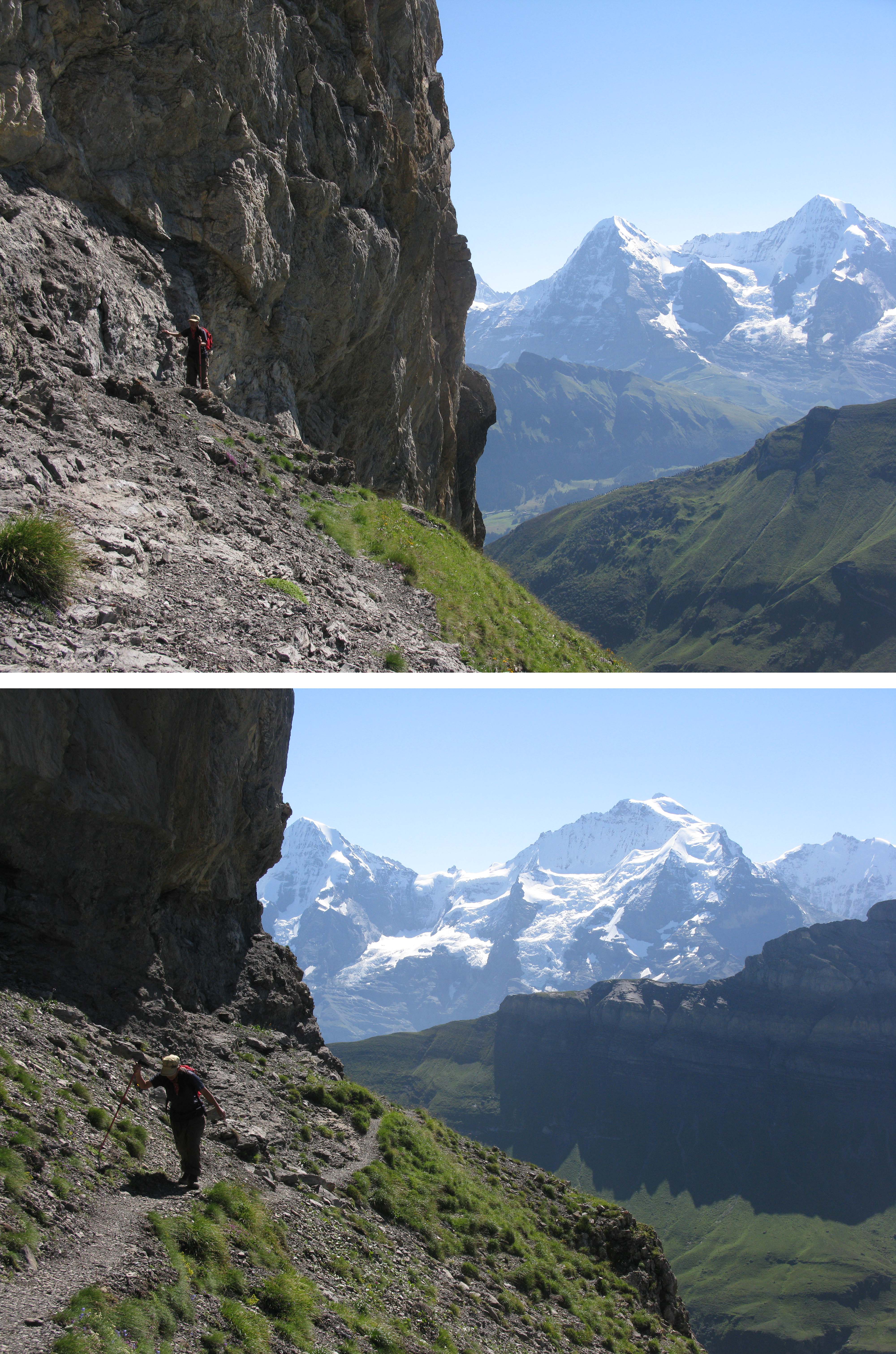
The path below the Lobhorn was a little exposed.
So it was in mid-afternoon that I set off on my second hike of the day after taking the 15 minute train journey from Murren to Grutschalp. There was not a cloud in the sky and as the train weaved back and forth along the shelf that connects Murren and Grustchalp high above the Lauterbrunnen Valley.
The three peaks that are the symbol of the Oberland, the Eiger Monch and Jungfrau dominated the views rising above the western ridge of the Lobhorn and I thought they had never looked finer but then I always think that when I make the short rail journey between Murren and Grutschalp on a blue sky day! However many times I make this trip my eyes are inevitably drawn to those magnificent peaks that are the symbol of the Oberland and I think how fortunate we are have a home accessed by one of the most spectacular rail journeys not just in Europe but in the entire world.
I was hiking with my friend Ampai who has often walked with me over the last 9 years and when we alighted at Grutschalp we saw that the Lobhorn Hut was signposted as 2 hours and 15 minutes away. We were soon retracing the previous days walk through the woods from Grutschalp to the magical Soustal Valley which is one of my favourite destinations in the Bernese Oberland. There were many tantalising views of Wengen and the upper slopes of the Eiger above the Mannlichen Ridge and eventually of the Lobhorn Hut on an elevated plateau high above the hamlet of Sulwald. With stops for a late lunch and photos the walk was clearly going to take a lot longer than two and a quarter hours!
Our first view of Schwalmere – to the right of centre.
Whilst hikers from Murren to Isenfluh or Sulwald will descend into the western end of the Soustal Valley (which is a favourite picnic place of mine) it is only the committed long-distance hikers who will penetrate the Soustal Valley to cross the Chilchfluepass and descend to Kiental or to cross the Bietenlucke to reach the Schilthorn Hut and climb the Schilthorn or descend to Murren. I think the Soustal has a real Shangri La feel and from the western end the valley is dominated by the almost fantasy like and imposing Spaltenhorn, a mountain that was too look far less imposing from the east and north as we were to discover the following day. If one looks up the valley at the very end one can spot the Schilthorn which affords a magnificent panorama and which is visited by hundreds of thousands each year courtesy of the cable car which readily transports them to the revolving restaurant on the summit. Having walked up it several times in the past I am now happy to take the cable car up and use the Schilthorn as a high-altitude starting point for a number of hikes. To the north of the Schilthorn one could make out Chilchflue, a less frequented summit which I usually manage to hike to each year as it affords spectacular views over the Chilchfluepass and the upper reaches of the Soustal Valley.
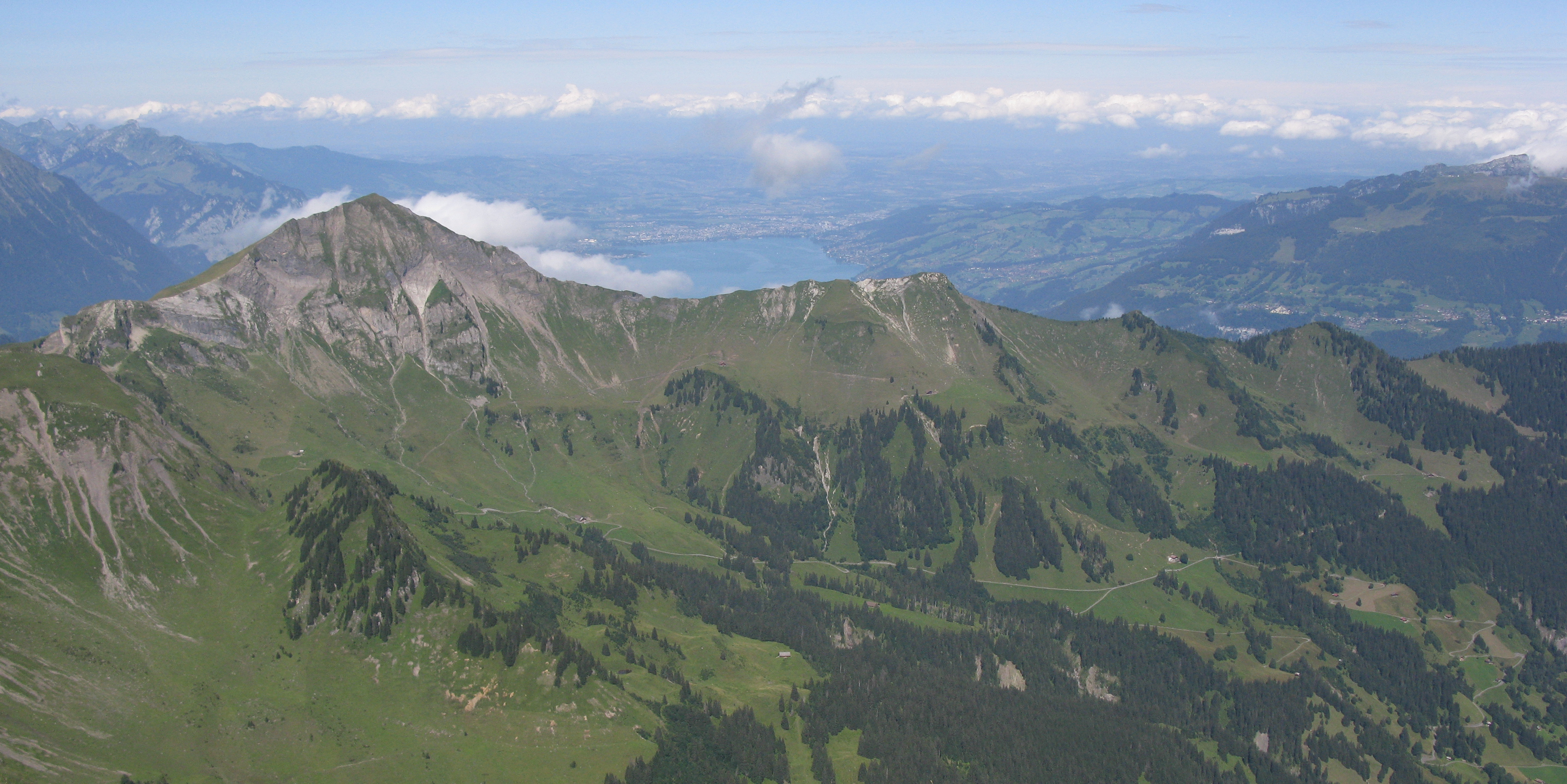
Morganberghorn with Lake Thun behind is one of my planned hikes for 2015.
We crossed the Sousbach by the new footbridge just adjacent to the bridge that had failed to survive the constant battering of the raging torrents after the annual spring snow melt raises the river’s level, and we then made the steep climb up and around the end of the ridge dividing the Soustal from the cleft leading up to the Dairy at Suls. The upper slopes of the Eiger faced us as we rounded the ridge and were clad in fresh snow which was hardly surprising considering it had rained the previous four days. We eventually arrived at Suls which I will forever associate with a forlorn wait for the rain to stop on a previous hike several years previously and from where it was only a further 15 minutes to the Lobhorn Hut where we found a dozen hikers sitting in the sun enjoying a late afternoon beer or wine.

Leaving the Lobhorn behind as the writer points out our route.
It had taken us 4 hours from Grutschalp and even allowing for a lunch stop, picture stops, Snack stops and Pee stops taking up an hour we were still significantly slower than the two and a quarter hours posted which was perhaps a harbinger of the day to follow.
Swiss Alpine Huts tend to elicit two reactions from those hikers and climbers who stay in them. Firstly everyone admires and appreciates the magnificent vistas that these spectacular locations afford and secondly no one particularly likes sleeping in the communal dormitories where there is usually one vocal snorer whose only attribute is to drown out the occasional farts. £50/$80 will usually buy one a four course dinner of soup, salad, pasta and desert and a breakfast of Bircher muesli, bread, jam, cheese and coffee. A new sleeping annex had been built since I was last there 15 years previously and that was where we were housed.
The Lobhorn takes on a different appearance from the north and provides a striking contrast to the high Alps behind.
The Lobhorn Hut is less than a 90-minute walk from the Isenfluh to Sulwald cable car (although we had preferred to walk rather than take an additional cable car and bus from Grutschalp to Isenfluh) so for those hikers arriving after just a 75-minute walk from Sulwald the location afforded a lot of bang for the buck with spectacular views of the Wetterhorn, Eiger, Monch and Jungfrau and down across the Lauterbrunnen Valley to Wengen, the sister car free village to Murren although many times bigger.
After a filling dinner and beautiful views with the pink Alpenglow on all the peaks the Lobhorn Hut certainly afforded us and another 12 guests a pleasant night’s stay as no one snored obsessively (unless it was me!). The only blot on the night was that I had forgotten to put my wide necked pee bottle in my pack but hey ho, not to worry as I emptied my water bottle and with careful aim perched on one hip was able to fill it without mishap which saved me a visit to the outside toilet during the cold night which approached freezing point. I just had to make sure I flushed my water bottle out the following morning before it resumed its normal function!

After the Lobhorn the route descended to some easier terrain.
I had left in such a hurry the previous day I had forgotten to bring my photocopied guidebook notes but the route was clear from my map and I asked Lisa, the hut warden how long it took to reach Schwalmere and she replied ‘Most people take three to four hours’
When we left at 0840 there was not a cloud in the sky and we had great views of our immediate destination – the Lobhorn which is a very distinct landmark being a rocky outcrop with four separate but connected towers before a distinct col (gap) to another slightly lower rocky outcrop. Little were we to know that Lisa would be locating us through her telescope still on that col almost 12 hours later mid evening! I assume the Lobhorn is the remains of a volcanic plug as it stands alone and soars upwards from the ridge and is not dissimilar to the famous Black Tusk in British Columbia Canada.
It turned out we were the only ones heading for Schwalmere as the others were hiking to Murren in one direction or to Ballehochst and Saxeten in the other whilst there were also some day hikers climbers heading to the Lobhorn but by an alternative route to ourselves.
Magnificent views of the Eiger, Monch and Jungfrau high above the Soustal Valley but there was to be no easy descent to the Soustal!
We retraced our path for 15 minutes to Suls (1910metres/5920 ft) where the sign advised us it was three and a half hours to Schwalmere and then we started the long climb up a grassy gully towards the milking sheds at Sousegg where a farmer spends the summer milking the cattle who spend a couple of months on the surrounding high pastures. Incongruously there is a small cable cart quite literally in the middle of nowhere used to transport the milk down from Sousegg to the dairy at Suls to be made into cheese and our route was broadly parallel to this. I remember thinking route finding could be tricky in poor light or if the clouds were low with parts of the trail hidden by long grass and always the risk of twisting an ankle with potholes and hidden rocks. As it turned out this was quite prescient of me!
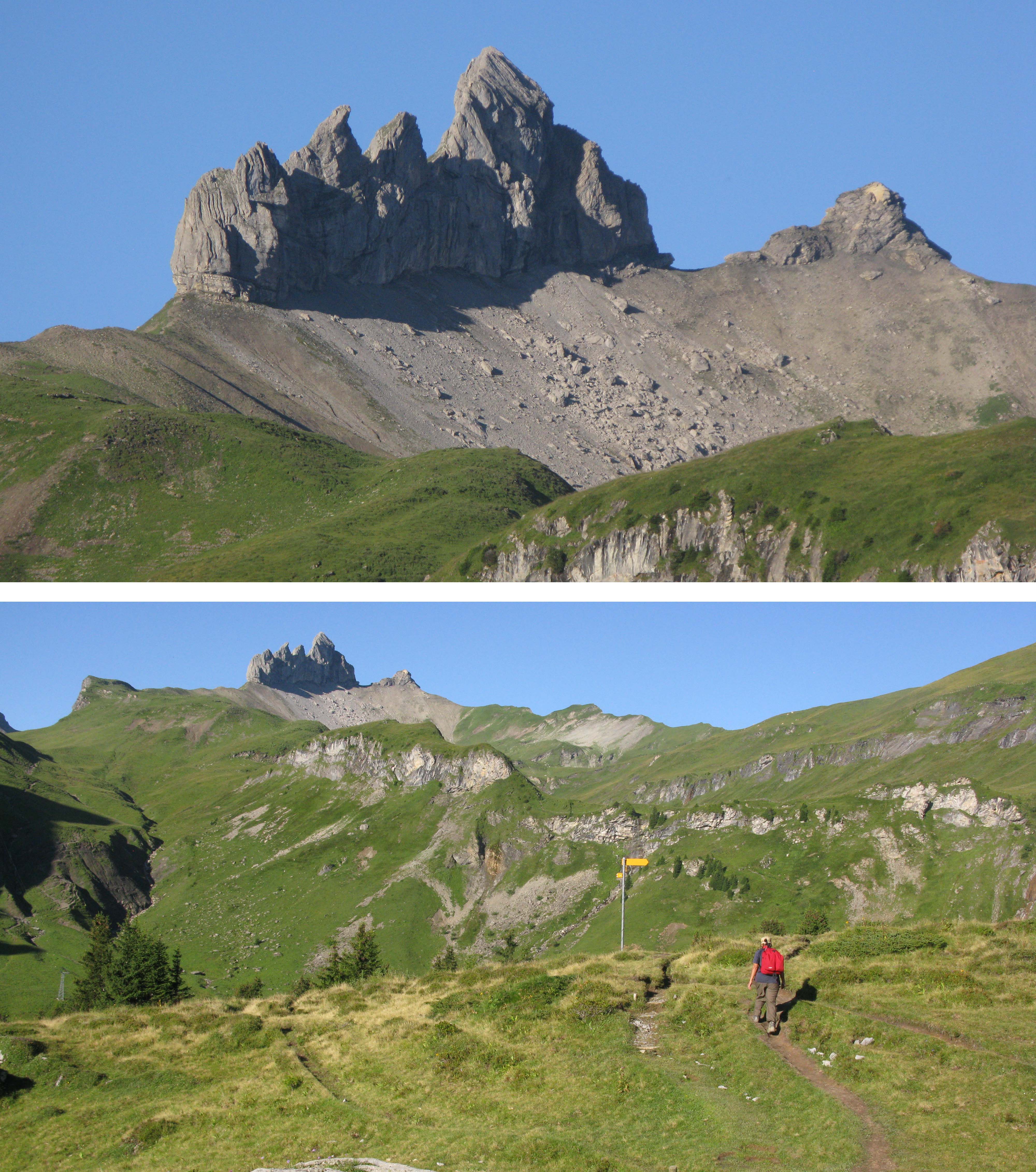
Yet another perspective of the Lobhorn, easily
recognised from afar but rarely visited!
It took us 45 minutes to climb the 230 metres to Sousegg at 2140m/6630 ft and we skirted the milking sheds and made our way to the ridge high above the Soustal that led to the Lobhorn. The views down into the Soustal where we had crossed the Sousbach the previous afternoon and also into the the rarely visited upper Soustal Valley were magnificent. We had the additional distraction of watching a helicopter apparently practice rescue pick-ups on another ridge leading up to the Lobhorn from the north.
We finally reached the base (2400m/7440 ft) of the Lobhorn at 1044, two hours after we had left the hut and got our first views of the beautiful but wild country beyond. However as the posted time was only an hour and ten minutes from Suls and we (or should I say I!) had taken an hour and 45 minutes maybe we were not going to get to Schwalmere in 4 hours from the Lobhorn Hut! We were not alone as high above us on the vertical rock face two rock climbers who had also stayed in the hut were busy ascending the vertical face of the first tower in the Lobhorn group.
As we approached Schwalmere the terrain got more rugged.
After a ten-minute break we continued along the rocky trail which skirted the southern base of the Lobhorn. It was not really dangerous but a little exposed and there was a little scrambling when we had to use our hands but this could have been because I lost the trail proper in a few places. For sure it was enough to get the adrenalin flowing and quite clearly Ampai was no longer enjoying herself as she does not like walking on steep shale or anything that moves so we took a break only to be overtaken by two more hikers who came up behind us. They must have started from Sulwald as we did not see them in the hut and as they were in their 70s and having no difficulty with the terrain this put our discomfort into perspective and so we continued on until we eventually traversed below the Lobhorn and got to the col between the Lobhorn and the next rocky outcrop where we took another break.
We noticed that the older couple and another solo hiker who came up behind us took a right at this point and headed towards the ridge where we had been seeing the helicopter practising whatever and clearly we were the only ones heading towards Schwalmere. Given how Ampai had not enjoyed the previous 20 minutes traversing below the Lobhorn she was wondering if Schwalmere was going to be more of the same and was happy to head back the way the other hikers had gone.
The Lauterbrunnen Wall is one of the most imposing mountain features to be found anywhere and is well named.
I pointed out the weather was perfect, the scenery was fantastic and I had waited almost 20 years to go to Schwalmere so that was not an option but if Ampai was not happy at any point she could wait on the trail until I came back. So on we continued across the shale slopes below the second rocky outcrop which was nothing like as tricky and we stopped for a chocolate bar on the grassy slopes beyond the outcrop which like the last 90 minutes offered magnificent views but now in every direction as we were no longer below the Lobhorn..
It was wild country as in remote, rugged and far from any settlement although we could see the village of Saxeten far below in the distance but our route towards the final approach to Schwalmere was clearly visible as the trail descended to cross grassy slopes to reach a col of sorts and then continued on to reach before some rugged rocky and boulder clad areas completely bereft of vegetation and I that suggested would be a good area for Ampai to wait.
To our north and east we could see the rounded slopes of Ballenhop blocking the view of Ballehochst, an easily accessible hiking destination from the Lobhorn Hut which affords great views over Interlaken and the Brienzersee. Far below we could also see the village of Saxeten and the Saxeten Valley where 21 young travellers (mainly Australian) had tragically died canyoning in 1999, and across the valley Morgenberghorn another lesser peak that is nothing more than a day hike from Saxeten and like Schwalmere long on my ‘To Do’ list and Lake Thun.
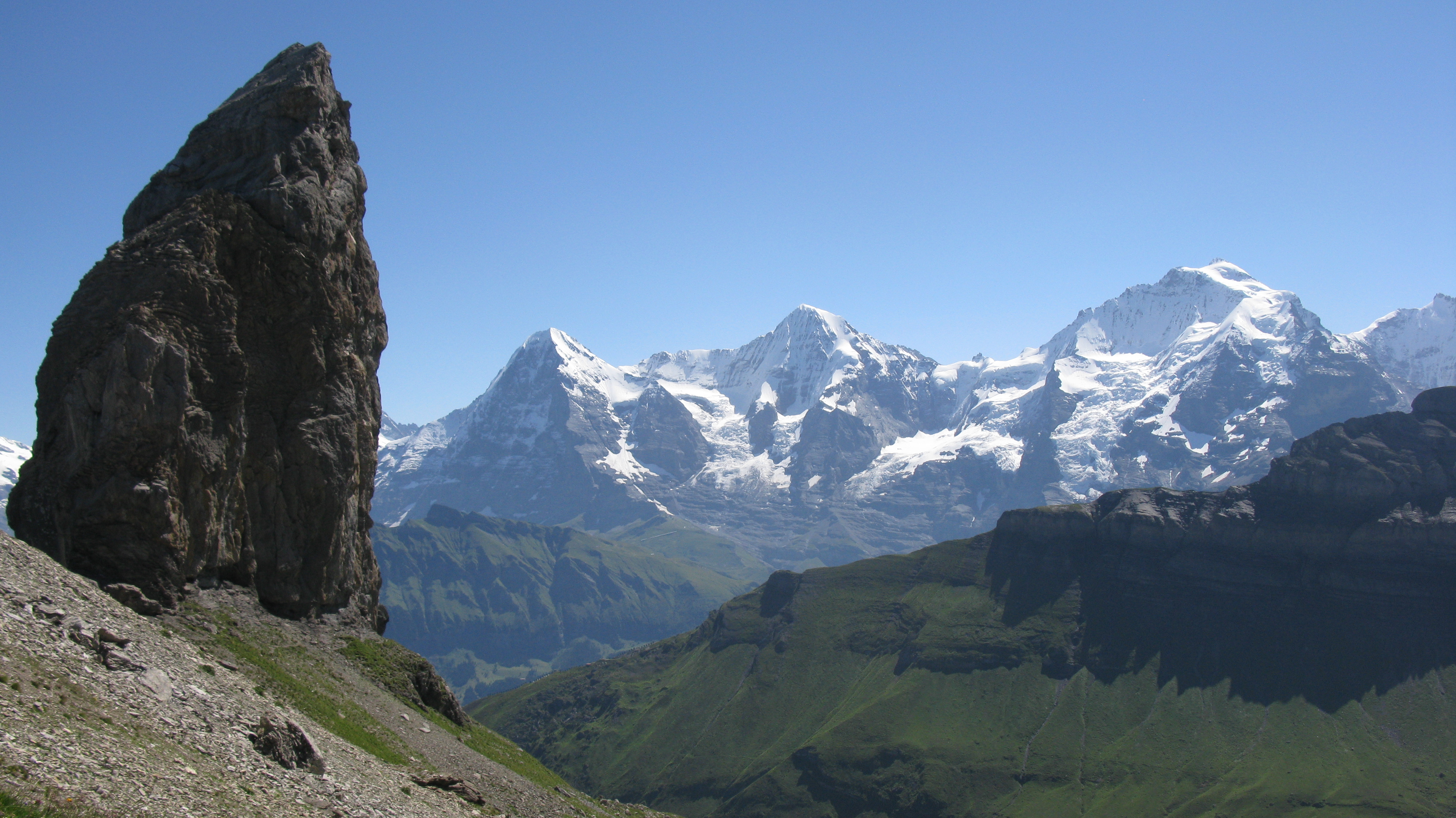
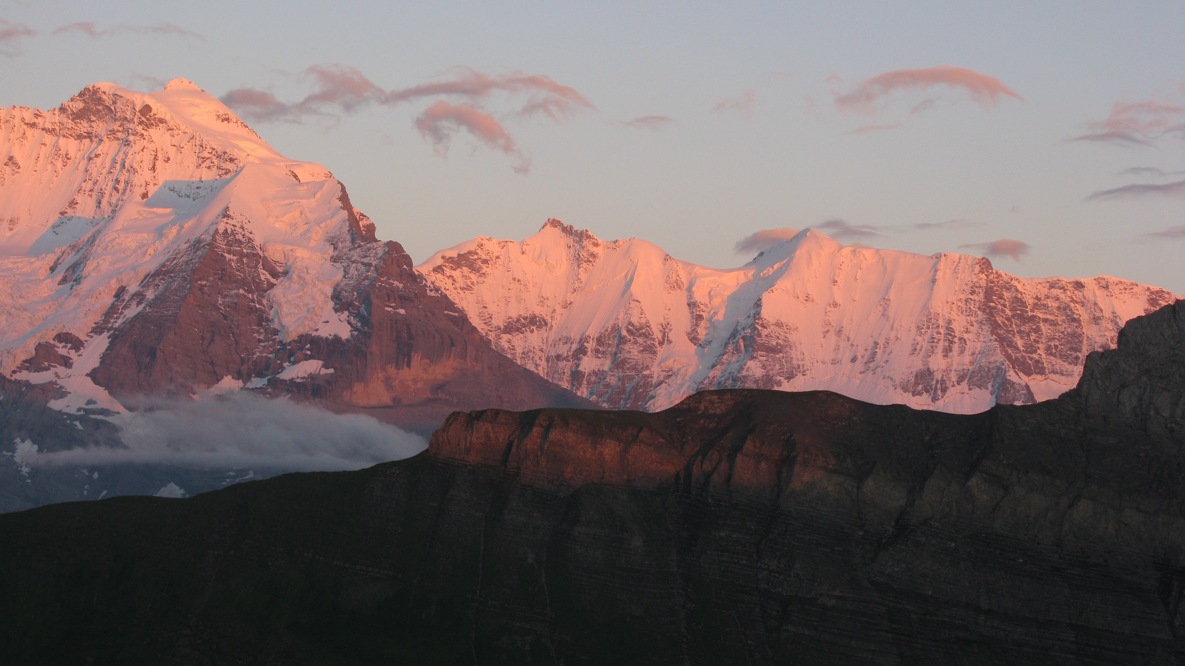
Legendary Peaks familiar to mountaineers worldwide. From the left the Wetternorn whose first ascent marked the birth of mountaineering, the Schreckhorn and the infamous and imposing North Face of the Eiger.
I was already wondering if there was an alternative way down that meant avoiding the traverse below the Lobhorn on our return journey and saw what I thought was a hiker on a clear trail a few hundred feet below us and my map also indicated there was a point where if we crossed some flattish land we should meet a rough trail which would take us down into the Soustal Valley which meant we could continue to Grutschalp without having to scramble below the Lobhorn again. Clearly this hiker was on that trail so we could see an easy way back as an option for our return – or so I thought!
No hiker likes descending when one knows you have to go back up but we dropped down to the col which left us with 400 metres or 1300 feet left to climb and made our way along and easy trail. To our left we could see the Spaltenhorn which looked little more than a nondescript bump on a plateau rather than the dramatic peak that dominates the Soustal when viewed from the valley but most impressive of all was that as we moved around from the Lobhorn we could now see the full majesty of the northern slopes of the Bernese Alps including from east to west the Wetterhorn, Schreckhorn, Eiger, Monch, Jungfrau, Gletscherhorn, Ebeniflue, Mittaghorn, Grosshorn and Breithorn.
Lunchtime with the summit of Schwalmere behind – but still 40 minutes away!
It was easy to see why the peaks from the Eiger to the Breithorn are known as Lauterbrunnen Wall as a high ridge connects the succession of near 4,000 metre (13,120 feet) peaks each with its own dramatic and almost vertical North Face of which the famed North Face of the Eiger, ‘the Eigerwand’, is the most impressive famous or should I say infamous. From our position between the Lobhorn and Schwalmere it looked like a continuous snow clad wall or barrier and the dramatic impact was all the greater as a result of the barren and rocky southern ridge above the Soustal Valley being in the foreground and accentuating the impact of the snow clad peaks behind.
My eyes are always drawn towards the graceful summit slopes of the Ebeniflue which I always liken to the breast of a woman with an arched back. Perhaps that’s why it always entices my lingering eyes and why it is the sole high peak (3962metres/12,995 feet) in the Bernese Oberland that I have climbed. I hasten to add this was from the easier southern side after a 4 day hike from Murren to the Hollandia Hut. It was my worst ever day in the mountains, I fell into two crevasses and when we got to the summit where for years I had longed to view down on Murren across the Lauterbrunnen Valley I could see all of ……………3 metres so thick was the cloud! At least I have earned the right to return by helicopter with some heli skiers to admire the view on another day!
Crossing the snowfield to access the Col beneath Schwalmere.
Whilst I admired the vistas I remembered reading an interview with a famous Swiss Alpine climber some 10-15 years ago and he said ‘Whilst I enjoy climbing and challenging myself against the greater peaks I really love walking between two and three thousand metres where you are both in the mountains and can truly enjoy the vistas and appreciate the scale of everything that is around you in its totality.’ Never were these words more applicable because scenically this walk was turning out to be magnificent.
After the low point between the Lobhorn and Schwalmere we slowly regained the altitude we had lost and I was forever checking my altimeter checking off each hundred metres ‘three hundred to go, two hundred and fifty to go’! The path was easy to follow even as were clambering over the boulders with easily visible markings although I could see why the only guidebooks I had found that featured this route suggested turning back at this point in anything other than clear weather because it would be easy to get lost amidst the scree and boulders if one could not see the markings!
The ‘Sattel’ with Blumisalphorn prominent behind.
Most Alpine Passes are desolate places.
At 2554 metres (8380 feet) we found a large flat rock that would work as a table and had a leisurely 40-minute lunch as the cloud started swirling over the col below us and I noticed a lone hiker descend from the summit. Clearly he had ascended from the Kiental side of the mountain. As the way had been fine so far Ampai announced she was happy to continue until the scree was too unstable and so we set off again after leaving our day packs at this point to save carrying them the last 200 metres.
Ampai had set off before me as I was sorting out what to leave and having a pee and she was soon approaching the col which separates Schwalmere from the neighbouring peak of Hoganthorn, interestingly enough the exact height of Schwalmere. Left to my own devices I had inadvertently lost the trail which was what Ampai was trying to shout and gesticulate to me although with my hearing and the wind I had not got a clue what she was saying! I think once I had lost the trail I was trying to avoid the snowfield on the col but the alternative route that joined the summit ridge was clearly going to be too steep to reach directly so I gave up that on that option and followed Ampai’s (correct) route. I caught up with her on the col (appropriately named ‘Sattel’ on the lone sign post) after crossing the snowfield following her footsteps and those of other hikers in recent days. The signpost advised it was only another 4 hours if we wanted to continue to Kiental! No thanks as that was not on the agenda but as things turned out it would have been quicker!
The final ascent.
The col like so many was a bare windswept place devoid of any vegetation and with spectacular views towards Blumisalphorn but all that remained for us was the final steep walk up the scree slope to the summit and we passed another hiker on his way down. Ernst lived in Bern and was taking advantage of the outstanding weather to hike up Schwalmere and when I commented that I was surprised at how few hikers were about he said Schwalmere was far more popular as winter destination for ski touring. We bade our farewells, continued up amidst the wind and finally made it to the summit of Schwalmere at 1455.
Joined on the summit by a climber who had made his own route up!
Only six hours and ten minutes after we left the Lobhorn Hut! However in our defence our accumulated stops had accounted for 75 minutes and I had also taken 180 pictures as I walked.
No sooner had we arrived at the summit when we spotted a lone figure striding up the eastern ridge along which there was no marked footpath and it turned out be an obviously very fit and experienced mountain walker /climber who had climbed Morgenberghorn and then followed the ridge crest around to make his way to Schwalmere. It was very windy and cloud was coming and going below us but we had a pretty spectacular 360 degree view including the Lakes Brienz and Thun to the north and the entire
Bernese Alps from the Wetterhorn to Blumisalphorn.
After 20 minutes on the summit we started to descend carefully over the steep shale back to the Sattel where the sign told us it was a mere 3hours and 40 minutes to Grutschalp. As it was 1530 and the last train from Grutschalp to Murren was at 2035 we had time a plenty and some wriggle room. Or so I thought!
Made it!
It was not long before we had collected the day packs we had left on our lunch spot and also passing a group of 4 very tired looking Belgian boys who had walked with heavy packs all the way from Interlaken to climb Schwalmere and then camp somewhere on the trail below the mountain. However after chatting to the Belgians (‘You really walked from the centre of Interlaken rather than take the train and cable car to Grutschalp?’) and videoing the will of the wisp cloud formations that were dancing above our heads as we approached the low point between Schwalmere and the Lobhorn we did not have quite so much wriggle room but not to worry as I proposed to take a short cut down into the Soustal Valley.
My map clearly shown a rough trail from the Soustal to some probably disused farm buildings high above the Soustal and that poorly maintained trail continued beyond the buildings towards the low col between the Lobhorn and Schwalmere. Surely that was the trail I had spotted this morning and it did not look as if it was much more than a kilometre from the col to that trail which would surely lead us down to the Soustal without having to contour round under the Lobhorn which I knew Ampai was not looking forward to repeating.
Ampai on the summit of Schwalmere.
So off we went and sure enough we were soon on the trail and even better it was marked with (faded) flashings. However after the best part of an hour I was getting concerned as we were not making much of a descent and had already passed high above Oberberg, a long way below us in the Soustal and close to where the route I was hoping to be on descended into the Soustal. I correctly deduced this was an alternative route to Sousegg on the other side of the Lobhorn and where we had passed this morning. The good news was we were wanting to go to Sousegg but the bad news was the condition of the trail deteriated and eventually crossed some very steep scree slopes which Ampai was not minded to cross.
‘’Don’t be silly Ampai, we have to go on as we have no time to go back and this is the right direction. Its quite OK – let me go first’ was my not very sympathetic response. However after and four or five steps on to the slope I was not at all comfortable so returned with the pithy comment
Time to descend
‘Well if YOU don’t want to go on I guess we will have to go back’
We later worked out that the trail we were on was the former route from Sousegg to Schwalmere which had been replaced by the more exposed path that hugs the base of the Lobhorn and which would be less susceptible to stone and rockfall. And the lone hiker we had seen that morning was
probably the surefooted farmer at Sousegg out looking for his cattle.
I was not happy as we had to go a long way back but I was sure there had to be trail down to the Soustal at some point and we ventured a little way down two gullies which ended up in impassable cliffs and I gave up on the third as we would have to descend a long way before we could see if it was passable.
Back at the Sattel. As it turned out it would have been quicker to go right and walk to Kiental in 4 hours!
Every time Ampai asked me a question I got more frustrated and we had long since lost any chance of getting to Grutschalp and just responded with ‘I cant hear you’ or ‘well what do you suggest’. I am not at my most sympathetic when the person with me starts getting nervous and rather than reassuring it brings out my worst qualities…………’Well You wanted to turn back!’
I was beginning to think we would just have to find somewhere with some shelter besides a rock to sleep out for the night as we were a long way below the Lobhorn and had to make our way back to the col, climb up to the Lobhorn and by that time it would surely be too late to scramble along the trail beneath the rock face.
I was able to call my friend Andrew back in Murren and tell him we would not be back in time to join him and his wife for dinner as planned and where we were in case we had any problems and did not make contact with him the following day and we eventually made our way back to the col perhaps three hours after we had left it on our short cut to the Soustal.
The usual afternoon cloud coming in!
It looked a steep climb back up to the base of the Lobhorn but as I had a good signal I called Lisa, the warden of the Lobhorn Hut to see if there were routes down to either Saxeten or the Soustal. ‘Very definitely not’ was the answer and the only way back was the way we had come which I was hoping to avoid.
When I suggested as it was now 730pm it was going to be too late to make that traverse in the dark I was told there was plenty of time left and not to even think about sleeping out. Lisa asked if we had head torches and normally even on a short day hike I always carry waterproofs, a head torch and a whistle and make sure my companions have the same as the weather can always change rapidly in the mountains and a simple fall and badly twisted ankle can leave one immobile and benighted at any time. However sods law on this occasion we only had one head torch between us and the previous evening in the Hut I had noticed the battery was getting low. Of course I should have checked it was soon as I had arrived in Murren this summer and bought a second torch for Murren as I could only find one in my hiking drawer in Murren.

Unsuccessfully looking for a short cut down to the Soustal to cut out the Lobhorn. The gullies were all impassable.
‘Make your way up to the gap between the first rock outcrop and the Lobhorn and call me from there’ said Lisa ’and I will set off with a couple of head torches and meet you. It should only take you an hour to get here after you have contoured below the Lobhorn’
I have to say in the mid evening light the Lobhorn looked spectacular bathed in a golden glow and the closer we got the more it looked like an isolated pinnacle quite different from its usual appearance from the south and west. Late or not I could not resist capturing some more images and caught up Ampai at the gap between the rocks. Of course Ampai was looking longingly at the route we had seen the hikers take that morning towards Ballehochst and asked ‘We go that way?’
I called Lisa who said she could clearly see us through her powerful telescope and I was standing and my friend was sitting.
‘No it is me sitting but what about the ridge towards Ballehochst. Can we not go down that way and then drop down to the Sulsseewli Lake near your hut’
Lisa confirmed that it was a long and in parts narrow ridge that would take much longer so we should make our way back the way we had come and she would come and meet us – ‘it will only be an hour once you are pass below the Lobhorn’.
Climbing back up to the Lobhorn.
In truth it barely took us 20 minutes to contour round beneath the Lobhorn and it was nothing like as difficult as we (sorry Ampai) had anticipated although a couple of times I resorted to easing myself down two steep rocky sections on my buttocks!
Once we had passed the Lobhorn we made our way down the ridge towards Sousegg and could see Lisa making her way up from Suls to meet us and it was as well she did because the grassy descent to Suls as I had surmised this morning was a little tricky in poor light and we made good use of the two head torches and our walking sticks in the dark before finally arriving back at the hut for an unexpected second night.
It was 945pm and our day hike to Schwalmere had taken us……………13 hours and although we were not hungry steaming hot soup was soon in front of us as we chatted to a Swiss group who had also stayed the previous night and who had spent the day on a circular hike to the Lobhorn and back.
Approaching the Lobhorn. Ampai can be made out at the
foot of the first rocky outcrop.
And no sooner had we returned than a Slovenian hiker turned up looking for his girlfriend as somehow they had got separated between Sulwald and Ballehochst and before we had time to properly thank Lisa she was off out again helping the hiker look for his missing girlfriend!
I seem to have a bit of a reputation for making use of every last minute in my day hikes and this was probably the most extreme occurrence yet and will surely bring a few chuckles of familiarity to some readers who have hiked with me.
If there were two lessons from the day they were surely to firstly always check that you have all your emergency equipment with you on every hike and secondly do not deviate from marked and posted trails.
830pm. Almost 12 hours and counting with still a way to go!
When we got to the dormitory the last thing Ampai did before curling up in the provided sheet sleeping bag was to bow three times to Buddha to thank him for keeping her alive so she would see her family again. She would probably add a 3rd lesson to the day – Make sure Michael’s hikes don’t take me over any loose scree slopes as that is one surface she very definitely does not enjoy walking over.
And when I was woken by a very loud thunder and lightning storm at 6am the following morning I was indeed grateful we had followed Lisa’s advice and made our way back to the hut rather than sleep out next to some rock.
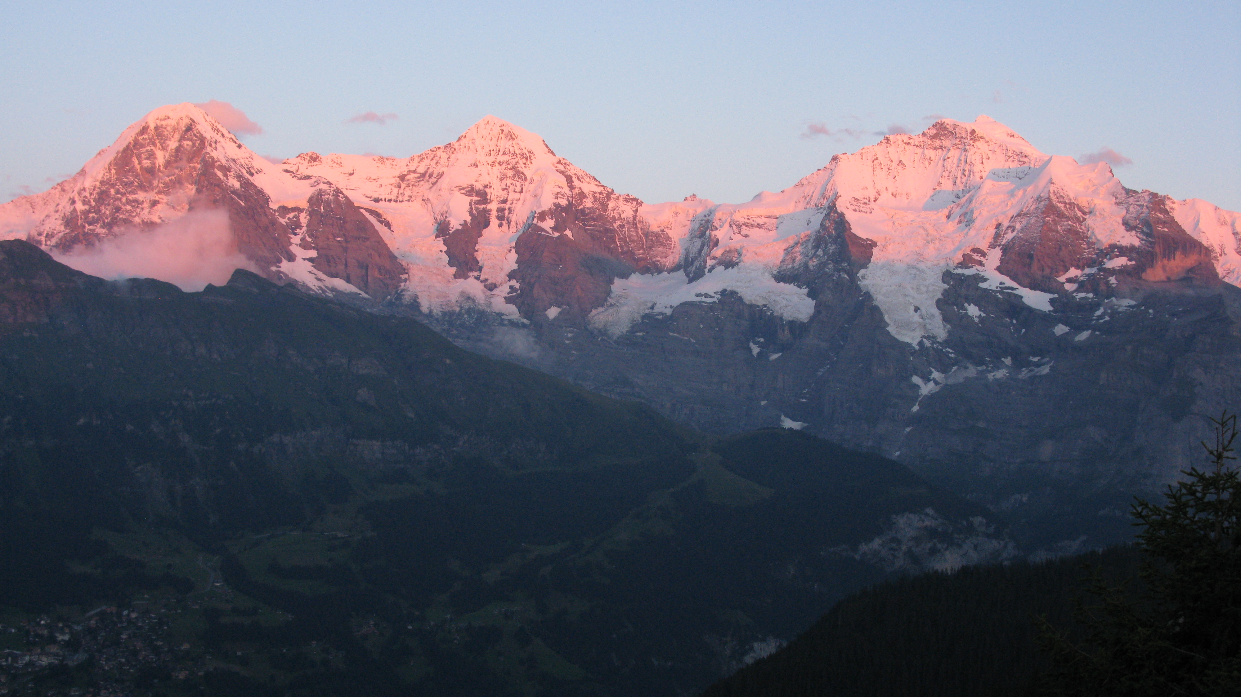
At least on this occasion the tardy hikers were rewarded with beautiful Alpenglow colours!
It had been a long and challenging day but the scenery was spectacular and I would repeat the hike in a heartbeat. The Bernese Oberland offers fit walkers a host of magnificent walks and the hike to Schwalmere is one of the most spectacular offering never ending vistas from Sousegg onwards and a wonderful panorama from the summit of Schwalmere.
I thoroughly recommend the hike to Schwalmere as long as you make sure it is a settled blue sky day and you are capable of 8 -10 hours walking with some steep ascents and descents. And as for me I am already looking forward to a repeat visit in 2016 with my daughter Lisa and nephew Daniel to celebrate the ten-year anniversary of our climb of Kilimanjaro!
© Michael Bromfield 2014

October 20, 2014 at 10:58 AM
Nice to see you enjoying the Swiss mountains. Hello from a Japanese whom you saw on the hiking trail between Bettmerhorn and Eggishorn, alreday what 4 years ago? I love Mürren as well.
January 2, 2015 at 6:38 PM
Hi Katsunori. I remember that day above the Grosser Aletsch Glacier very well. Are you still in Geneve? Maybe we can go for a hike next summer. I will be in Murren Mid June until mid August. Michael
July 1, 2019 at 10:26 PM
Thanks for the detailed description of your hike. I’m planning on doing a lot of hiking when I’m in this area in September. We’ll be staying in Gimmelwald for 7 nights, and are looking for more options than the 4 or 5 we have right now.