I have had a close affinity with Canada for over half of my life, being married in British Columbia, or more specifically in New Westminster, either an independent town (or small city as defined in Canada) or a suburb of Vancouver, depending on your viewpoint. And I have visited BC pretty much at least once most years since 1980.
A brief stop near Hells Gate
Initially we would incorporate visits as a half way break on long multi month marketing tours, promoting our Educational travel company to schools and colleges in the USA and Canada. Our company was not built on the philosophy of paying others to do what we were capable of doing ourselves, however laborious the task, and as our company grew, we subsequently devoted several weeks in Vancouver each year to organizing a mailing to up to 100,000 potential group leaders.
My wife and I designed the brochure ourselves, organized the printing and indeed I supervised the printing by sleeping at the Printing Press to do hourly press checks. We stuffed the envelopes with a brochure and covering letter, attached 100,000 labels and licked and affixed 100,000 stamps before my wife sorted and bundled all the envelopes into zip code order, stuffed them into pre labelled mail bags and I would drive across the border to Bellingham in Washington State in the USA, as the postage was much cheaper and we would stagger the mailing over several days. The six border crossings each summer of a strange Englishman driving a 1967 Red Buick Skylark Convertible stuffed full of mail bags was a constant source of amusement to both the Border officials and Post Office workers.
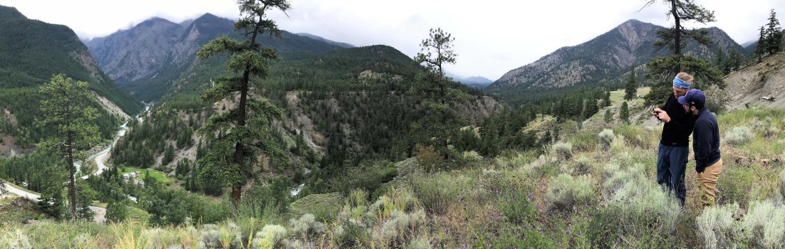
Lillooet BC where we met Enja and Stefanie
After my father-in -law died and my mother-in-law moved into an apartment, from 1987 onwards we either rented or exchanged homes, as we needed space for both our expanded family and at least one member of staff who we would take with us to help with the mailing. All in all writing copy, selecting images, designing, printing and mailing the brochure kept us busy pretty much 24/7 for three or four months a year.
In the years from 1980 to 1990 people would frequently say,
‘You are so lucky to go to Vancouver, it is such a beautiful city’.
And I would reply,
‘So I am told but I don’t get so much time to sightsee’
But as our company expanded, we eventually let our staff take over more and more responsibilities for the mailing and we would just design and co-ordinate the printing. And this gave us more time to explore both Vancouver and British Columbia.
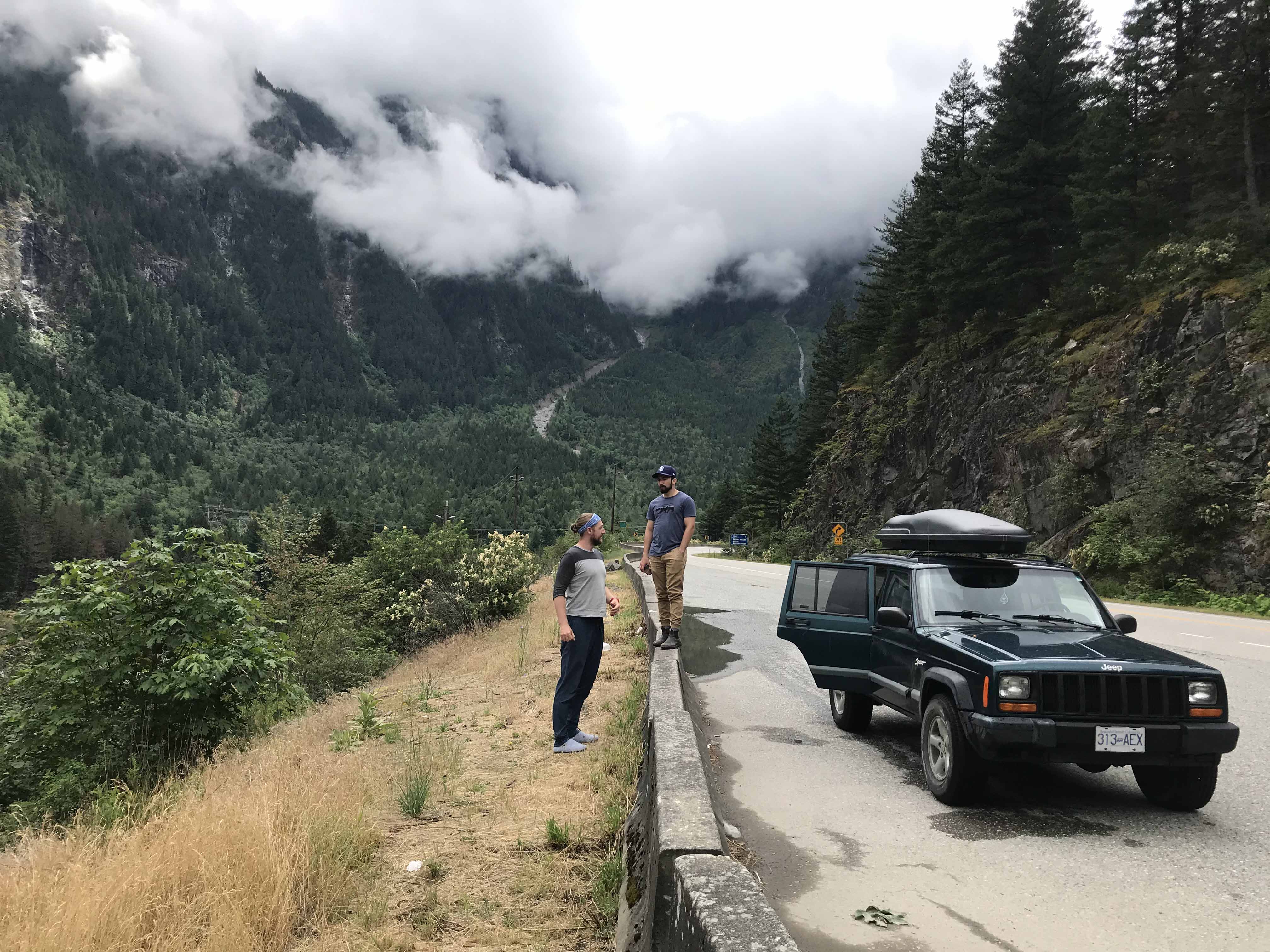
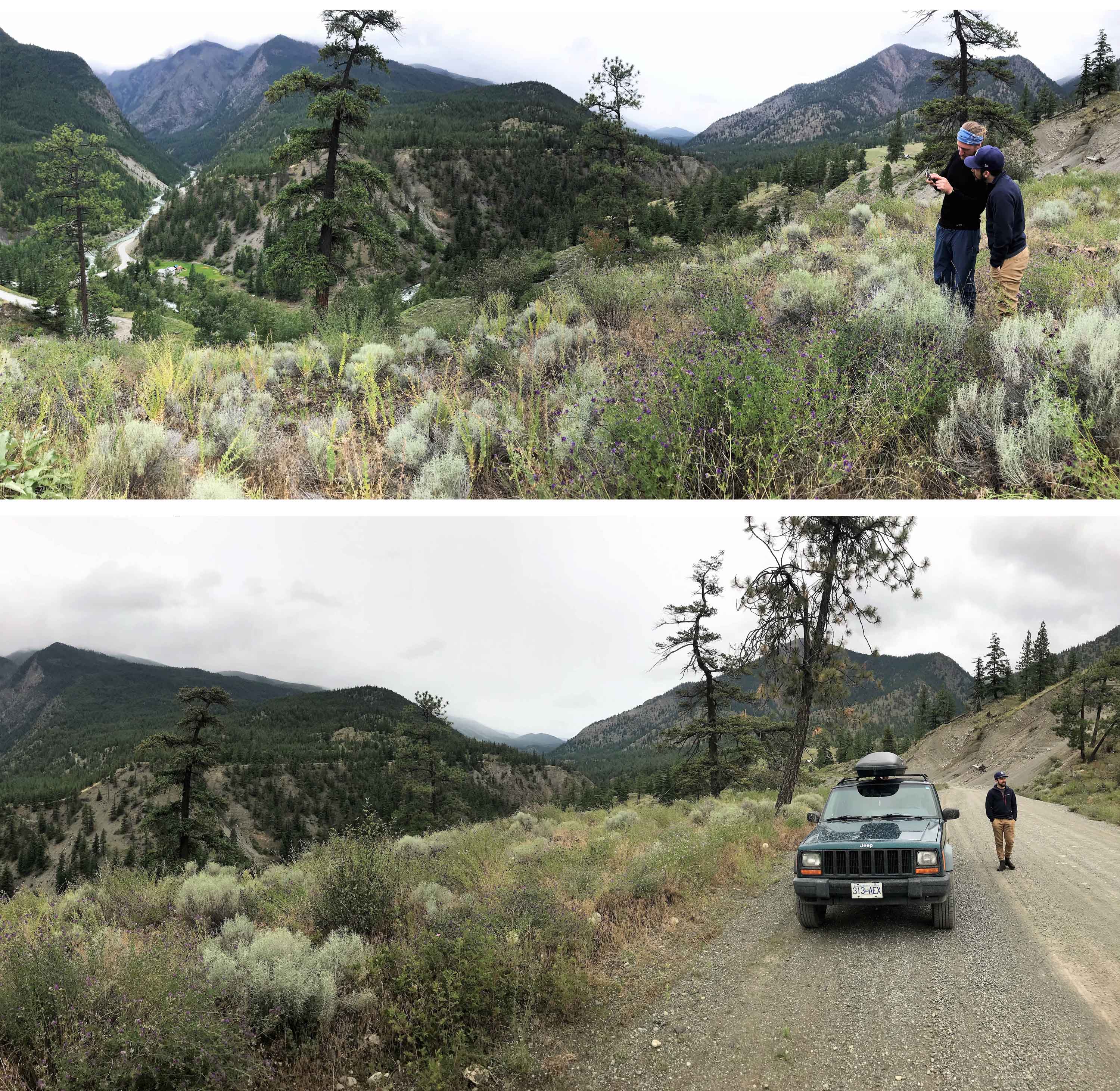
Heading out of Lillooet
And indeed it was in BC around 1989/1990 that I first discovered the joys of mountain walking with a hike up Black Mountain above Horseshoe Bay. And this is an activity I have relentlessly pursued ever since, with 14 treks in the Himalayas up to as recently as last November, and many other long distance hikes in Africa, Asia and South and North America as well as hundreds of day and multi day hikes in my beloved Alps.
In the 1990s we tended to alternate summers between our family exploring Europe in a Peoplemover Van and exchanging homes in Vancouver. Indeed I think our eldest daughter Sarah was well into her teens before she spent an August day in England.
Indeed with no close relatives in the UK other than my mother, our children considered their Canadian cousins to be their close family and their friendships with their Canadian cousins have endured to this day. Our kids all have Canadian passports and I thought it was important they had the chance to experience life as Canadian residents rather than as tourists, so in 1996 we exchanged homes with a Canadian couple and lived in Point Grey, Vancouver for 9 months and our kids went to school in Canada.
Heading into backwoods country
We continued our biannual summer visits until 2002, when we purchased the house we had lived in during our 1996 exchange and, ever since then, Sharron has often made two trips a year to visit her Mother, brother and friends and we have also made numerous visits either as a whole or part family. We also usually spend about one Christmas in three in Canada.
During all these visits and especially through the 1990s, I hiked many of the trails in the BC Coastal Mountains between Vancouver, Whistler and Pemberton and usually with one or more of our kids accompanying me. Sarah and Lisa hiked from Whistler Mountain to Singing Pass and to Whistler (about 12 miles) when they were 7 and 5 respectively, Lisa climbed the magnificent Panorama Ridge when she was 6 and Sarah completed the tough 8 day West Coast Trail on Vancouver Island when she was 11 and I probably knew the trails of the Southern Coast Mountains as well as any non Canadian resident.
Checking out a gentrified ranch – the last dwelling on the Yalakom River Road
We also made many backpacking and camping trips which was not driving to a campsite but rather parking the car at a trail head and hiking with tent, sleeping bags, fuel, food, sleeping bags and rain gear etc. We had some memorable camps at Russet Lake, Elfin Lakes, Garribaldi Lake, Cheakamous Lake, Lizzie Lake and other destinations which often involved 1000 metres of ascent just to arrive at our campsite.
Since my first visit in 1978 I have visited 47 of the American States and most of the Canadian Provinces. I have also visited pretty much all of the major North American cities Vancouver is without doubt the most spectacularly located North American city. Indeed together with San Francisco, Hong Kong and Sydney, it is one of the four great and spectacularly located cities on the Pacific Rim. And there is no part of North America with such an abundance of spectacular natural attractions as British Columbia.
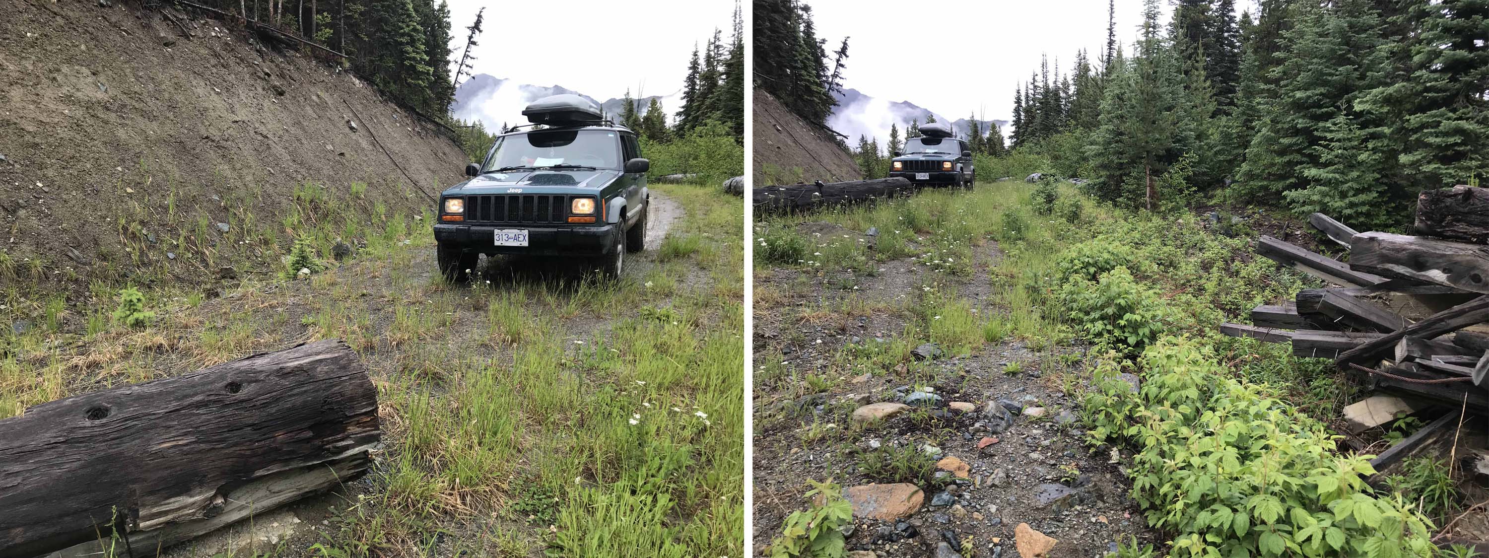
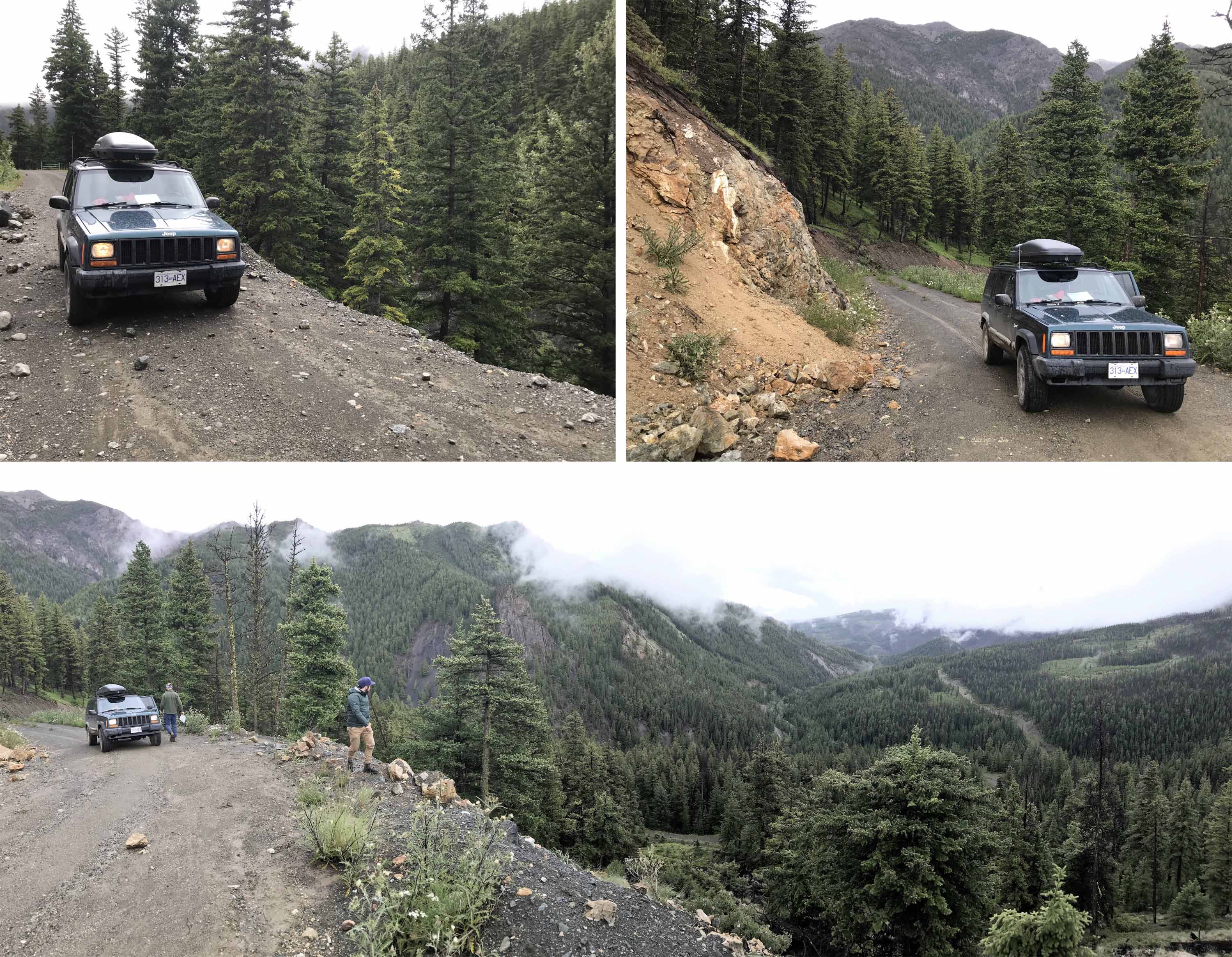
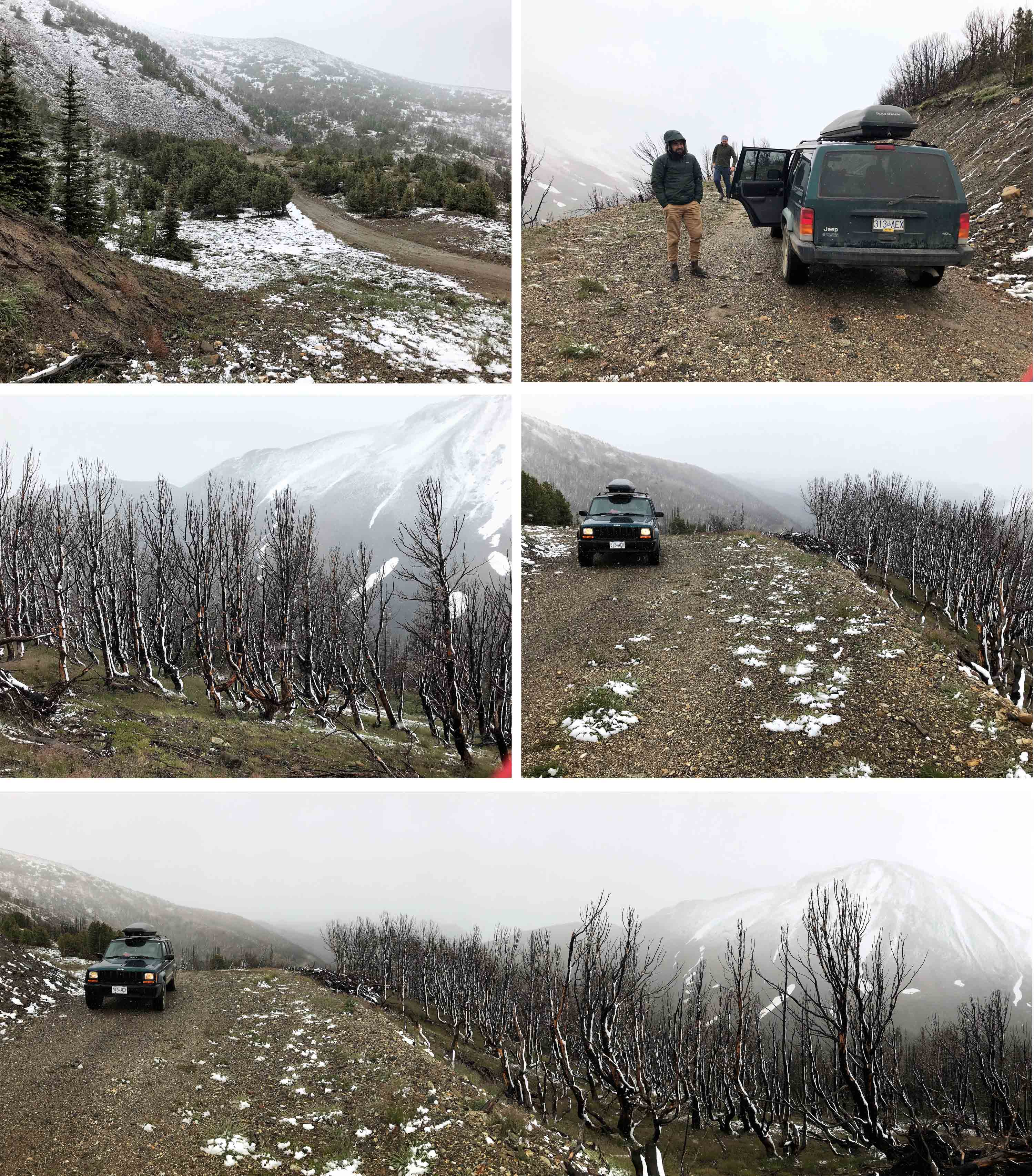
Making slow progress on the Yalakom River Road
So you now know the strapline ‘Beautiful British Columbia’ is indeed well deserved.
Immediately after buying our house in 2002, I also purchased a 1999 Chrysler Sebring Convertible and a 1998 4wd Jeep Cherokee and interestingly we still have both those cars in Vancouver 17 years later!
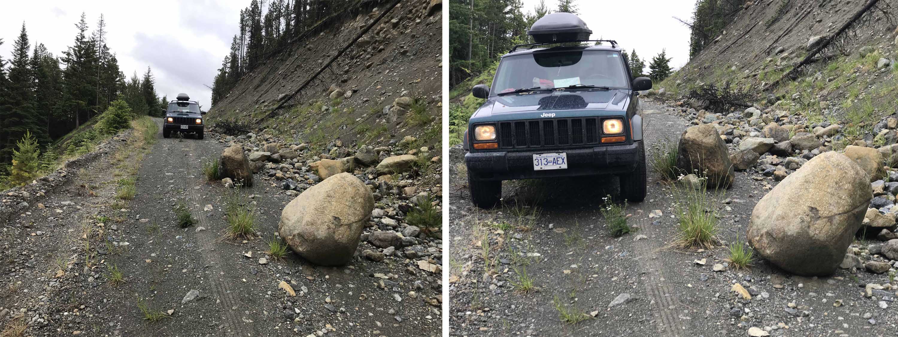
It was James’ job to clear the road of rocks and debris!
Because we do not live there full time, it is difficult to justify buying newer and more modern cars, whether or not we can afford it. Clearly the philosophy of Waste not Want Not is still alive and well in the Bromfield households!
And in 2006 our son David then 17 and I went on a five day road trip in our Jeep. We drove north from Vancouver along the famous Sea to Sky Highway, alongside the spectacular Howe Sound, almost as impressive as the famed Norwegian fjords, to the international Ski Resort of Whistler, on to Pemberton and the First Nations settlement of Mt Currie, before we camped on the shore of Lillooet Lake about three hours north of Vancouver.
Our route followed the Yalakom River – very closely!
Lillooet Lake is very beautiful, surrounded by mountains and only accessed whether from the north or south along an unsurfaced forestry road. There are 4 camp sites on the shores of the Lake administered by a First Nations Tribe and about 10 camping spots in each camp, all well separated from each other in the glades of the lakeside forest.
The following day we returned to Pemberton and took the spectacular unsurfaced road known locally as the ‘Hurley Main’ (a major route in the network of logging roads that abound in BC) northwards to Lajoie Dam and the old settlement of Gold Bridge (population 40) located between Downton and Carpenter Lakes and which used to be a Service Centre for the various gold mining communities and camps. We camped that night at Mowson Pond Recreational Site, a campsite on a small Lake (or Pond!) just to the north of Carpenter Lake.
Into the woods!
This was another of the many unmanned designated camping spots that exist in BC. They are equipped with a few benches, an outhouse or two (Septic Tank Toilet) and a Bear Cache where you can store your food in a metal safe or hoist it into the air swinging below a branch. In both cases it will not attract bears, the ever present concern, if not danger, of camping in the Canadian wilderness. Sometimes such campsites are visited by a local official to collect a nominal camping fee or it can be deposited in a lock box if provided. Many of these Recreational Campsites have been abandoned in the sense they are no longer maintained but are still attractive camp spots and many are snow covered for much of the winter.
The following day David and I returned to Carpenter Lake and took Route 40 along the northside of this spectacular Lake in the destination of Lillooet. The Lake, just over 30 miles long, is actually a Reservoir which was created in 1951 by the construction of the Terzaghi Dam.
First glimpse of our campsite to the right of the river, centre.
We passed the Dam and climbed up through a narrow rocky canyon until we came close to the small settlement of Moha where we took a left to head north west up the Yalakom Main, another forestry road following the Yalakom River.

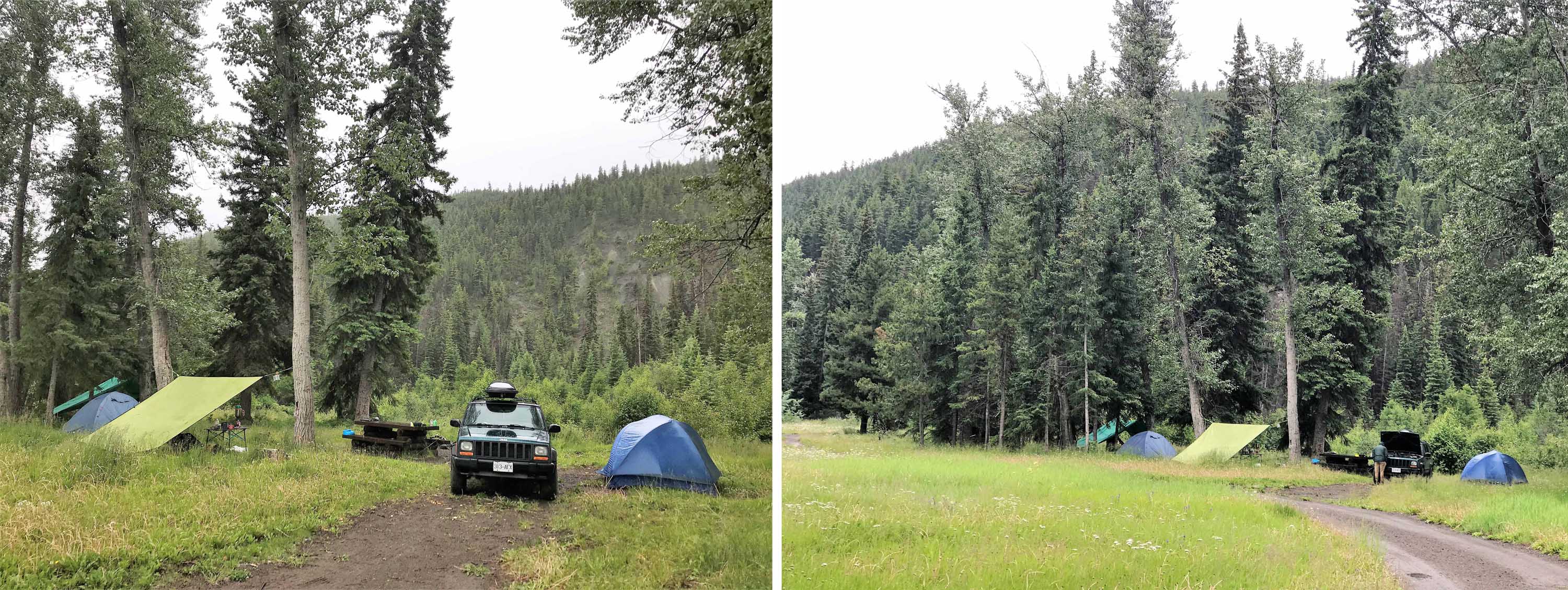
Its been a long time coming indeed! Return to Beaverdam Camp after 13 years
And after about 20km along another rough unmade road we reached our destination of Beaver Dam Camp, sometimes referred to as Beaverdam Creek Camp. We headed another 20 or 30km along the road exploring that afternoon, before returning to our camp site, which I remembered as an idyllic spot with a large meadow adjacent to a wide stream or narrow river, actually the Yalakom River. I can say with confidence I cooked dinner of soup and pasta on a gas cooking burner, not because I have a fine memory, but because that is a staple dish when I camp. (When our daughter Sarah is along our meals are magnificent culinary experiences but its usually 11pm before we eat but I follow the KISS philosophy when I camp and cook – Keep It Simple, Stupid!)

Checking out our campsite
I remember thinking this was a campsite I had to return to for an extended stay and just laze next to the river with a couple of books and a camp chair. At the time David and I were there in 2006 the weather was blue sky perfect and there were about 4 or 5 other families present but there were so many spots along the river and in the Meadow it did not feel at all crowded.
The following day David and I retraced our route and returned to Route 40, continued eastwards to Lillooet and then drove north, eventually finding the Cornwall Fire Lookout where we watched a glorious sunset from 2036m/6600 ft and then just unrolled our sleeping mats and had the luxury of sleeping in a historic structure, that was left open for access by anyone 24/7 and nominally managed by BC Parks. We had a bit of a scare when 4 bikers drove up around 10pm, said ‘Hi’ and then drove on their way and some subsequent research on the internet reveals it is still a popular 4wd and Quad Bike destination.
Dinner with our Swiss friends and a million mosquitoes!
The following day we drove back to Vancouver along Route 1 via Hope after five enjoyable days driving through a wide variety of landscapes. However I have always remembered Beaverdam Camp as a glorious campsite that I always wanted to return to and also show to our other kids Sarah and Lisa.
However I could not remember the name of the campsite!
Nine years later in September 2015 all of our family had gone to Vancouver for our nephew Adam’s wedding to Beth. This was a major milestone of our family history as Adam was the first of the Seven Cousins to get married and has subsequently been followed by almost a wedding per annum (Patrick 2016, Lisa 2018 and David 2019 so only three to go!). After the wedding David had returned to his work in London and Lisa to her PhD studies in Australia, which left my wife Sharron, Sarah (then 30 almost 31) and her partner James.
Toasted Marshmallows for dessert!
We decided to head off in search of this wonderful campsite that Sarah had heard me talking about for years but what was the name?
I consulted the South Chilcottin edition of excellent BC Backroad Mapbook Series. I remembered David and I had stayed at Mowson Pond and remembered the idyllic campsite I was looking for was firstly north of both Mowson Pond and Carpenter Lake (I was correct), on a Forestry Road heading northwest (I was correct) and so was probably Tyaughton Creek Recreation Site on Mud Creek Forestry Service Road.
An unexpected guest wandered by
I was close but I was wrong, as there were two main Forestry Roads heading north from Route 40!
Just as nine years earlier, we spent the first night camped on Lillooet Lake, which has subsequently become a favourite camping spot for Sarah and James, who are now living semi permanently in Canada.
And just as nine years later Sarah, James and I continued the following day to Gold Bridge by taking the still very rough but spectacular Hurley Main to Gold Bridge where we refilled my faithful Jeep. It was a wonderful blue sky day in early September , the scenery was magnificent and the trees were already beginning to turn with shades of gold and brown intermingling with the green and Carpenter Lake looked spectacular as we drove along the north shore before turning left and climbing above the Lake and driving past Mowson Pond, where David and I had camped nine years earlier. We continued heading northwards, following what I assumed was the route we had taken nine years earlier. The road was of course unsurfaced and we drove past Tyaughton Lake where there were a couple of camp sites and also what appeared to be a scattering of isolated vacation homes on the lake shore below us.
James and Daniel escorted our guests back towards the main road whilst I stayed in camp
We eventually descended through the forest, joining the Mud Creek Forestry Service Road (which ran north west from a point further along Carpenter Lake than where we left) . We were aware we were on the Mud Creek Road from the occasional signs and distance markers but we had not noticed an actual junction, nonetheless we continued heading northwest. We were now looking for for the Tynaughton Creek Recreational Site on the left, which was where I erroneously thought David and I had stayed in 2006.
And this was where the day started to unravel as it was 1830 and beginning to get dark and we needed or at least wanted to make camp!
Beaverdam Creek Campsite
Sarah started getting stressed as she thought we were to the south of Carpenter Lake, which James and I knew was impossible, and eventually the Mud Valley Road came to a fork, which meant we had probably passed the camp site if our map was accurate. We took a right to stay on the Mud Creek Road, but after several kilometers and no camp we turned around, went back to the fork and took the left fork which was the Bonanza (!) Forestry Road. We then took a Right Fork to stay on the main drag which was now named the Relay Creek Forestry Road. No joy here either so we returned back to Bonanza Forestry Road, where we did find a camping area just before a derelict bridge, which was where the Bonanza Road seemed to falter out.
Time to head out exploring
The campsite was long since abandoned and no longer maintained, but there were a couple of flattish spots in the glades and from memory a toilet area. As far as James and I were concerned it was serviceable and would suffice, but we both agreed it was ‘creepy’ – a feeling that was reinforced when we found some beer cans and several bicycle chains nailed on trees. This very definitely turned Sarah off and I must admit I had visions of drunken bikers or a Satanic cult turning up in the middle of the night, although this was highly unlikely, as we were now losing the light and at least a three hour drive from the nearest settlement through forests in the dark on abandoned and unmade forestry roads.
Looking for the road to Elizabeth Creek Mining Camp
But if Sarah was not happy it did not need much persuading for James and I to agree to turn back to Mud Creek Road, still keeping our eyes open for our original destination of the Tynaughton Creek Recreational Site (which we never saw) so we, or rather James, kept driving on and on south eastwards for a couple of hours, and in this direction the junction with the road to Tynaughton Lake and Mowson Pond was more obvious.
We made a half hearted attempt to check out two rec site camping areas on Marshall Lake as we passed but as the access road was marked Private and No Entry, we decided to continue until we reached Carpenter Lake late in the evening. We turned left in the direction of Lillooet and we reached the end of the Lake where a camp site was marked on our Backroads Map as the Mission Dam Rec Site. This was located close to the Terzaghi Dam and we found it (hurray!), although in the dark it was difficult to see where one should actually camp as, in truth, it seemed to be located in a gravel pit. Sarah’s comment that she was not even sure this was a camping area (it was) and ‘you can camp here if you want but I am going to sleep in the Jeep’ was not particularly encouraging, so we crossed the Dam, went through a tunnel in search of the Carpenter Lake Boat Launch Rec Site, which our map indicated also had camp spots.
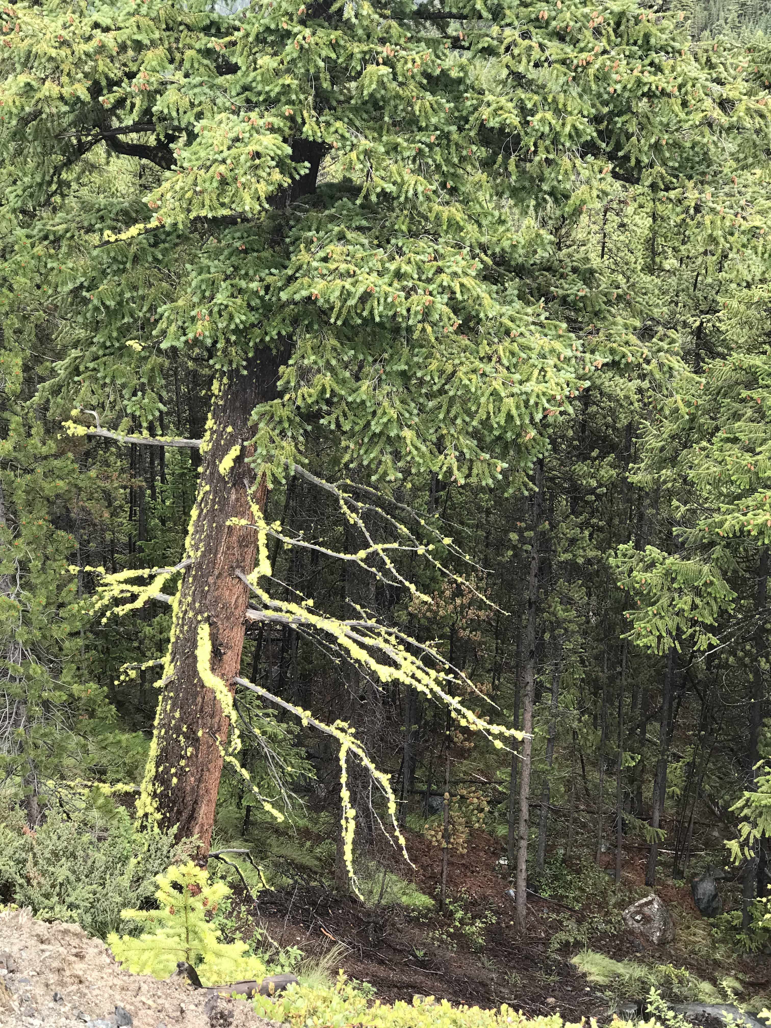
Moss covered branches testify to high precipitation levels
By now it was well after midnight and we never found the Rec Site and nor did I notice it this year either when we drove past in daylight! In our defence I should point out that these Rec Site Camping areas are all unserviced wilderness sites and at best marked by a small sign on an access track that is often not noticeable and certainly not in the dark!
At this point I suggested we head for the town of Lillooet 50km/30 miles away, where there were hotels/motels and that was what we decided to do. James loves driving and continued to do so and when we eventually arrived at Lillooet around 2am (about 9 hours after we had started looking for our campsite!) we discovered the entire town, let alone any hotels/motels was closed down for the night! Anyone who has been to Lillooet will understand!
We found the Central Municipal Parking Ground where some other tents were erected and some mobile homes were parked. James quickly put up a tent for Sarah and himself but I was too tired, passed on their invitation to share their tent and just put my new minus 12 degrees MEC Sleeping Bag on the ground and drifted off to sleep.
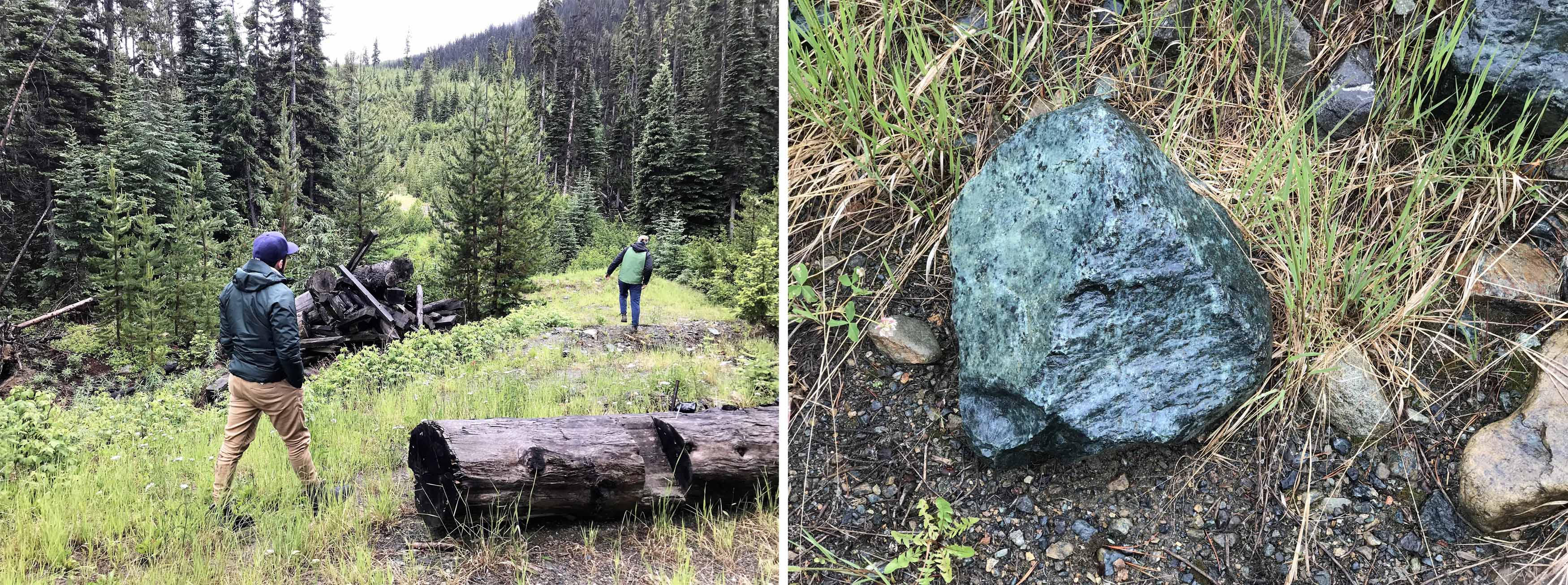
We found some Jade at the end of the (wrong!) road
Perhaps as an aside I should comment that MEC is Mountain Equipment Co-operative, which is Canada’s main outdoors retailer. It was founded by 6 UBC students around 1970 as a way of making bulk purchases of hiking equipment for the University of British Columbia Hiking Club and to this day one has to pay a $5 lifetime membership to the co-operative to shop at their stores (sorry megastores), which are found in all the leading Canadian cities. Any profits are returned to members as a dividend or donated to environmental good works. MEC is a brand I would trust with my life and I never feel I have ‘arrived’ in Canada until I have spent a few hours at least at their Broadway store. And as one travels around the world it is a dead giveaway that if you see a traveler with an MEC Daypack or pants, shorts whatever then you are looking at a Canadian!
Time to turn around
The following day Sarah, James and myself followed the Fraser River past Hells Gate to Hope and back to Vancouver and I was determined to work out where we had gone wrong. This was not without a little acrimony from a clearly frustrated daughter, who just wanted to write the whole trip off and forget about it!
Mind the Rocks!
However after a lengthy examination of the maps and the images I had taken on my trip with David nine years earlier, I realised that David and I had returned to Carpenter Lake rather than head north from Mowson Pond and when I took took note of both the images and driving time between the campsites from the times recorded on the digital images, it became pretty clear that the road David and I had taken in 2006 was not the Mud Valley Road but the Yalakom River Forest Service Road and almost certainly the campsite I had been looking for was Beaverdam Creek Campsite, as the description of a riverside Meadow allied with my memories.
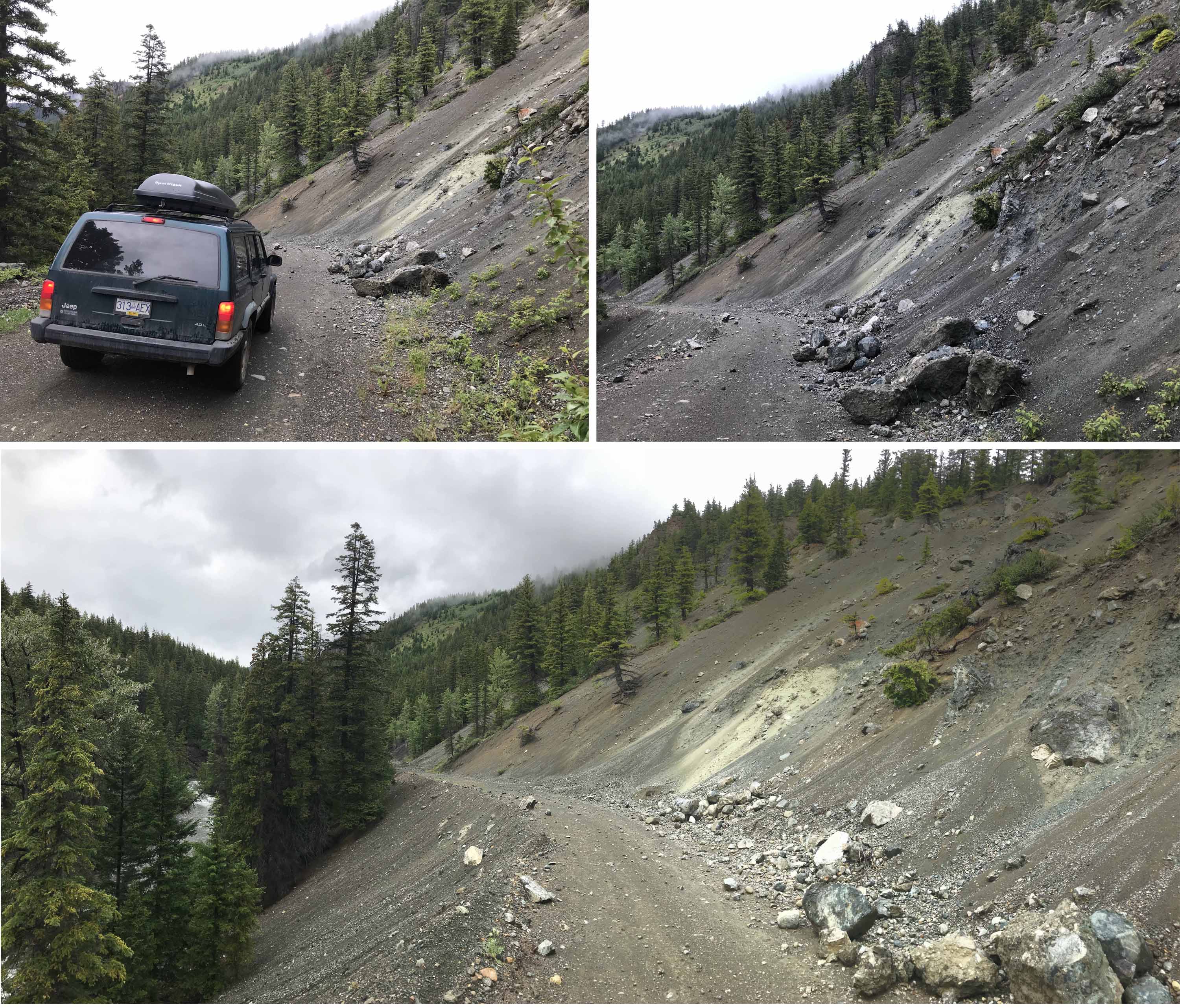
Driving across scree slops above the Yalakom River
I returned to our home in Vancouver the following summer for the wedding of our nephew Patrick and had time for an eventful Camping Trip with my Pal Bill which you can read about here and we also took our faithful Jeep up the very rough forestry road towards Brandywine Meadows near Whistler, where it did break down some 10km from the main highway (James to the rescue). In fact this was a notable event for our family as this short walk to the Alpine Meadows from the trailhead was the first time I had hiked with our son David since we had trekked into and out of the Annapurna Sanctuary in the Nepalese Himalaya in 2003 when he was 14! We also found time for a family camp on Lillooet Lake again, but alas there was not sufficient time to make a visit to the South Chilcotin region to finally make a return to the elusive Beaverdam Camp.
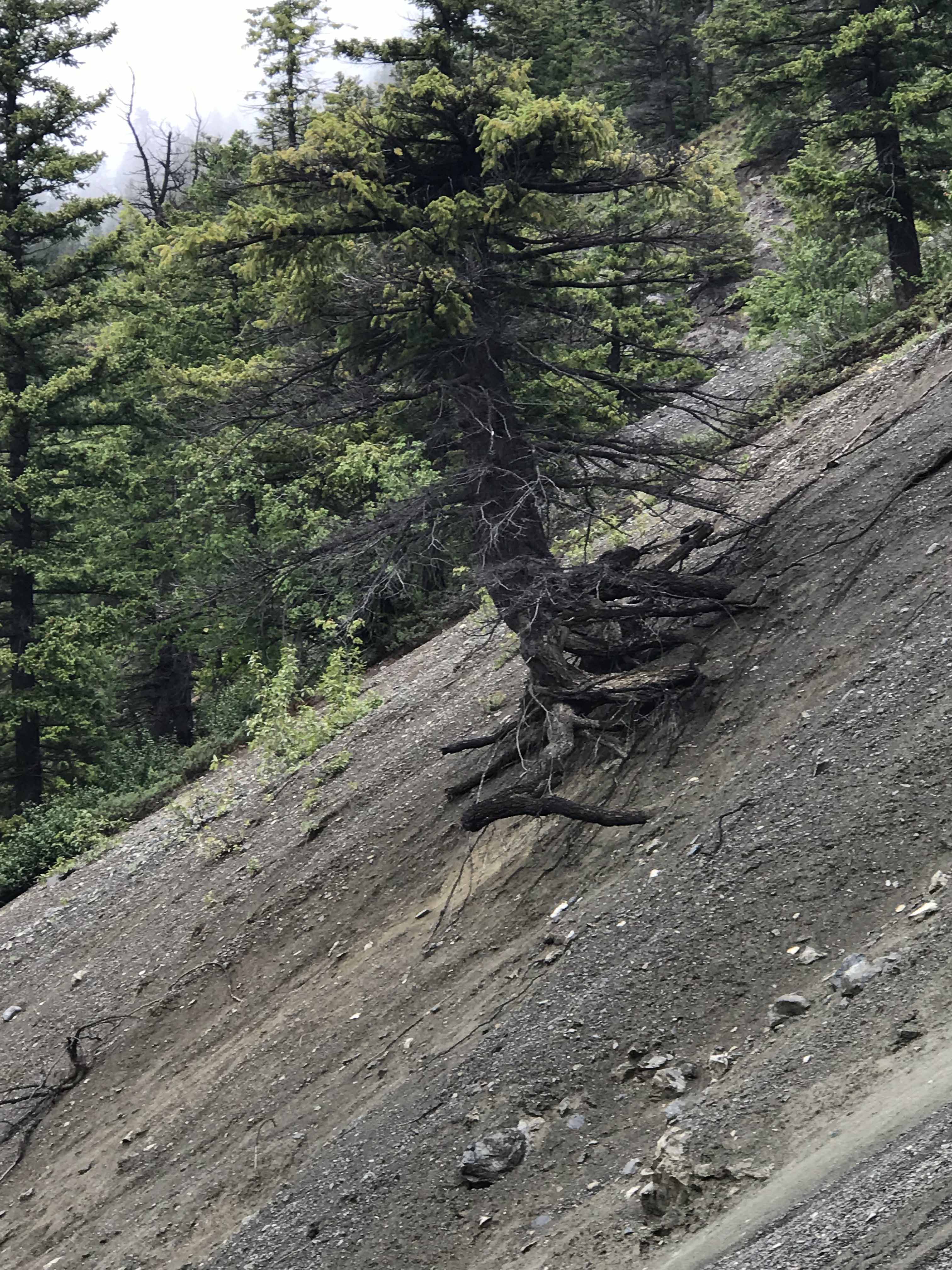
About to fall? How long will this tree remain in place?
It was another 18 months before I returned to Vancouver in December 2017 for a family Christmas and again that was hardly the time to go camping. We did exchange homes for the New Year with a family who had a Luxury Lakeside Mansion on Nicola Lake about half way between Hope and Kamloops and only maybe 120 miles south west of Beaverdam Camp but it was hardly camping weather as the landscape was snow covered and the Lake frozen as it was -15 degrees!
And with the pattern of my life firmly set with winters in Thailand and South East Asia and summers in the Swiss Alps that does not currently leave me with much time for Vancouver.
For the past two years our daughter Sarah and her partner James have been living in Vancouver and renovating our Point Grey home and last year I had seen them for Christmas 2017/New Year 2018 in Vancouver and then they had made a trip to Hong Kong with me when I returned to Thailand. We had also spent time together at our other daughter Lisa’s June wedding in the UK and again at Christmas 2018 so our family is pretty good at staying in touch and meeting up regularly, despite being scattered around the world. And indeed this year I had seen Sarah and James at Christmas in the UK, at my 70th Birthday Party in the UK and they also returned to Vancouver via Thailand so they could attend the Thai version of my 70th, replete with Live Jazz at our restaurant and a Ladyboy cabaret for afters!
Jeep at work!
But I was very much aware that, whilst Sharron was a regular visitor to Vancouver twice a year and had seen most of the refurbishment work at our home, I had not, so I suggested visiting Sarah and James for three and a half weeks after the French Open tennis in Paris and before I headed off to Switzerland, for what will surely be one of my last walking seasons. I suggested we could do three camping trips. Firstly to the wild rugged and somewhat isolated Cape Scott Provincial Park at the North of Vancouver Island, secondly to our old favourite Lillooet Lake and
‘Lets see if we can get to Beaverdam Camp, now we know where it is.’
The three and a half weeks got reduced to two and a half weeks when the only time when our son David and his American fiancée Amber could arrange their Nikah (Islamic Wedding Ceremony) in New York State was on June 12. I had vowed I would not set foot in the USA whilst the current imbecile is their Head of State, but rules are made to be broken and our son’s wedding was more important than my personal protest against the USA and I was still going to be left with 18 days in BC with two full weekends, when it was easier for Sarah to get time off from managing the Apron Manufacturing outlet, where she has worked the past 15 months.
This is Bear country!
It transpired that our planned trip to Beaverdam Camp coincided with the long Canada Day weekend and Sarah was concerned that there would not be sufficient space and that people would go days before to reserve spaces. I explained that this was a very remote unserviced campground, too far from Vancouver for even long weekend campers and in any case, the Meadow could hold hundreds of tents so I really did not see a problem. I think Sarah was genuinely concerned, because she had experience of the Provincial Parks close to Vancouver, which do operate a reservation system and are normally long booked out for all summer weekends, let alone a holiday weekend.
And perhaps Sarah had some negative memories of our somewhat disastrous 2015 efforts to find Beaverdam Camp. I know I did, but we penciled in the dates of June 27 – 29 for our proposed trip, which was a few days before the approaching long Canada Day weekend.
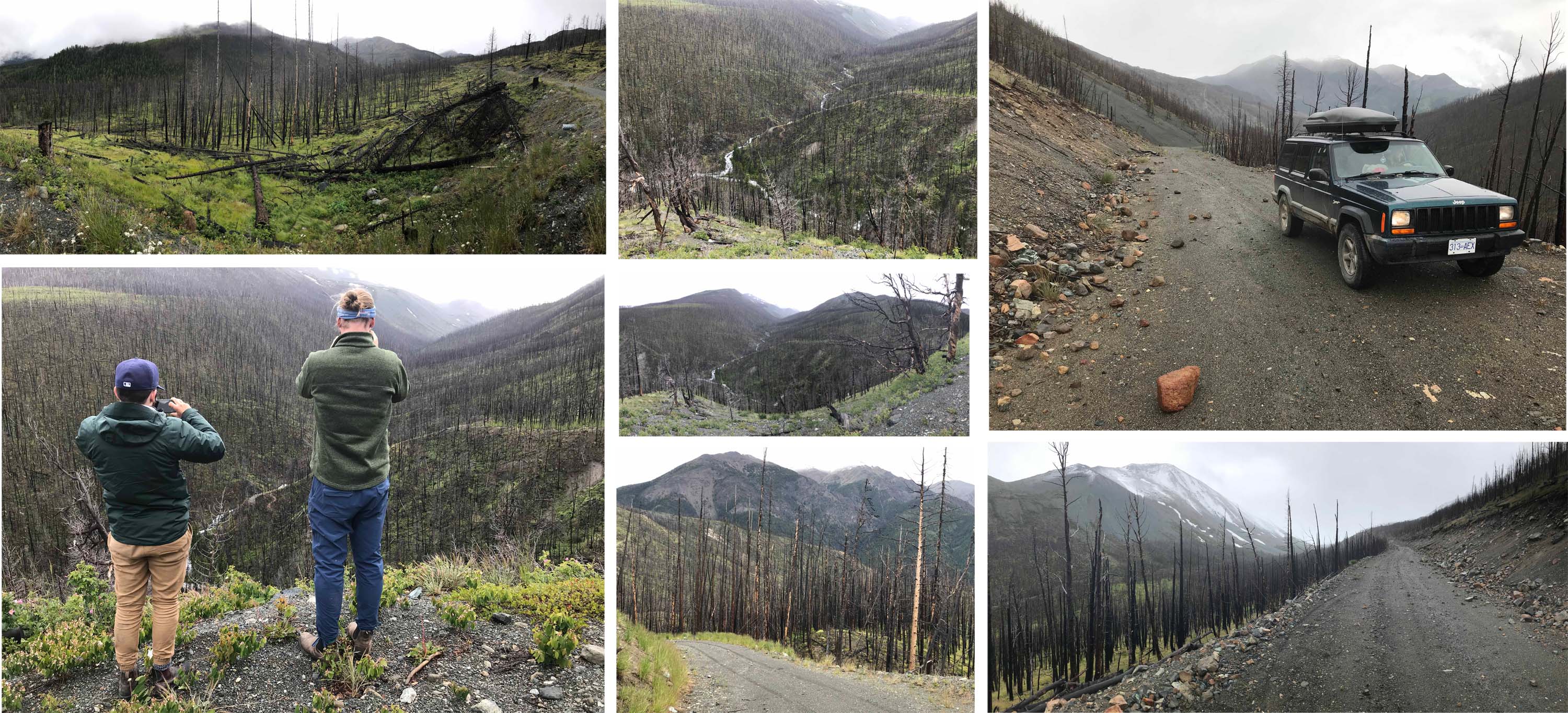
As we climbed closer towards the Blue Creek Mining Camp we entered an area totally burnt out by a forest fire
However, before that, we made our planned trip to the Cape Scott Provincial Park at the north end of Vancouver Island. As well as Sarah and James, my nephew Daniel was joining us, as he had recently quit his job as a Manager at a Film and Acting school after 7 years and was planning to take the summer off, before coming to Europe for our son’s wedding. My friend Vartan from Nanaimo on Vancouver Island was also coming with us and I also (finally) took the opportunity to visit my Canadian friend Phil, who spends 6 months of every year in Pattaya Thailand (where I met him in 2013) and the other 6 months in Nanaimo with his delightful Filipina wife Lydia.
The camping trip went well and was a good introduction to the wild and rugged north west coast of Vancouver Island and we spent three nights camped on the beach at San Jose Bay with a handful of other campers spread out over a two kilometer stretch of sand and with some spectacular sea stacks nearby and a rushing stream enabling us to replenish our water supplies. Some of us (including myself!) had not realized it was not a drive in campsite so the biggest challenge was getting all our camping supplies and food from the trail head to the beach, but it all worked out and we had campfires on the beach and feasted on some marvelous meals prepared by Sarah. There was also time to hike inland and explore the rainforest and we agreed that after a couple of days back in Vancouver we would head out again in search of the elusive Beaverdam Campsite.
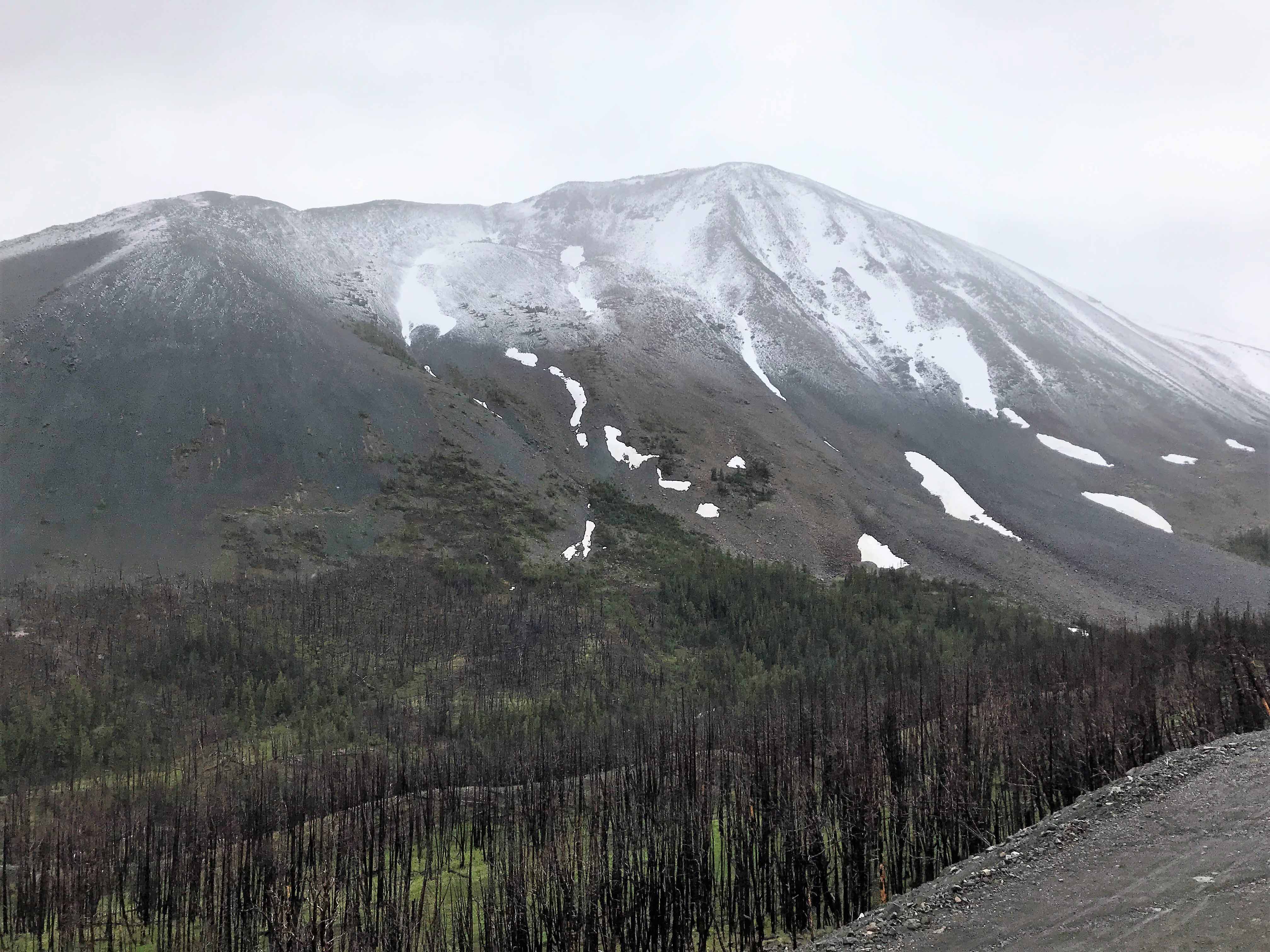
Big Sheep Mountain faces the abandoned Blue Creek Mining Camp
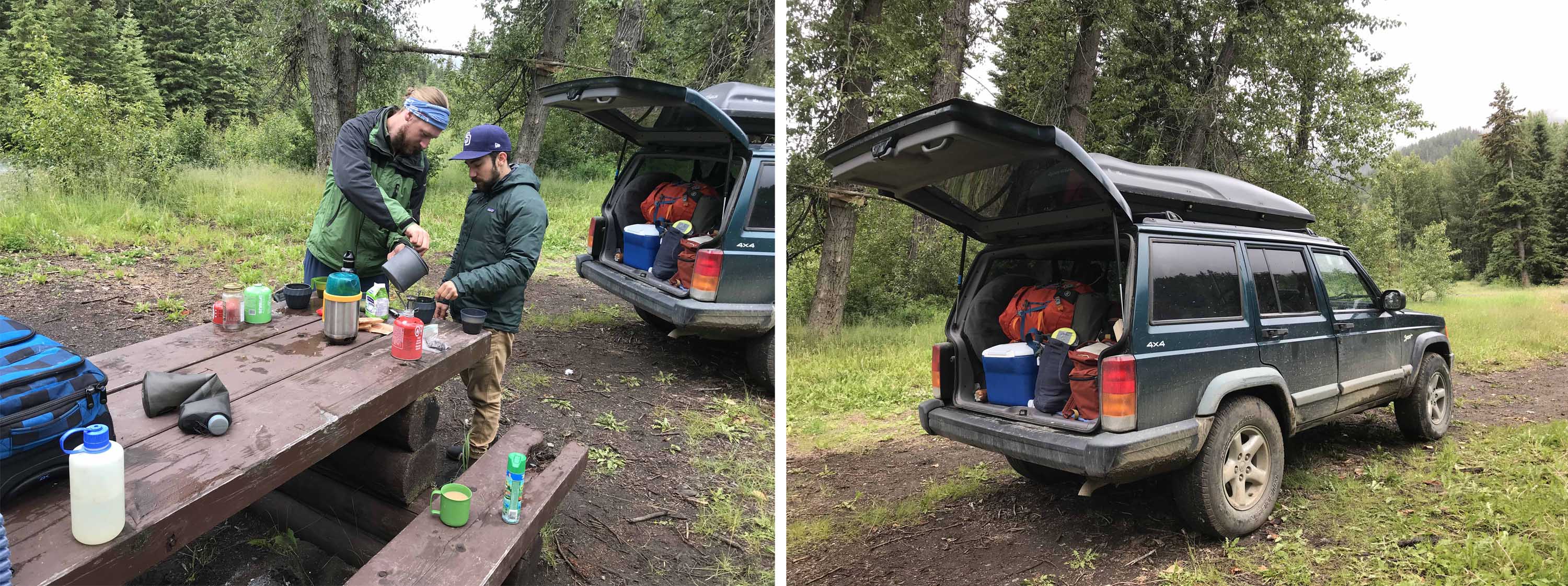
And so 48 hours after we returned to Vancouver, James, Daniel and myself were heading out again in my trusty Jeep, heading for Beaverdam Creek. This time I was pretty certain we knew where we were going and that we were heading for the right campsite. Sarah had decided she had to work as her employer’s company had a few problems that needed to be addressed, so it was just the three of us and my faithful Jeep Cherokee.
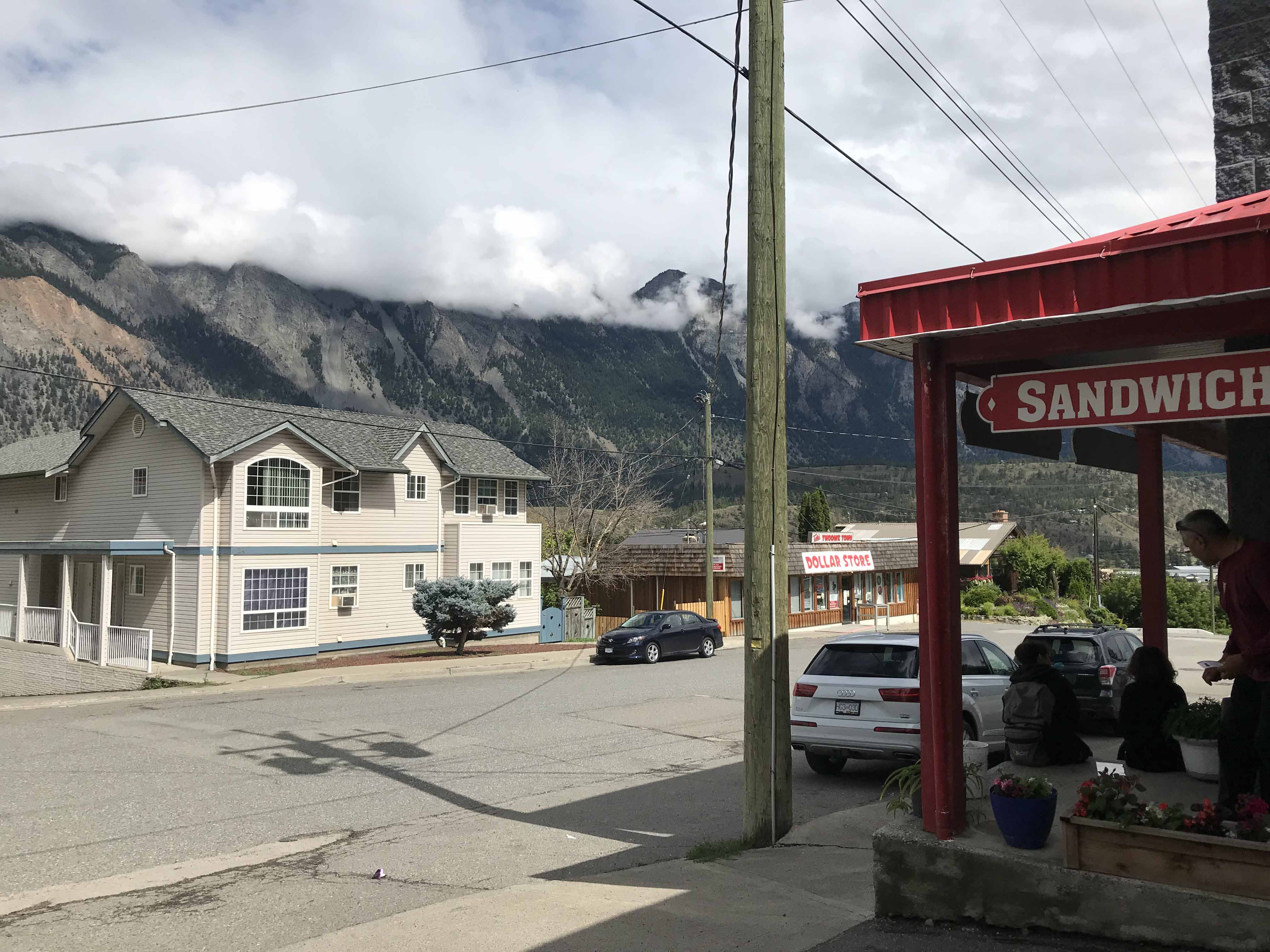
The weather forecast was not good so we decided to stay on the main Trans Canada Highway as far as Hope, where we stopped for some breakfast and then continued through the Fraser Canyon (briefly stopping at the Hells Gate cable car to look at the rushing Fraser River carve its way through a narrow gorge ) before continuing to the small town of Lillooet where we needed to refill the Jeep. There is not much to Lillooet and after buying myself a coffee I wandered over to a local dollar store to see if there were any bargains to hand, whilst James and Daniel refilled the Jeep.
We continued to climb above the Blue Creek mining camp on the flanks of Big Dog Mountain as it began to snow
When I wandered to the Garage/Store James, the Good Samaritan, was helping two girls to put air into the tyres of their car and Daniel said to me,
‘Hey Michael, these two girls are from Switzerland’
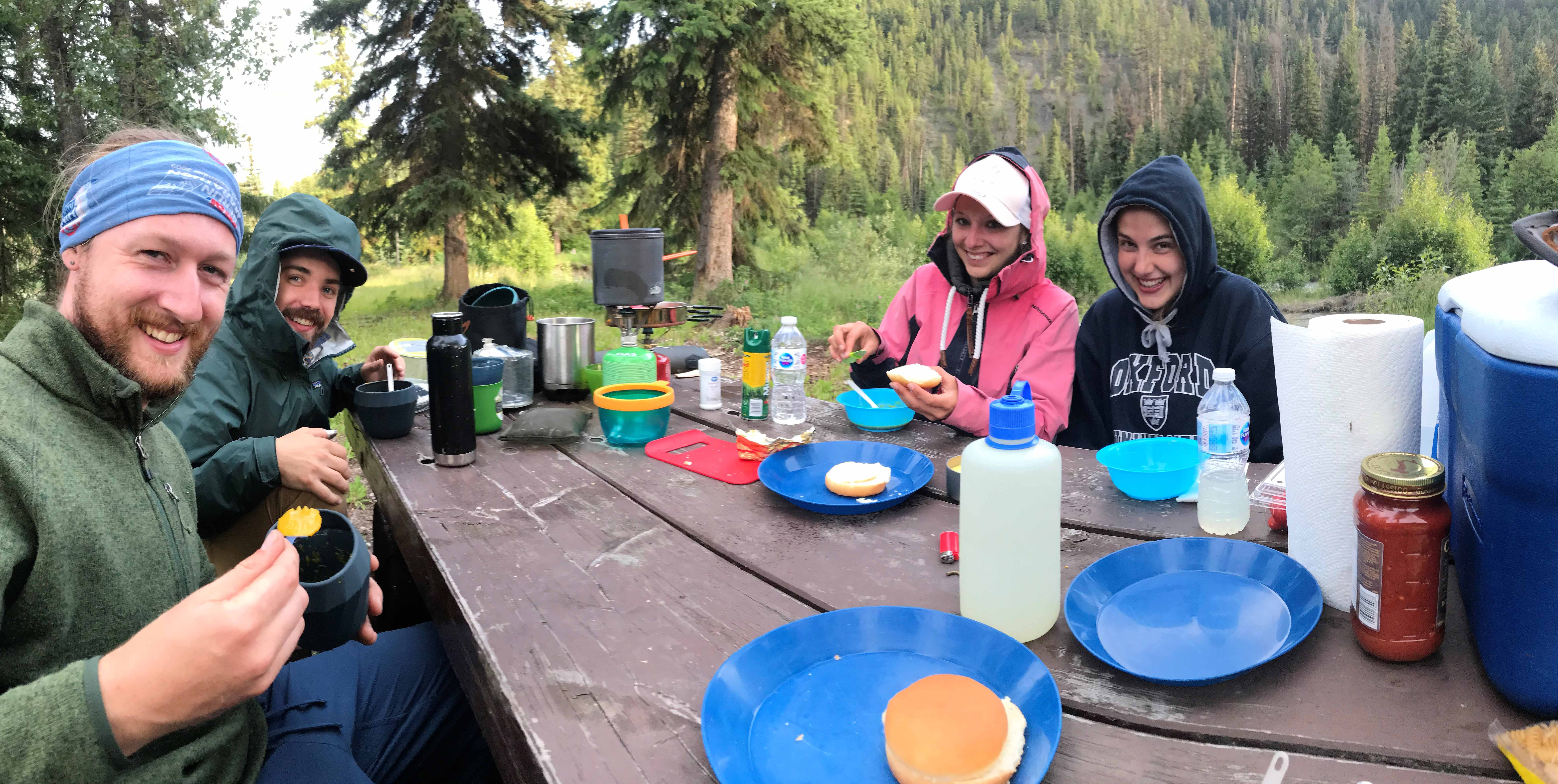
And so it proved. And not only that but they came from the beautiful lakeside town of Thun in the Bernese Oberland, only about an hour from our family apartment in Mürren! Their names were Enja and Stefanie and they were spending a month touring Canada, almost like a ‘gap year’ trip, whilst they were completing a three year vocational work study program, which they described as an ‘apprenticeship’. Being Swiss, they were doing it in some comfort with a nice hire car and had started in Calgary and had so far driven through the Rockies to Vancouver, before continuing to Victoria and Vancouver Island. They had then returned to the mainland and had spent the previous day Quad biking around Whistler, from whence they had driven that morning. It turned out both were familiar with Mürren and indeed Stefanie had competed there in the famous downhill ‘Inferno’ ski race, where she had fallen and been injured. They also had friends who managed one of the 11 hotels in Mürren and as I was familiar with all the hotels, we tried to identify which one.
Exploring the Core Sample sheds at the Blue Creek Mining Camp
I asked them what their plans were and they said they were planning to head towards Kamloops and then on to Jasper in the Rockies, before completing their ‘loop’ and returning to Calgary. I told them if they wanted to experience the ‘Real’ Canada they were welcome to join us, as we were heading for a very remote camp site some 30km down a rarely used forestry road. I explained that we had a spare tent and plenty of food as long as they liked pasta! I advised them that they would need sleeping bags and they replied that they had a tent and sleeping bags so that was no problem, but
‘Do they have showers at this campsite?’
James exploring at the Blue Creek Mining Camp
I explained that this was very much a wilderness campsite with no showers, but there was an outhouse (Toilet Pit) when I was last there 13 years ago. I explained that it would be a great experience for them to get a taste of the Canada that most visitors do not get to experience and James interjected,
‘You don’t have to decide now. We can draw you a map and if you want to follow in your own time you are welcome to do so.’
More Core Sample sheds at the Blue Creek Mining Camp
This cued a quick conversation in German, which I suspect went something along the following lines:
Enja: This might be fun
Stefanie: I am not so sure. Do you really think it is that sensible going off in the middle of nowhere to somewhere we don’t even know with three guys we only met 5 minutes ago?
Enja: They seem friendly enough – the young ones helped us put air in our tyres.
Stefanie: Sure – but do you really think it’s a good idea? Our parents would not be very happy.
Enja: Oh Come on. They seem honest. The older one is obviously trustworthy and seems to know the Bernese Oberland better than we do. We know he is telling the truth about living in Mürren so he is obviously genuine.
Stefanie: I suppose so.
Enja: Come on, lets do it.
And with that the German conversation ended and Enja who was the more outgoing of the two announced:
‘OK – We will come with you’.
And so within a few minutes our small convoy of two vehicles was climbing out of Lillooet heading towards Gold Bridge.

We think the Blue Creek Mining Camp was abandoned around 2010
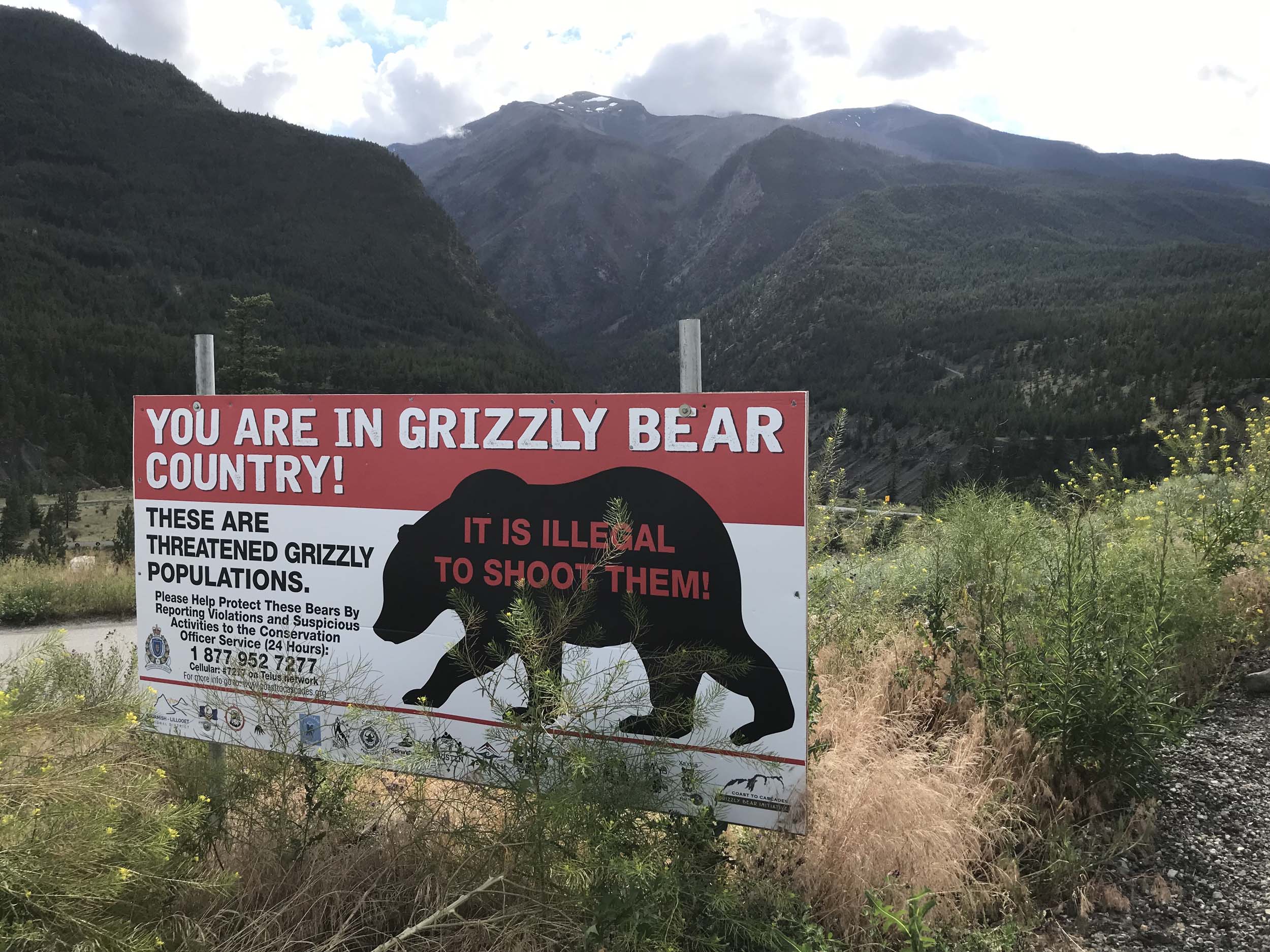
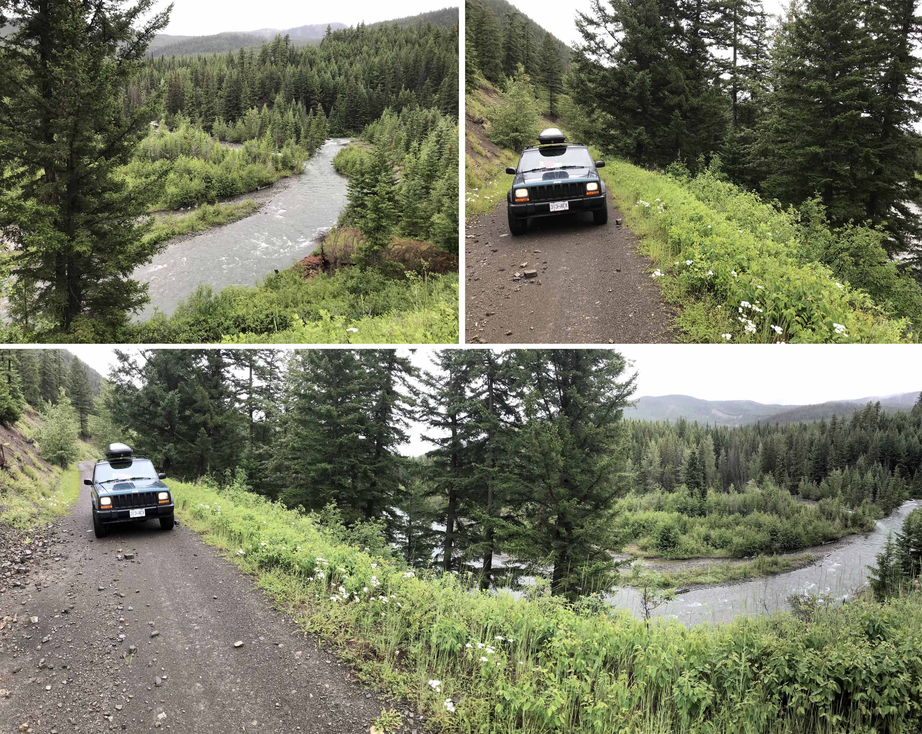
The scenery was very different to the glacier clad Coastal mountains to the north of Vancouver and as he drove, Daniel commented that he could not believe how arid and desert like it was, with steep scree slopes descending to the narrow valley floors and with isolated trees securing a foothold where they could on the slopes We drove above a river gorge that would not have been out of place in Utah with sandy coloured cliffs dropping down to the valley floor. The road was already a gravel surface when, about 30km from Lillooet, we came to the turnoff for the Yalakom River Forest Service Road near the small settlement of Moha and we were immediately greeted by a large sign advising us we were in Grizzly Bear country.
The Forestry Road gradually got narrower and we soon passed a small lake on our left which had a boat house and nicely landscaped grounds. Clearly this was a ranch that had been purchased and upgraded to provide a palatial retreat for someone of means but more importantly I had memories of stopping here (and as it transpired taking the same pictures!) 13 years earlier, which indicated we were on the right route.
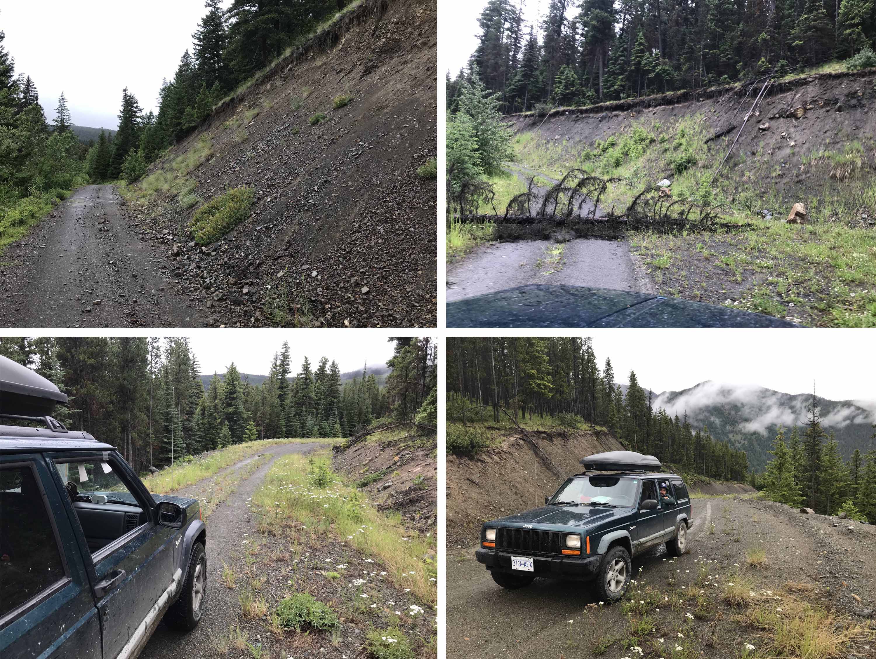
We were following the Yalakom River and soon came to the seemingly abandoned (or long unused) Yalakom Recreational site. From that point on the road deteriorated, in that it clung to the side of a steeply sloping valley with steep rock and scree slopes to our left and the river below on our right. The road was probably put in 50 -70 years ago by a logging company and once the logging operations ceased would see very little subsequent use other than recreational users such as ourselves.

Former accommodation blocks
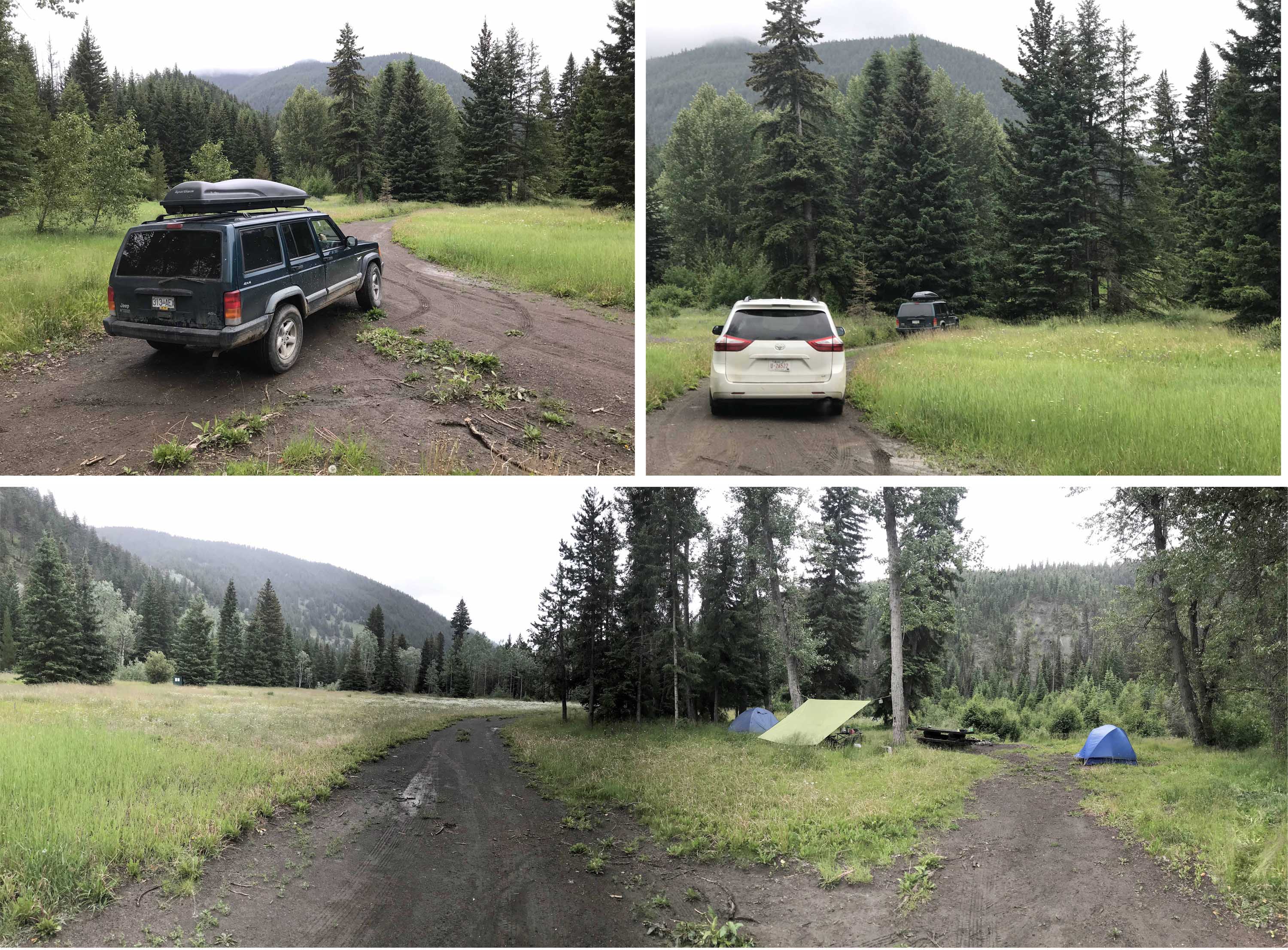
Enja and Stafanie did not have a four wheel drive vehicle and not being used to the conditions were more cautious drivers so our rate of progress was slow and even slower when James had to repeatedly get out of our Jeep to remove large rocks from the road. We passed what appeared to be two ramshackle dwellings with what looked like an abandoned car which I definitely did not remember from 13 years previously and as we gained elevation the landscape became more atypically Canadian, with forested slopes. Eventually we turned a bend and the forested valley was visible in front of us for several miles and I wondered if that was a clearing I could see a couple of miles ahead and, indeed, after we descended and made our way along the bumpy track, there was a turn off and a big sign on our left ‘Beaverdam British Columbia Recreation Site’
‘Well’ said Daniel ‘Its been a long time coming’.
And indeed it had, after our unsuccessful effort five years previously and after some group pictures by the board we drove in and, as I recalled, there was a big expanse of meadow amongst the trees and adjacent to the Yalakom River, together with two picnic tables and a bench. There was room for a 100 tents but also, as I suspected would be the case, there was not a single person at the site even though a long holiday weekend was approaching. With stops for breakfast and in Lillooet, it had taken us the best part of six hours from Vancouver and I suspected this site was more likely to attract visitors from more local communities like Lillooet.
Medical centre at the abandoned Mining Camp
We looked around the two bench areas to try and ascertain the best place to pitch three tents on level terrain and then Enja asked me,
‘What do we do now?’
to which my reply was
‘Eh…………pitch the tents?’
and wondering if my proposal to come camping had been such a good idea!
Actually what Enja meant was what could they do to help because despite having a tent, for most of the past three weeks they had preferred to be sleeping in their car as the back seats folded flat and they had could unroll airbeds. So the two of them were soon at work helping us erect our tents!
There was only one downside from our solitary campsite – although it was cloudy and overcast we had to share it with a zillion mosquitoes which I very definitely did not recall from my previous visit!
Time to depart
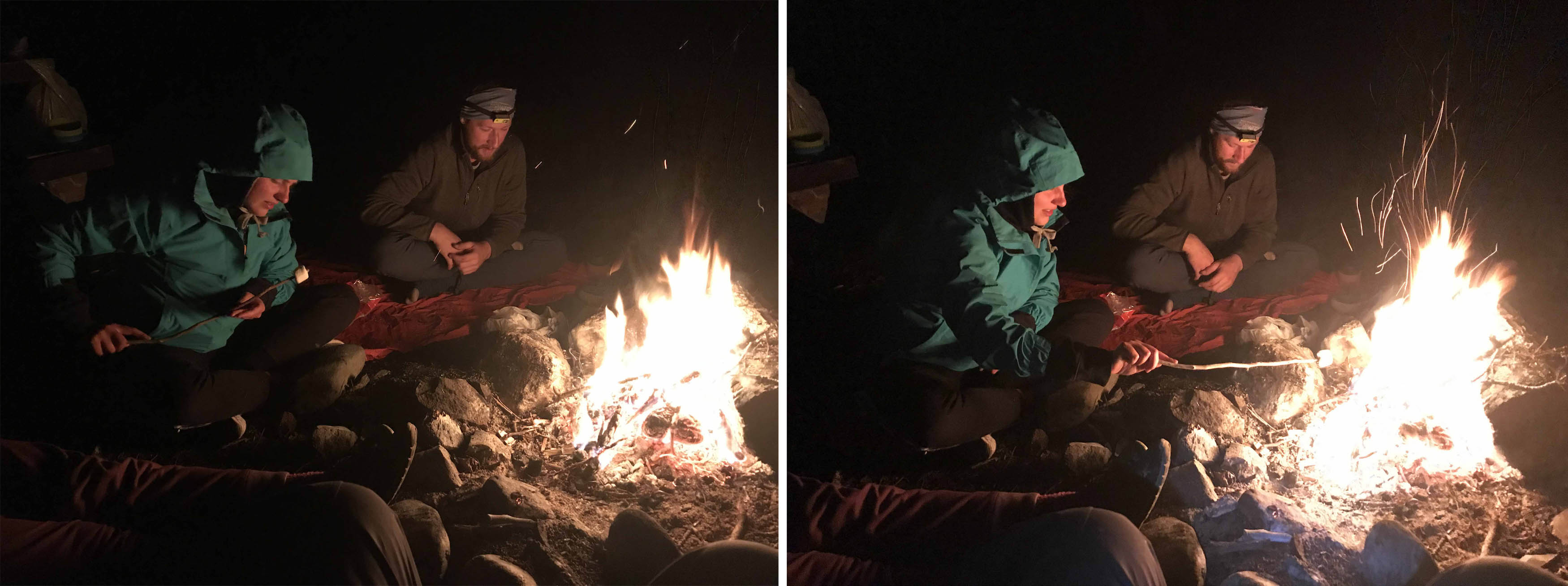
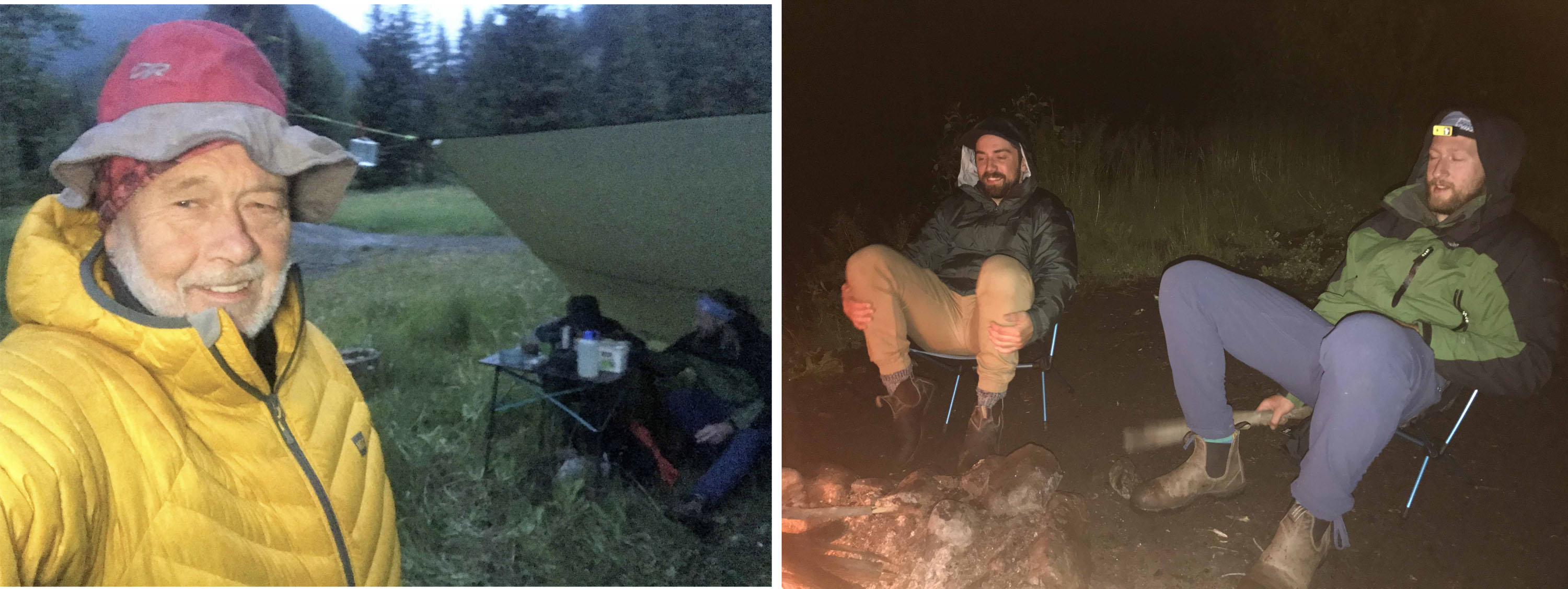
We ate well that night and Daniel and James built a grand camp fire and Enja found some marshmallows which she proceeded to toast and the two girls told us about their lives in Switzerland. They had met doing vocational training which incorporated two periods of overseas study to improve their language skills, as well as work experience. They had both met on the course and got to know each other when they were studying in the UK. Stefanie came from a farming family just outside Thun and had been working in local government since she finished her ‘apprenticeship’ and had hiked with her father around Grindelwald which is not too far from my apartment in Mürren. After working at a number of Banks after her apprenticeship Enja was now at a school for Christian Leadership (so brave to be going off into the wilderness with three heathens!) that also incorporated a work release program 3 days a week. Her father was an a carpenter in Thun and they were making this trip on the recommendation of her 30 year old brother, who had done a similar trip ten years earlier.
It also turned out they were both only 21(!) so I suspect their parents would not have been too thrilled about their disappearing into the wilds of the Canadian forests with three strange men they hardly knew! And although Canada is a lot safer than the USA, less than a few weeks later sadly two young Australian travelers were murdered in a remote part of British Columbia. Stefanie was already a qualified ski instructor who had taught in Mürren (it is indeed a small world!) and, as both Daniel and James had made several visits to Mürren and the famous Swiss Bernese Oberland, we had lots to talk about. Indeed Daniel was planning to stay with me in Mürren just a few weeks later, prior to our son David’s wedding, and I suggested at least 4 of us could meet up in Switzerland for a reunion hike. A light rain began to fall and after making sure all the food and dishes that we washed in the stream were locked in the Jeep (bears with their acute sense of smell are attracted by the smell of any food including even candy bar wrappers!) we retired to our tents – or car! In my case to continue reading Michael Caine’s very readable biography ‘From the Elephant to Hollywood’.
Back at Camp!
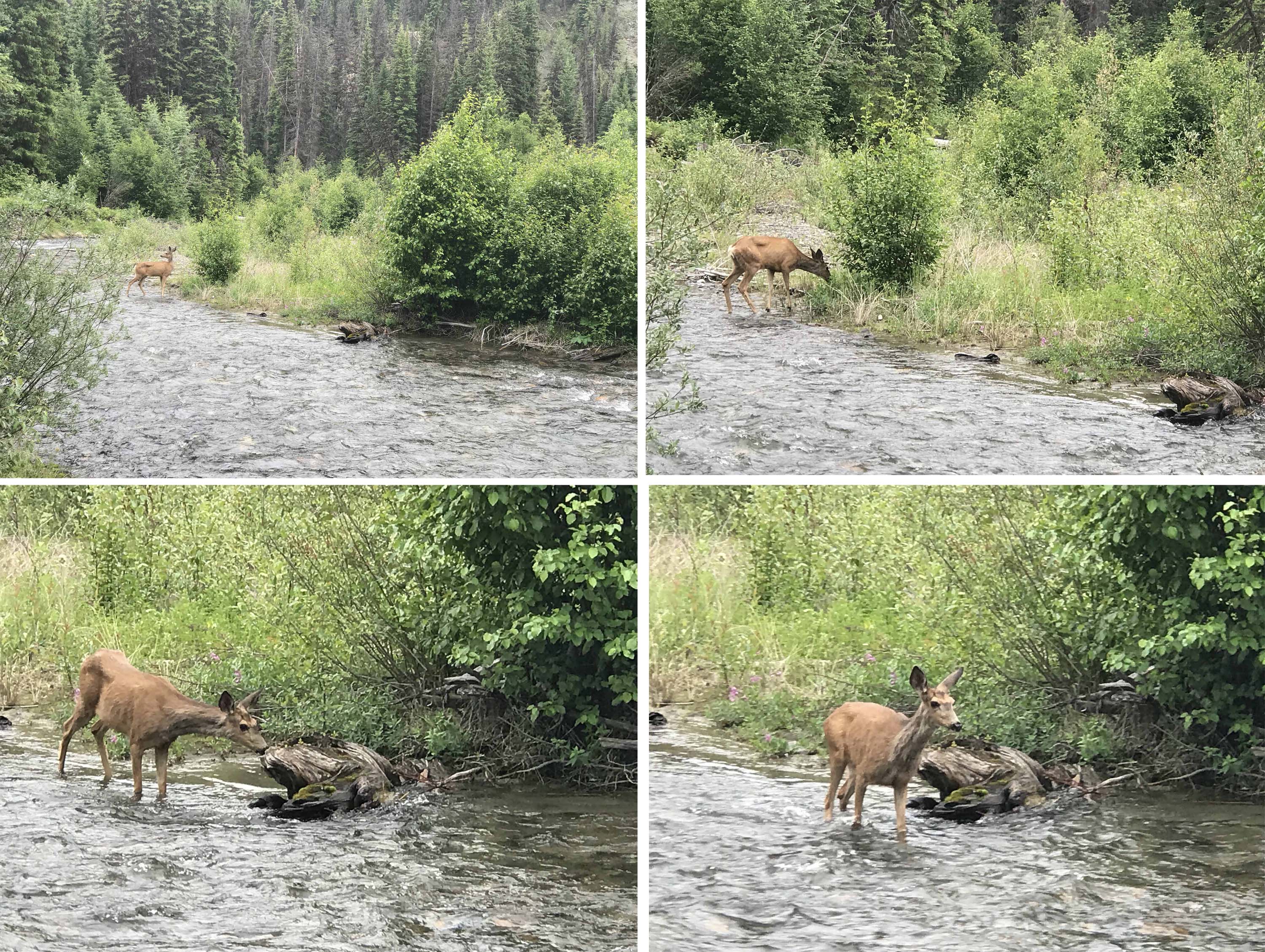
The following morning we were joined by a guest for breakfast as a deer wandered across the meadows and did not seem so concerned by our presence and continued into the shallow but fast flowing river, explored a small island half way across and wandered past us as we watched from the river bank, before coming ‘ashore’ on the other side of a tributary steam.
Once we had cleared up after breakfast, our Swiss guests wanted to be on their way as they were hoping to cover several hundred miles and get close to Jasper and they were obviously a little concerned about navigating the Yalokam River road back to the ‘main’ road back to Lillooet. There was one muddy part on a steep hill a few kilometers from our camp so James and Daniel said they would be happy to accompany them in the Jeep until they had navigated the worst sections. I was happy to stay in camp and read, so after saying my farewells and seeing the two vehicles depart I sat in my camp chair under the tarpaulin that James had erected between two trees. By now there was a constant light rain falling and it was quite chilly as we were around 1200 metres or 4000 ft in elevation. In fact it was cool enough to be wearing a down jacket. Every 40 minutes or so I took a break and wandered up the access track to the forestry road a few hundred metres away. There were no vehicle tracks other than our own, but I did find some bear poo on the road, almost certainly a couple of days old. It did cross my mind that if there was a problem with the Jeep, I could be staying at Beaverdam Camp longer than I planned and I did wonder why I had not thought to bring my satellite phone with me – probably because I thought the Pre Paid Sim Card was so expensive and only valid for a month the last time I checked!
Breaking camp on our final day
After a couple of hours James and Daniel returned and the rain started to ease off and I suggested we did some exploring and continue up the Yalokam River Road and see what we could find, so after some soup and coffee we set off. James had not been doing any driving recently, because his Canadian driving licence had expired and his new UK licence had not arrived, but as we were well and truly not only ‘off road’ but ‘off’ the ‘off road’ no licence was required. We saw on the map there was a ‘road’ (perhaps track is a better word) that was called Elizabeth Mine Road and I have always been attracted by routes on maps that seem to go into remote areas. Our Backcountry map guide has hundreds of roads marked but these were mainly tracks bulldozed through the forests maybe half a century earlier and most are long since abandoned and rarely used. Indeed the first road we took got narrower and narrower, we drove over a small fallen tree, enjoyed the views, navigated around boulders on the road, marveled at the beauty of moss laden trees and came to a dead end at either a long collapsed or dismantled bridge. The area was famous for jade and there were some beautiful green rocks in amongst the boulders when we got out to check there was no way past the collapsed bridge.
A closer examination of the map revealed that perhaps we had turned off the Yalakom River road a little too early and so we turned around (we had no choice) and as we made our way back saw a Black Bear sitting by the road, which quickly ran off as we approached. And sure enough after rejoining the ‘main’ road and continuing a few more kilometers, including the crossing of a vast scree slope, we found another turning that headed west and we took that and began a journey that none of us are likely to forget for a while, though not I would hasten to add for any negative
reasons.
The First Nations ‘Blockade Post’ on the Yalakom River Road is perhaps more asymbolic than practical but serves to deter irresponsible use of land that the First Nations people claim is theirs
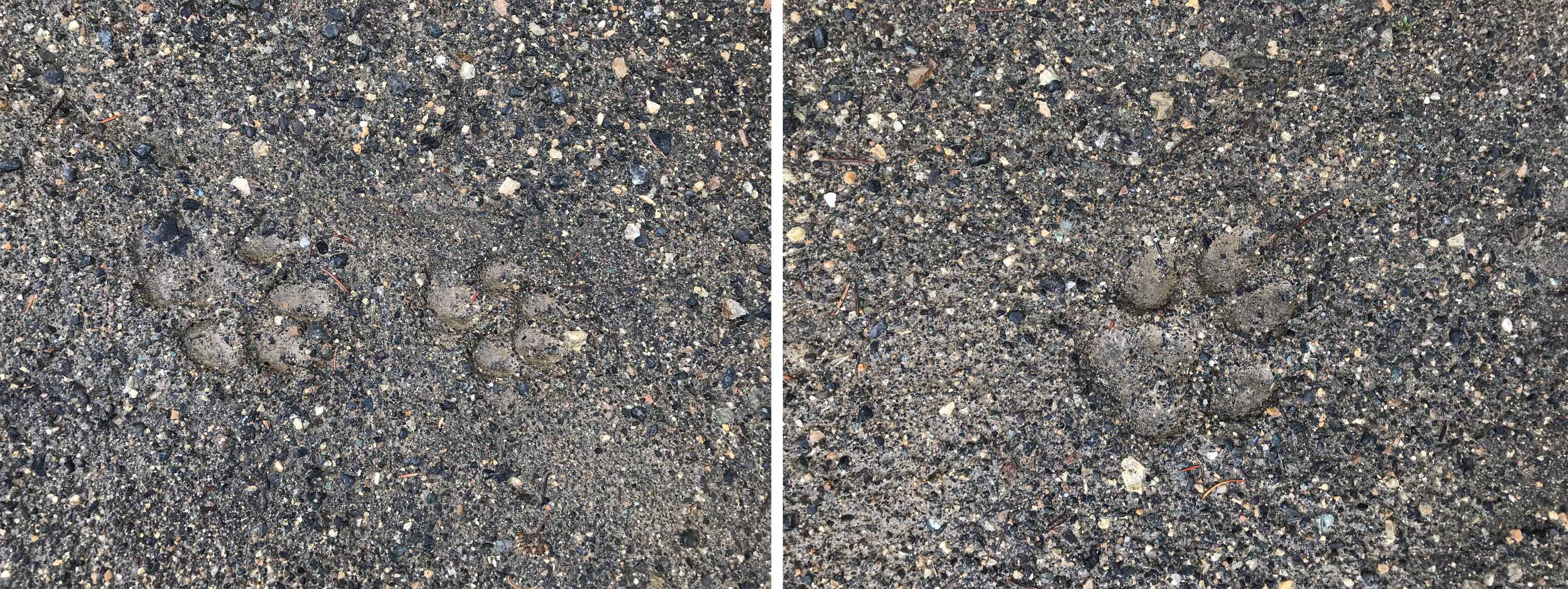
Our road gradually climbed following the direction of Blue Creek (a tributary of the Yalakom River) below us on our left, revealing ever more expansive views as we gained altitude. At one point when we left the vehicle to take photos and admire the view, we found very distinct bear tracks on the road.
And as we climbed a marked change occurred as the entire area we were passing through had been ravaged by fire. There were quite literally thousands of standing trees, all charred and without any vegetation. The entire landscape was festooned with charcoal black tree trunks with a secondary growth of bushes and grass already beginning to regenerate the ground levels. There had obviously been a major fire that had burnt out dozens of square kilometers of forest and as we pulled over to admire the burnt out landscape around us, one could see the contours of the landscape were clearly revealed with no vegetation to obscure the ground.
Onwards and upwards we continued and I realized we had almost driven up 1000 metres (3300 ft). Again I thought it might have been a good idea to have brought a satellite phone, as it was at least 6 kilometers back to the ‘road’ and another 10 kilometers to our camp and we had not been able to tell anyone where the three of us were heading that afternoon and indeed we barely knew ourselves!
Across the Blue Creek Valley on our left was a large snow dusted peak (which could have been Shulaps Peak) and simultaneously it firstly began to snow and secondly we approached a collection of buildings. We kept driving on the track to the right and above what was certainly the abandoned mining camp that had motivated us to come this way in the first place, as we could see an outhouse and what could have been a Trail sign on the ridge above us, which almost certainly lead to the summit of Big Dog Mountain. Our backcountry Trail book indicated there was a trail from the ridge to Noaxe Lake but I somehow suspected that most years it would be hiker free, as we were hardly in a popular Provincial Park attracting day or weekend campers from the nearby city!
Now which way is Carpenter Lake?
We were not equipped for any backcountry trekking, the weather was inclement, it was already late (1845) and no one else knew where we were so, much as we all enjoy exploring and see where this route was going to take us, it was time to turn before we found we were stuck in an incapacitated vehicle, so at 2145m (7078 ft) we made the decision that accessing the ridge above could wait for another day and we would turn around so we could descend to explore the mining camp which was now below us.
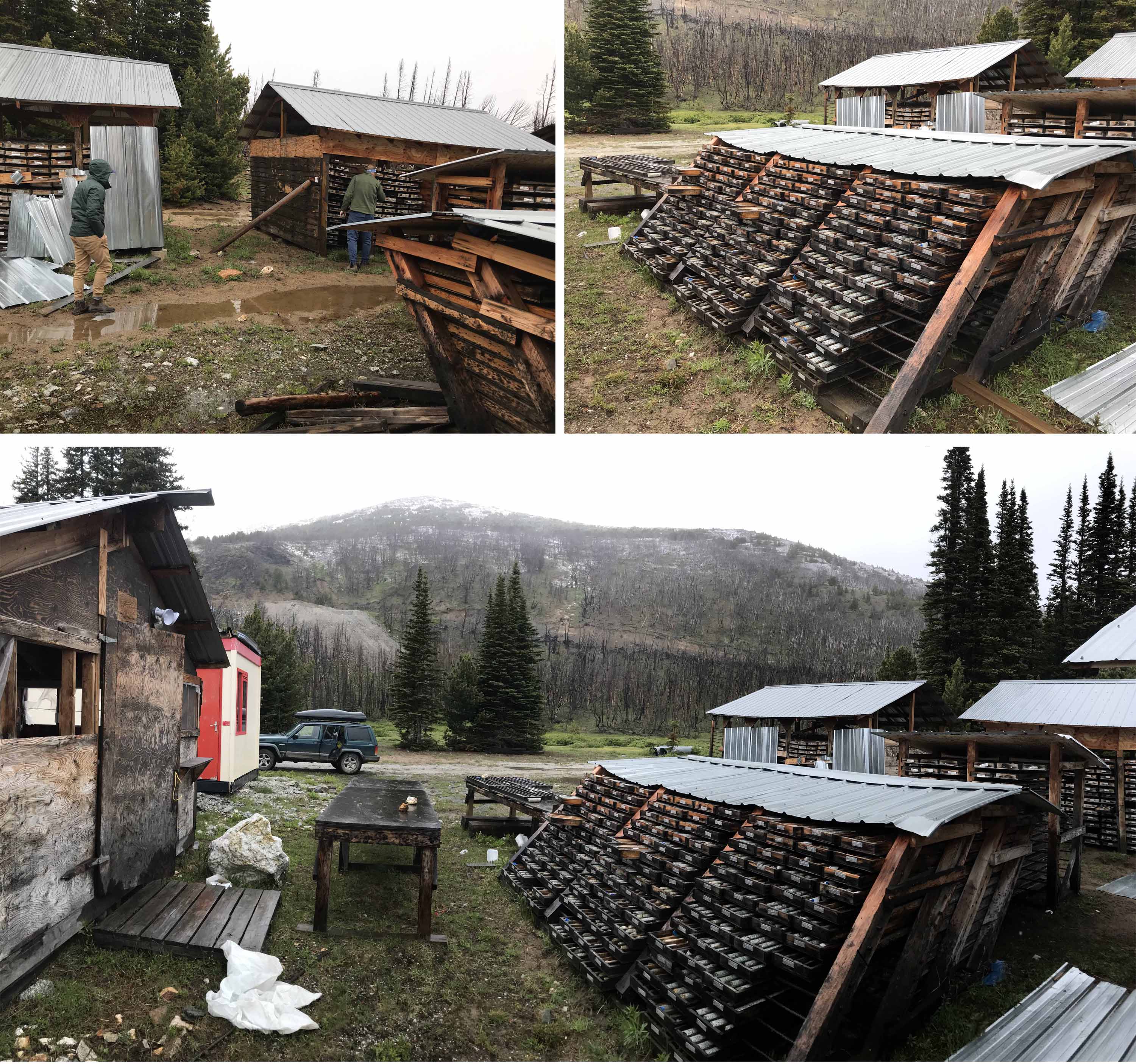
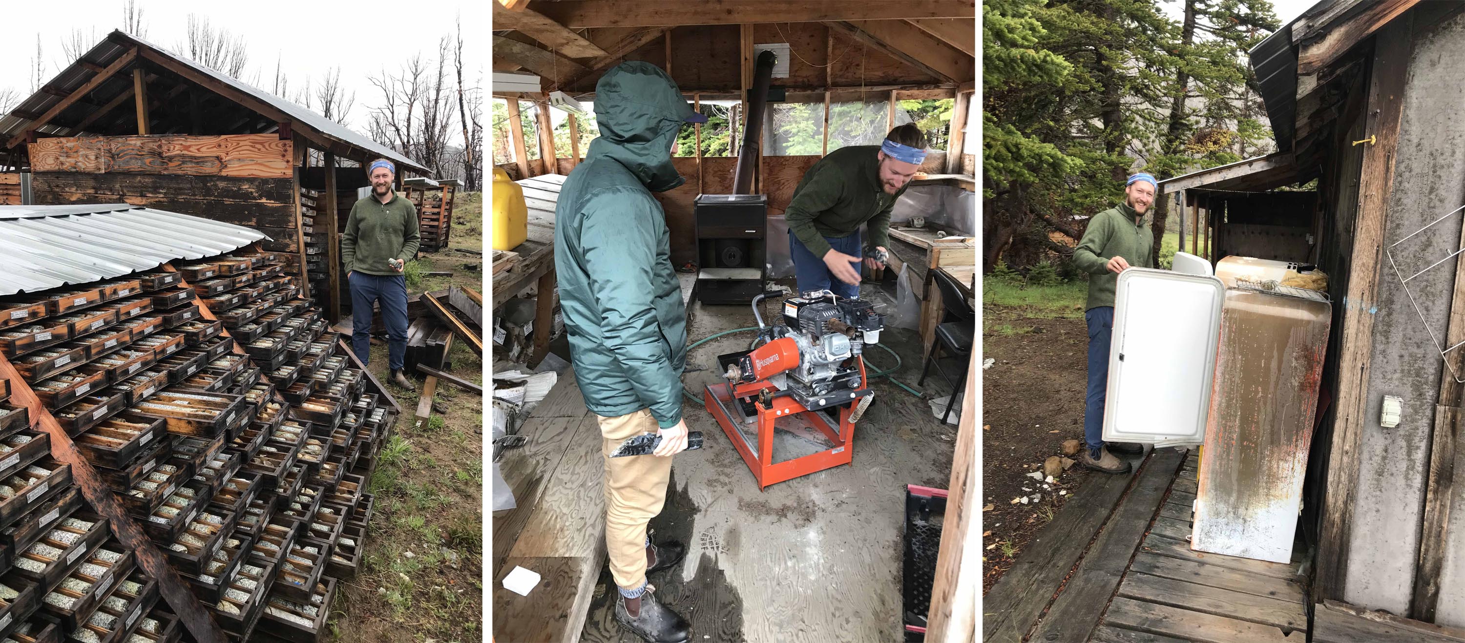
The camp was absolutely fascinating as there were multiple Core Shacks with thousands of stone core samples produced from exploratory drilling to see ‘what lies beneath’. Most of these core samples were in wooden trays that had metal date stamps attached and one of the shacks had tipped over under its own weight, leaving dozens of trays symmetrically exposed.
Prudence told us to leave our Jeep running whilst we explored the long abandoned camp because, much as I appreciate James’ mechanical aptitude and capability to resurrect vehicles that refuse to start, I thought this was not the best location to test his skills!
We found a Husqvarna Stone cutter in excellent condition in a watertight shed and were amazed that it had just been left, as it was surely worth at least a couple of thousand dollars. The site was fairly extensive with several outhouses and in one I found a selection of reading material, magazines that dated from 2010. We found a caravan sitting under a protective shelter and a pick up truck short of its radiator grill. We were careful to call out before we went into any of the open buildings as we did not want to surprise any occupant, but the reality was as we suspected – it was many years since anyone had been living here and perhaps what impressed us more than anything : the location was clearly so remote and attracted so few visitors that nothing had been vandalised.
There was an extensive accommodation block consisting of several permanent converted containers with heating units attached, a medical wing and a small gym and miraculously all was untouched by the fire which had decimated all the vegetation up to within 50 metres or so of the camp. Obviously the fire break protection around the camp had been very effective.

Approaching Seton Lake and Seton Portage after crossing the Terzaghi Dam and Mission Pass
We subsequently read reports that the property was owned by a person from Gold Bridge who had leased it to a Mining Company and that there had been exploration in the area since the 1950s. There are records of an ‘Elizabeth – Yalakom Gold Prospect’ dating from 1987. At some point the lease seems to have been transferred to a mining company named Sona Resources who were acquired by Skeena Resources and between 1992 and 2010 a lot of money was spent improving the road we had driven up to get all this equipment in and to establish the huge exploration camp that we were exploring. It appears the land is now claimed by First Nations people (we were to learn more of this the following day) and the shacks /cabin that we had seen the previous day were in fact a (pretty nominal!) blockade to deter people from using or accessing the land. So it seems the Camp has just been abandoned, possibly because of the First Nations Blockade but I suspect more likely because of a shortage of funding to continue operations.
We had spent the best part of an hour at the camp and it was time to get going, so after taking a few of the thousands of circular core samples lying around as souvenirs (they may make excellent paperweights?) we clambered back into our faithful Jeep, now 21 years old and so reliable. The headroom and driving position is not the best but I have battered this Jeep Cherokee along a never ending succession of backcountry forestry roads for the best part of 20 years and it has yet to let us down. (Stop Start driving in the City is another matter but I am a great fan of Jeeps.)
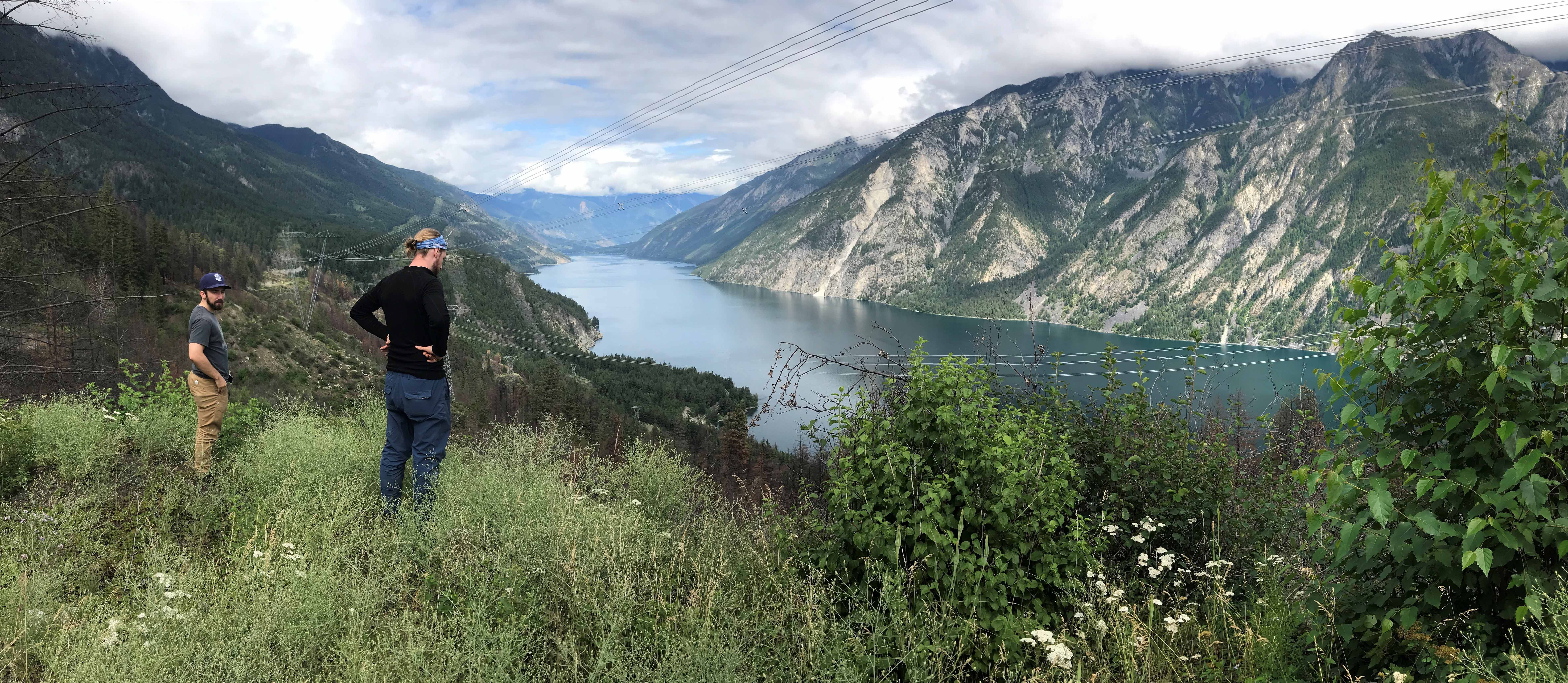
A pull over on the Hi Line route above Anderson Lake between Seton Portage and D’Arcy
Our descent and drive back to the camp was uneventful, except, once we reached the main Yalakom River road, we turned a corner and there was a Grizzly Bear sitting by the road, perhaps 50 metres away. I had seen Grizzlys in the wild when river rafting on the Alsek River in Alaska, but never before in BC. The bear went galloping down the road at some speed with us driving at around 20 mph and making little gain on it before it careered off into the bush!
We certainly had a lot to talk about when we sat around the campfire that night!
As this was an express trip, we were on our way back to Vancouver the following morning after dismantling the camp but this time, as we approached the two shacks on the Yalakom River Road, we noticed that someone was present, a First Nation’s Woman in her early 50s, with a heavily tattooed face. She explained that she was the ‘blockade’ and had been living there for five years, monitoring all users who accessed the Yalokam River Road and tried to deter Quad Bike users and rowdy groups. She felt the Provincial government was not doing enough to maintain the camping sites (in truth ours was fine) and that if they did not get their act together, then the Native Indian Tribe should be allowed to administer them. She felt it was important that the native population should be encouraged to return to their lands, rather than live in the cities, where alcohol and drugs blight their numbers. She stressed she had no problem with genuine lovers of the outdoors using the area. She told us she had never been up to the Blue Creek Mining Camp but understood the fire started when an overheating bulldozer had caught fire. It was very interesting to talk to her and just as we moved on a vehicle did pull up – the first we had seen for 48 hours!
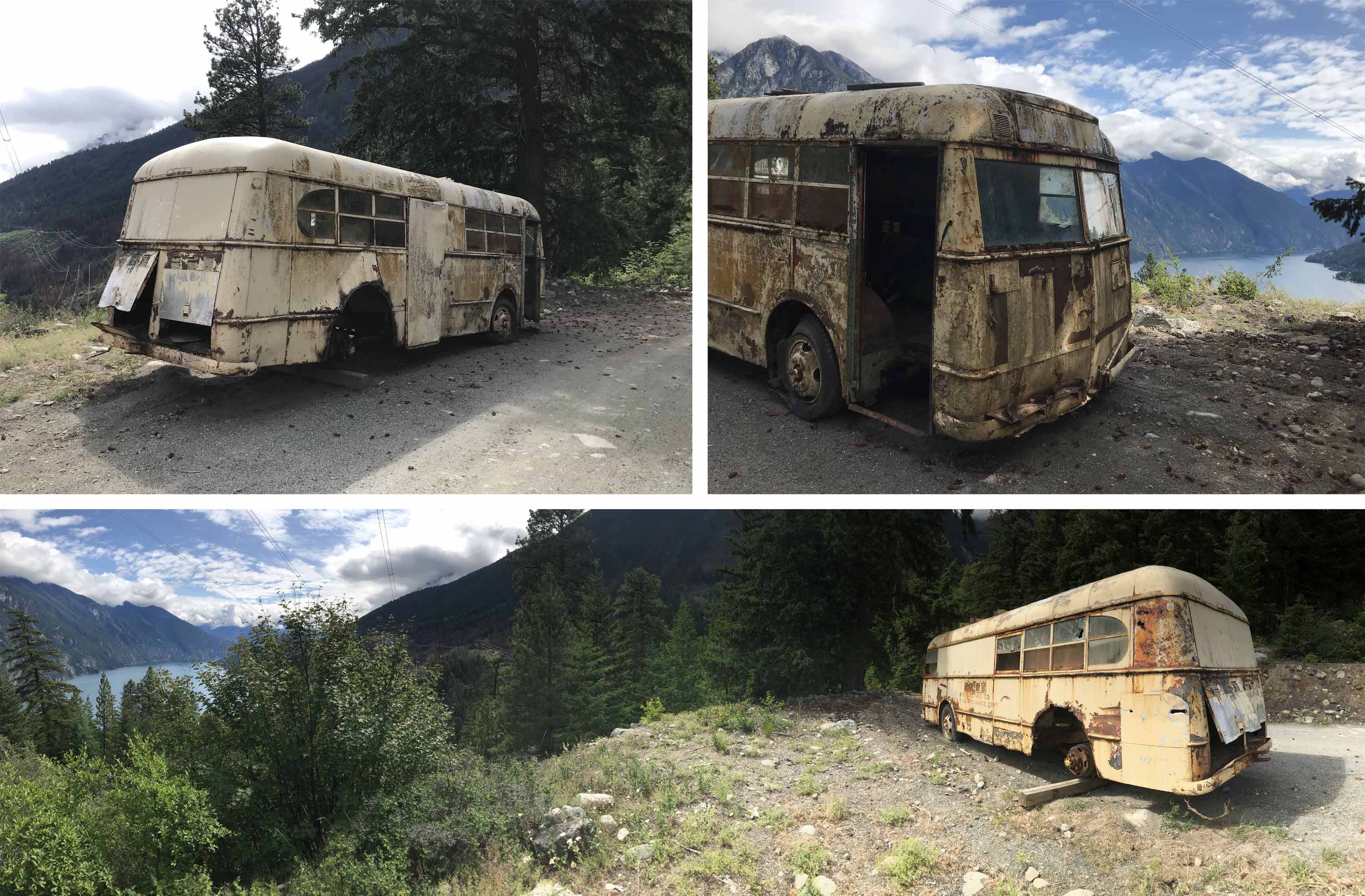
How long has this BC Electric Company Bus for maintenance workers been abandoned on the Hi Line Drive? BC Electric stopped operating in 1961!
Our return to Vancouver was uneventful as we returned to Moha and then made our way to Carpenter Lake, crossed the dam and then headed over Mission Pass to Seton Passage, where we bought some excellent coffee and Christmas presents from a Coffee and Handicrafts Shop located in a converted railway caboose.
We then made our way south towards Pemberton via the famous Hi Line route that follows the electricity power lines high above Anderson Lake between Seton Portage and D’Arcy. This was a rough route really only suitable for 4 x 4 vehicles and affording spectacular views over Anderson lake. And now that we were not much more than three hours from Vancouver, we did meet some occasional weekend campers making their way northwards above the Lake. From D’Arcy we dropped down to Mt. Currie and Pemberton and two hours later found ourselves back in Vancouver.
We had indeed fitted a lot into our three day trip and I was impressed with the off road beating our 20 plus year old jeep had taken with nary a murmur of complaint. I was pleased to have finally returned to the Beaverdam Creek campsite after 13 years and am already looking forward to returning and pushing much further up the Yalokam road and maybe doing some hiking above the Blue Creek Mining Camp.
And in contemplating these options, I am very much reminded of the basic difference between hiking in Canada and my beloved Alps in Europe in general and Switzerland in particular.
Last view of Anderson Lake before heading back to the city!
There is no doubt in my mind that the quality of the mountain scenery in the Alps is truly spectacular and yes more impressive than the mountain scenery in Canada. But hiking in the Alps is user friendly with a network of mountain huts and cabins, mountain villages and cable cars making it relatively easy to travel around and also to travel light.
In contrast when driving, let alone hiking and camping in remote locations in Canada, one has a truer wilderness experience, as everyone has to be fully responsible for their own safety and well being as well as carry food, fuel, clothing and shelter. It is not a question of one being better than the other, as they are very different experiences, united by the opportunity to enjoy and immerse ourselves in the outdoors.
And in reflecting upon these thoughts, I certainly hope it won’t be a long time coming (again) before I revisit the Chilcotin in general and Beaverdam Camp in particular.
It’s a telling thought that if I allow the same interval to my next visit as separated this visit from the previous one, that I would I will be 83 years old when I next get to Beaverdam Camp!
© Michael Bromfield

September 29, 2019 at 7:30 PM
Nice to hear from you Michael. We have been leading a nomadic life for the past 11 months. After traveling through Asia, US, and Canada (Yukon and BC), we are now in Europe. Interesting times! If you are curious, our website is the third link below. Best Regards Ashok Ashok B. Boghani+1 (617) 650-3301 My blog: http://ashokbo.blogspot.com My photos: https://www.flickr.com/photos/ashokbo/Our Travel Blog: https://ashokboghani.wixsite.com/bogtravel