
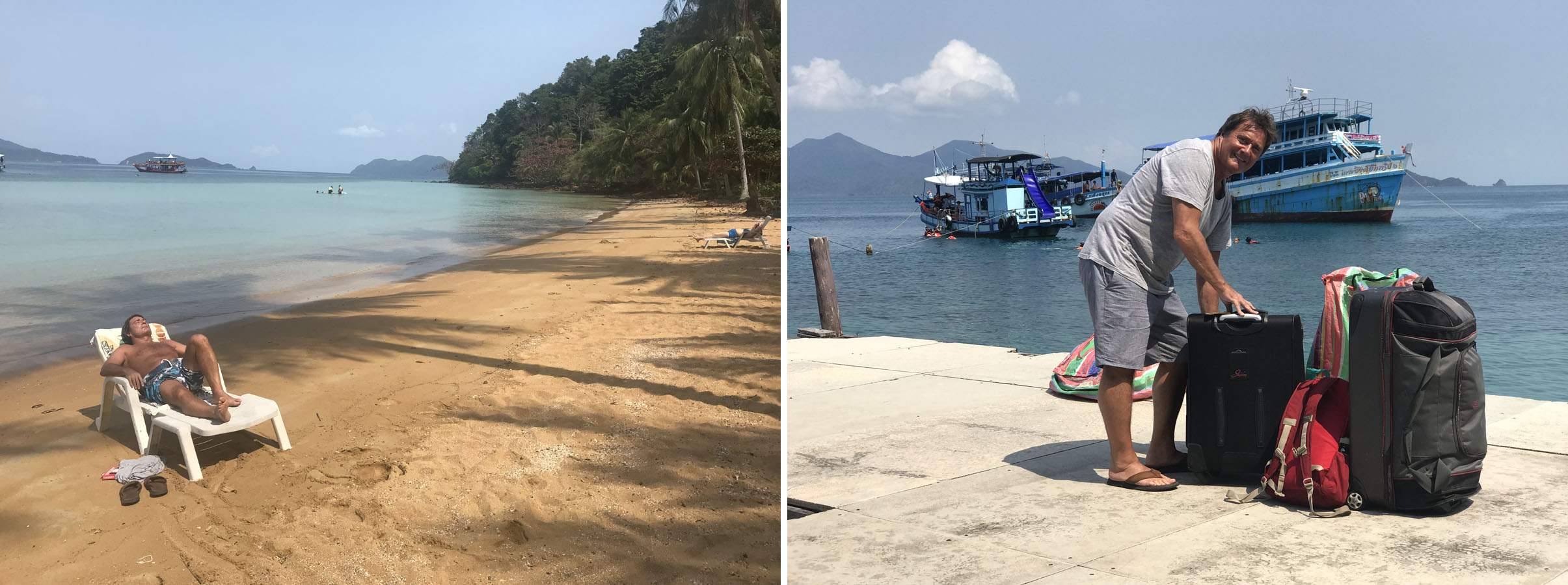
 In the end there were just 5 of us who flew out of Bangkok heading for Kota Kinabalu in Sabah via a change of flights in Kuala Lumpur.
And just why were we heading off to Borneo in the first place?
Our pre expedition training was particularly rigorous – not! However, this is where David may have strained his back!
Our intention was to climb Southeast Asia’s highest peak; Mt. Kinabalu and afterwards experience some of Sabah’s famed wildlife attractions, and notably the orangutan.
Mountaineers are competitive people and often motivated by targets. Whether it is to climb the fourteen 8,000 metre peaks in the world, the eighty two 4,000 metre peaks in the Alps, the two hundred and eighty two Munros (peaks above 3000 ft) in Scotland, the fifty eight Fourteeners (peaks above 14,000 ft) in Colorado or indeed the Seven Summits; the highest peak in each of the seven continents.
As long as there are mountains and people wanting to climb them, you can be sure there will be mountaineers compiling lists of targets – the second highest peaks on each continent anyone? (a far more challenging prospect as K2 makes it onto that particular list) All Alpine 4000 metre peaks in winter? All 8,000 metre peaks within 6 months? (see ‘14 Peaks‘ on Netflix). Indeed, there are almost as many lists as there are mountains, including the highest point in every US State or every European country. Not very high in low lying Holland!
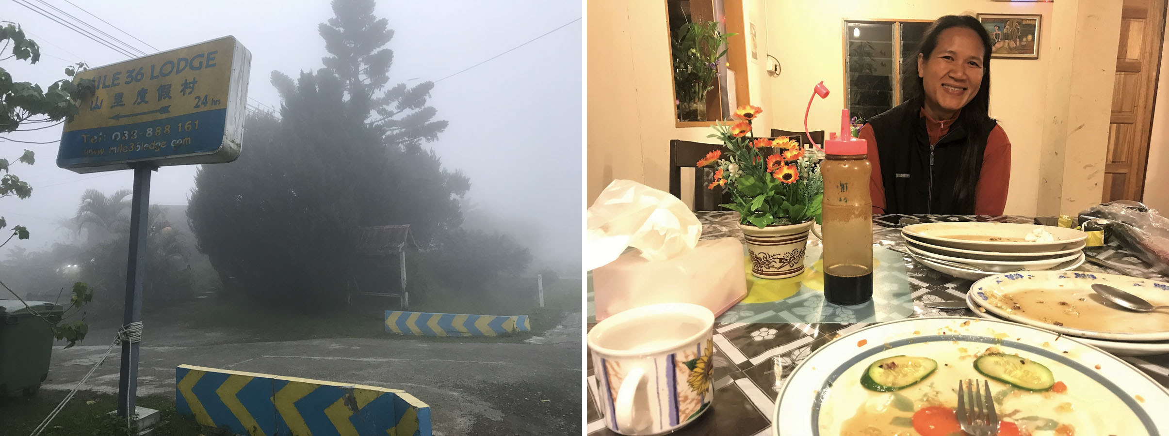
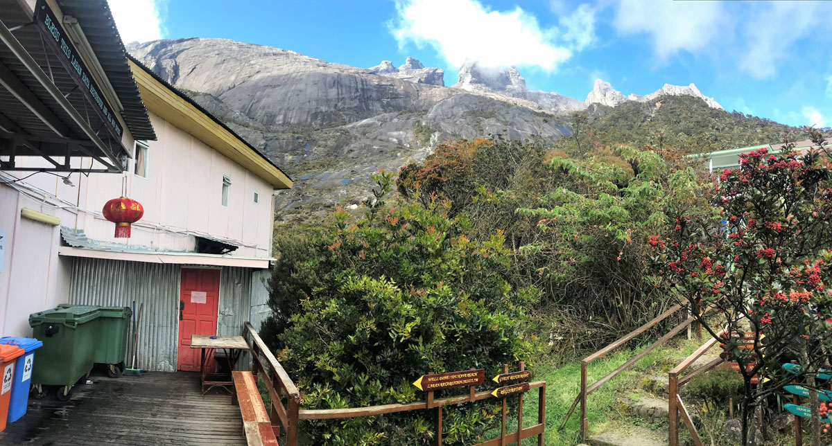
Our pre-climb accommodation was just outside the Kinabalu Park entrance at the Mile 36 Lodge.
And although my own height record is 6,550m at the Raphu La (Pass) at the foot of Everest’s Northeast Ridge, it would be presumptuous in the extreme to describe myself as a mountaineer, although I enjoy mountain walking and the ascent of easy non-technical peaks. Mountain walker? Yes. Mountaineer? Very definitely No!
However I am as competitive and target orientated as anyone, and Sabah is where Mt. Kinabalu (4,095m/13,435 ft) is located and, as it is a non-technical 2229m ascent from the trailhead to the summit, here was a ready opportunity to add the highest peak in Southeast Asia to my modest list of summits that included Kilimanjaro 5995m, the highest peak in Africa, a couple of the Alp’s 4000m peaks and Ben Nevis 1345m, the highest peak in the UK!
I had thought there would be more of us, but my Italian friend Gio and his charming Thai partner Noot said they were too busy to leave the Children’s Shelter they run in Pattaya (see here), even though our Kinabalu trek was planned as a preparation hike for a fundraising Himalayan Trek to benefit their shelter later in the year.
Appropriate equipment is always advisable when venturing into the mountains!
An American friend, Steve, was also planning to come with his Thai wife Tarn. But although I think his heart is in the right place, I find his ‘Make America Great Again’ and Trump supporting bilge so divisive and provocative that on a day when his views really irritated me, told him there was no way he was coming as I was not willing to risk exposing my friends to his Fox News views for the duration of the trip!
As it turned out, our Himalayan Trek did take place later in the year (see here ). Gio and Noot bailed out again which did not impress me (I have not spoken with Gio since!), but Steve and Tarn did come to the Himalayas, and Steve was good company, and a well-liked and appreciated group member, except on the one occasion when he defaulted to Trumpspeak. When it was patently clear his views were not shared by a single other person in the Tea House, his wife Tarn told him to quite literally shut up.
So, there were just five of us heading off to Sabah.
As well as myself and my Thai friend Ampai (see here), who has hiked extensively with me in the Himalayas, Alps and South America, there was Tony, his then girlfriend Nu, and David.
Tony and I had worked together from 1984 to 2011 and, after working together for most of our working lives, now surprisingly found ourselves living less than 500 metres from each other in Pratumnak, easily the nicest and quietest part of the (then) booming Thai resort of Pattaya.
Most of Tony’s walking is very much focussed on Thai golf courses three times a week, although he has joined me for a week’s walking in the Alps on two occasions over the years.

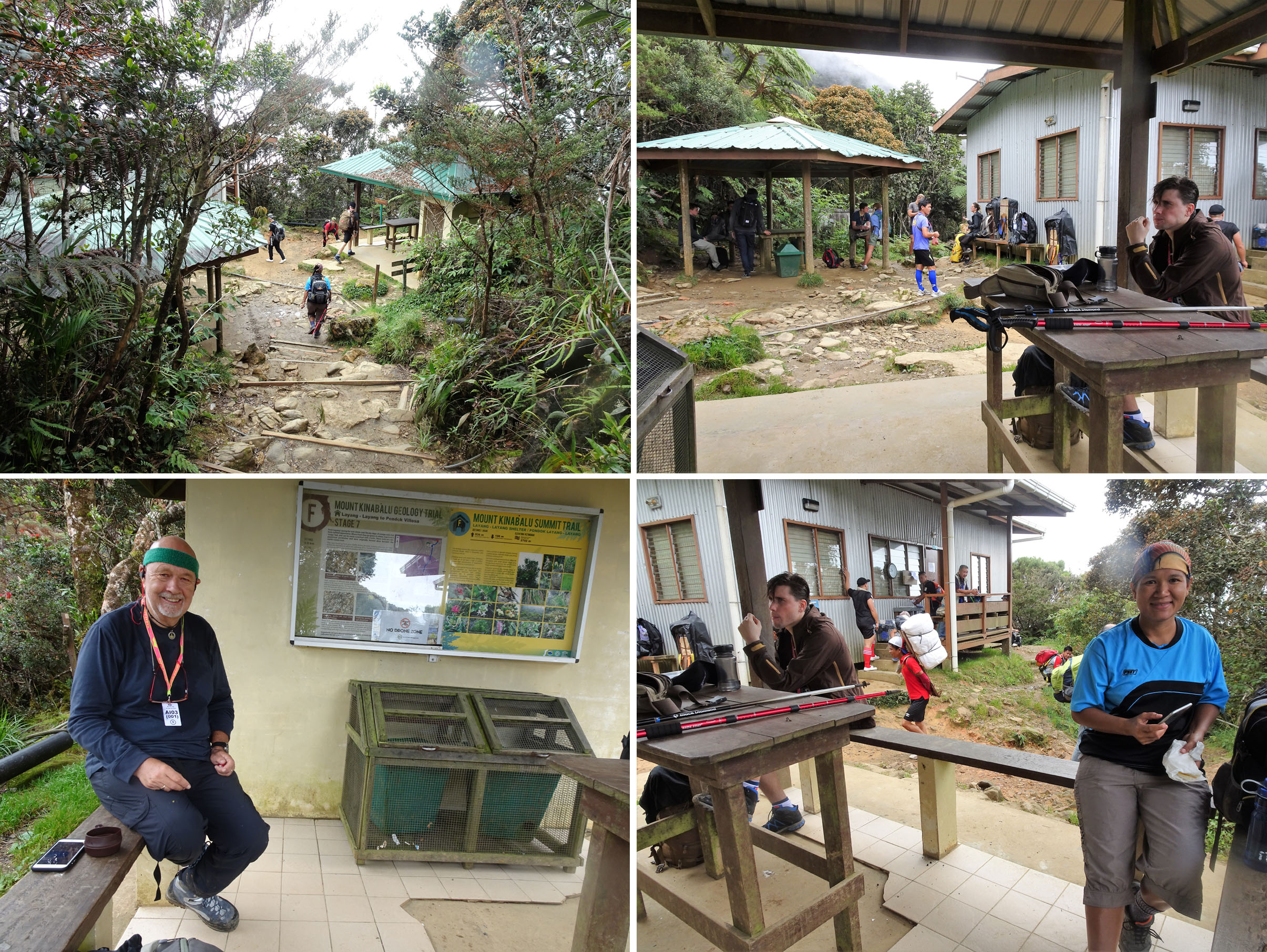
Meeting our Guide ‘Dennis’.
I explained to Tony that the ascent of Kinabalu was not demanding and little more than a stroll in the park, so well within his capabilities and as his Thai girlfriend at the time Nu was a golf caddy, 30 years younger than Tony, so she certainly had the energy to make it. I often teased Tony that the reason he was dating a caddy was surely to get someone to carry his bag for free and to save on tips!
However, Tony was adamant that whilst they would come to Sabah, Kinabalu was not on the agenda and while we were on the mountain, he and Nu would make some excursions and short walks in Kinabalu Park, and then join us for a week exploring some of the Orangutan sanctuaries and river resorts of Sabah.
David was, like Tony and myself, a Tour Operator who we had both known for almost 30 years. David had flown out from Thailand to meet up with a couple of friends in Pattaya and then join us on the ascent of Kinabalu. He had recently been diagnosed with Parkinson’s, but that had only encouraged and motivated him to be more active and make the most of every opportunity that presented itself.
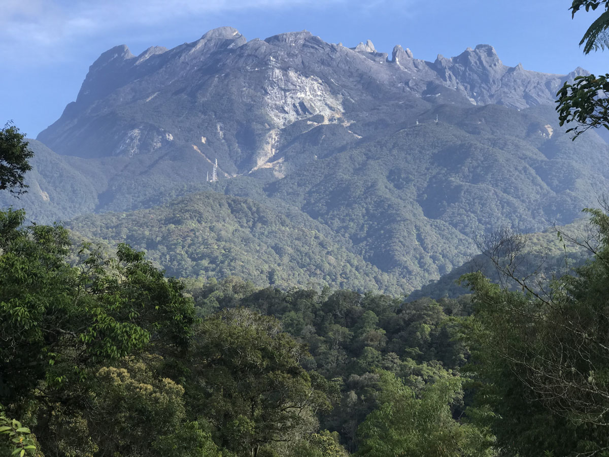
Mt. Kinabalu (4,095m/13,435 ft) is the highest peak in Southeast Asia. It is not technically challenging but a steep climb.
I guess this is the point in the narrative where I describe the efforts we went to in order to ensure we were fully fit for our challenge.
Challenge? What challenge? This was just a short walk in the park, right?
I had spent Christmas and New Year with my family in beautiful British Columbia, Canada. Christmas at our home in Point Grey, Vancouver, and for New Year we were joined by my brother in law, Wayne, and two of his nephews and we did a house exchange, and stayed in a huge and luxurious home, snowbound and on the shores of frozen Nicola Lake, some 150 miles inland from Vancouver.
Together with our elder daughter Sarah and her partner James, I had flown to Hong Kong from Vancouver where we were joined by Ampai and her best friend Suwanna, simultaneously making her first trip outside of Thailand and her first flight. After a very intensive 6 days exploring Hong Kong and Macau, Sarah and James continued to spend a week in Laos before returning to Vancouver, and Ampai, Suwanna and myself returned to Thailand where we were joined by David.
After a couple of days in Pattaya, finalising the arrangements for our gentle stroll up Mt. Kinabalu, we took David and his friend Stanl to the isolated Mango Beach Resort between Chanthaburi and the Cambodian border and then on to one of my favourite places in Thailand, the small and undeveloped island of Ko Wai to the south of larger Ko Chang. I had visited Ko Wai pretty much every year for the last ten years and there is no finer place to relax, chill out and do nothing but read.
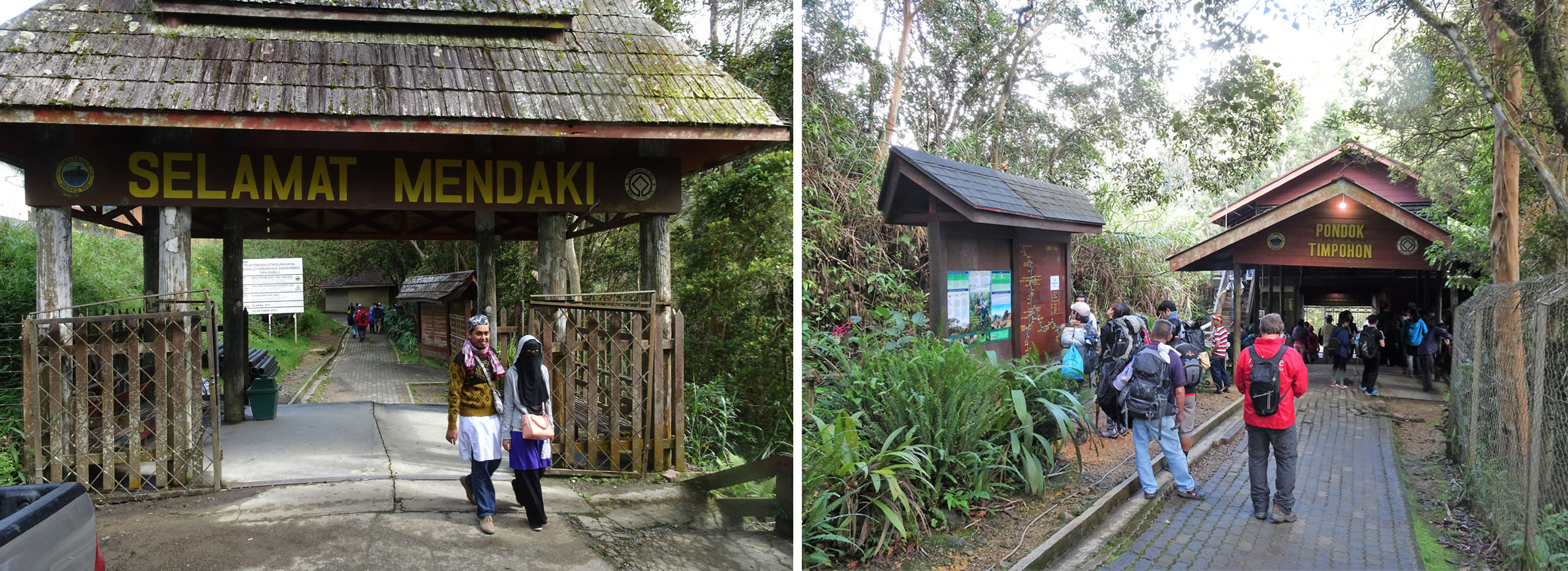
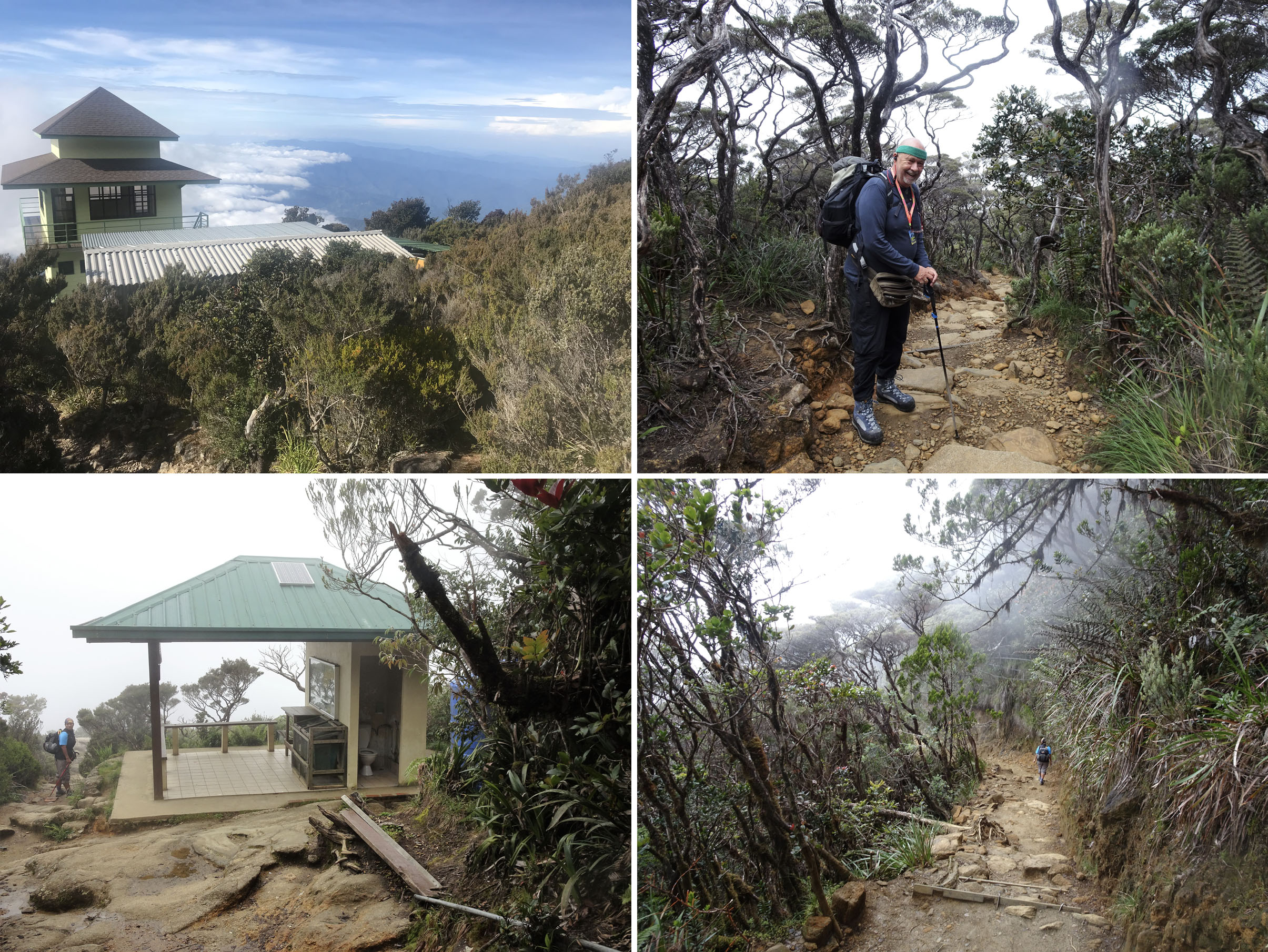
The Timpohon Gate is the main park entrance for climbers.
You might note that exercise and training did not figure prominently in the month before our departure for Sabah on February 1, 2018, although I do recall a couple of 8k walks along the beach at Mango Beach and a few leisurely strolls from one beach to another on Koh Wai!
However, whilst lying on the beach at Koh, Wai did comment that he may have tweaked his back which was giving him a little discomfort. Perhaps this was an early sign that our trip might not materialise quite as planned!
Whilst making arrangements for our visit to Mt. Kinabalu, I had discovered that it was one of the most heavily regulated and expensive mountains in the world, and also an important revenue generator for the Malaysian state of Sabah.
Not only was it necessary to book and prepay the park fee, climbing permit, porters if required, guide’s fee (mandatory) and overnight accommodation, but one had the option of doing it through a licensed tour operator, who had a quota of permits, or directly with the National Park which was the less expensive option. Although I seem to recollect (I am writing this account four years later!), with two nights’ accommodation in the Mountain Hut/Dormitory we still paid around $500 per head for the privilege of walking up Mt. Kinabalu!
Dennis describing our route. Would we still be smiling in 48 hours?
However, navigating through the labyrinth of Southeast Asian administration to arrive at the correct department to actually be able to make a request for a reservation, receive a provisional confirmation and then make a payment and (eventually!) receive a confirmation was a very time consuming task. It may have been quicker and less aggravating to go through a licensed operator, except we were making a special request (see below) which could only be authorised by the park’s authority.
Almost everyone has heard of Malaysia though perhaps few are aware it comprises of two constituent parts: Western and Eastern Malaysia. The latter is located in the northwest part of the island of Borneo, which Malaysia shares with Indonesia.
Peninsular or western Malaysia is located south of Thailand with the forever booming and independent city state of Singapore at its southern tip. Singapore quickly split from Malaysia in 1965, just two years after Malaysia won independence from Britain. Its remarkable success in the succeeding 50 plus years is still very much due to one remarkable individual, its first leader Lee Kuan Yew, whose achievements and legacy have provided the template within which the city/state has flourished. Whether one views Lee Kuan Yew as a benevolent father figure leader or as an enlightened despot will very much depend on your political outlook, but what is beyond doubt is how he was the driving force behind and responsible for the remarkably successful city state we see today. You can learn more about Singapore here .
Onwards and upwards through the equatorial rain forest.
In contrast, whilst Malaysia has not been unsuccessful as a developing nation, it has always struggled to find the right balance between its Muslim majority and the more entrepreneurial and not insignificant Chinese population. The capital Kuala Lumpur (see here) is a dynamic city which has managed to successfully blend old and new, evident in both modern and traditional architecture, modern e-commerce and traditional Asian living.
And after a change of planes in KL (as Kuala Lumpur is known throughout Asia), we were heading for Eastern Malaysia, comprising the two States of Sabah and Sarawak, located on Borneo.
When one starts talking about Borneo and Sabah, I believe most people would be hard pushed to successfully locate them on a map of the world and indeed the residents of Sabah and Sarawak often complain they are the forgotten half of Malaysia.
However, in recent years Sabah has become increasingly popular, attracting more and more visitors not least because of the Malaysian government’s successful efforts to promote it as a rewarding eco- tourism destination and in particular, for the opportunity to observe orangutan in their natural habitat.
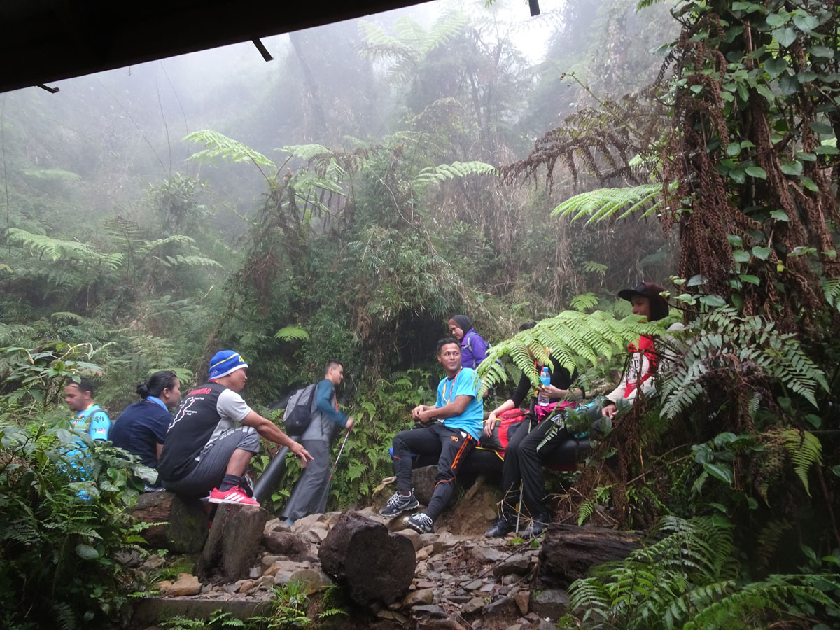
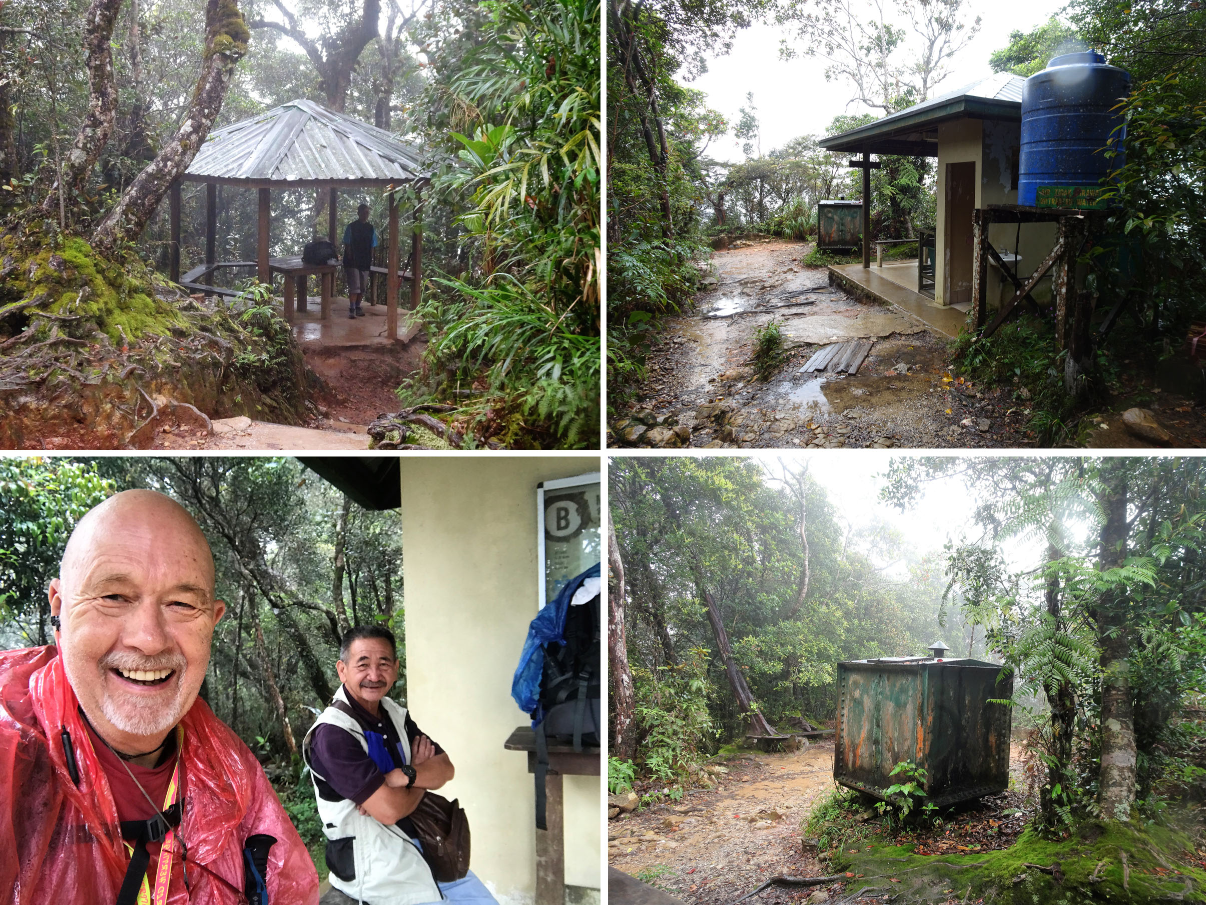
We stopped frequently at the various shelters as we made our way upwards.
And as we were flying to Kota Kinabalu, it dawned on me: whether or not Sabah was relatively unknown on the world stage, this would be my 3rd visit to Sabah and Kota Kinabalu and I seemed to be visiting on a regular pattern every 21 years!
In 1976, when spending several months travelling in Southeast Asia after teaching in Australia for almost 4 years, together with my then girlfriend Heather (who actually emailed me about our travels just a few weeks ago!) we had journeyed from Singapore to Manila, in the Philippines, on a series of plane hops along the northeast coast of Borneo, visiting river mouth towns in Sarawak, Brunei and Sabah. I guess our trip was adventurous and off the beaten track for the times. How remarkable that 50 years on I am still a regular visitor to the Philippines!
Twenty one years later, together with my wife Sharron and our three children, we had flown from the UK for a holiday in Sabah, where I had persuaded the upmarket Shangri-La Hotel chain to provide us with some complementary or discounted accommodation where we could relax and use as a base to visit wildlife sanctuaries that we were to visit again in 2018.
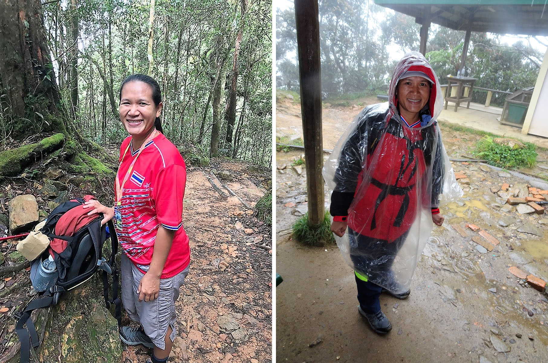
Always be prepared to adapt your clothing to the changing weather in the mountains!
It was only after returning to the UK later in 2018 that I realised I had previously visited one of the orangutan sanctuaries 21 years earlier!
My clear memory of the 1997 trip was it was not long after I had obtained my first mobile phone (a Motorola connected to the Orange network), and I was so impressed that with the roaming facility, I could use my UK phone in Sabah.
I was less impressed when I saw the bill!
Our journey from Bangkok to Kota Kinabalu was not uneventful on two accounts.
Tony discovered he had lost his phone and the following day he received confirmation that it had been safely located at the KL Airport. Although Tony was flying directly back to Bangkok, Ampai and I were returning via a couple of days in KL so hopefully we could retrieve it on his behalf.
However, of perhaps more concern was the fact that David’s back had significantly worsened since we had left Ko Wai and particularly on our two flights. His mobility was already severely restricted, and he had serious concerns in regard to our ascent of Mt Kinabalu and his priority, as soon as we had checked into our Kota Kinabalu hotel, was to arrange a massage.
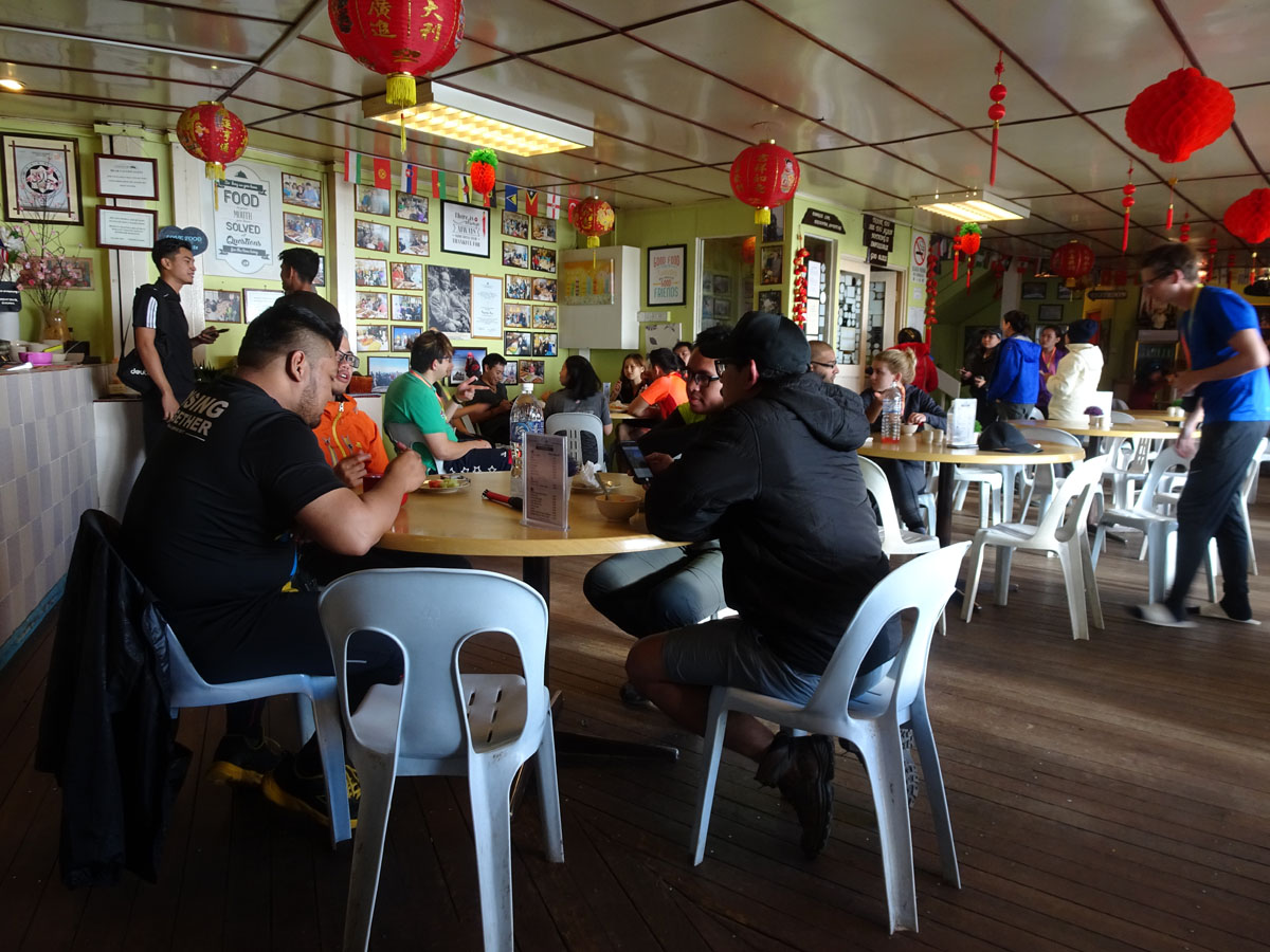
Checking-in, if not a challenge, was an experience. Our arrival coincided with the check-in of a large Chinese group which involved noise levels fairly comparable with a Premier League soccer match!
Steps and more steps were necessary when the trail was prone to erosion from both hikers and the high rainfall.
Ampai, Tony and I met in the hotel restaurant for a belated dinner before it closed, whilst David arranged his massage. We were of course all too polite the next morning to enquire if indeed it had involved a ‘Happy Ending’, but David reported he felt a little more mobile.
The following day all we had to do was relocate from Kota Kinabalu to the budget motel that I had booked just outside the Kinabalu National Park.
‘Grab’ is the Southeast Asian equivalent of Uber and certainly does not suffer by comparison and is widely available in Thailand, Singapore, Malaysia, the Philippines, and other countries, and by midday, courtesy of ‘Grab’, we were heading inland in a minivan on a 90-minute journey to the Kinabalu National Park.
Many people of my generation may sometimes scorn smartphones and profess they have little interest in modern and mobile technology, but it is often when one arrives in a new or unknown destination that they prove invaluable for booking taxis and accommodation, helping one navigate, translating etc, let alone provide access to innumerable free apps to provide instant information and self-guided walking tours about wherever we might find ourselves.
Kota Kinabalu was a clean modern city; the road was modern and well maintained and I found myself thinking if this was a Sabah starved of investment, perhaps the locals should make a visit to the Philippines, and they might appreciate maybe they were not so badly off!
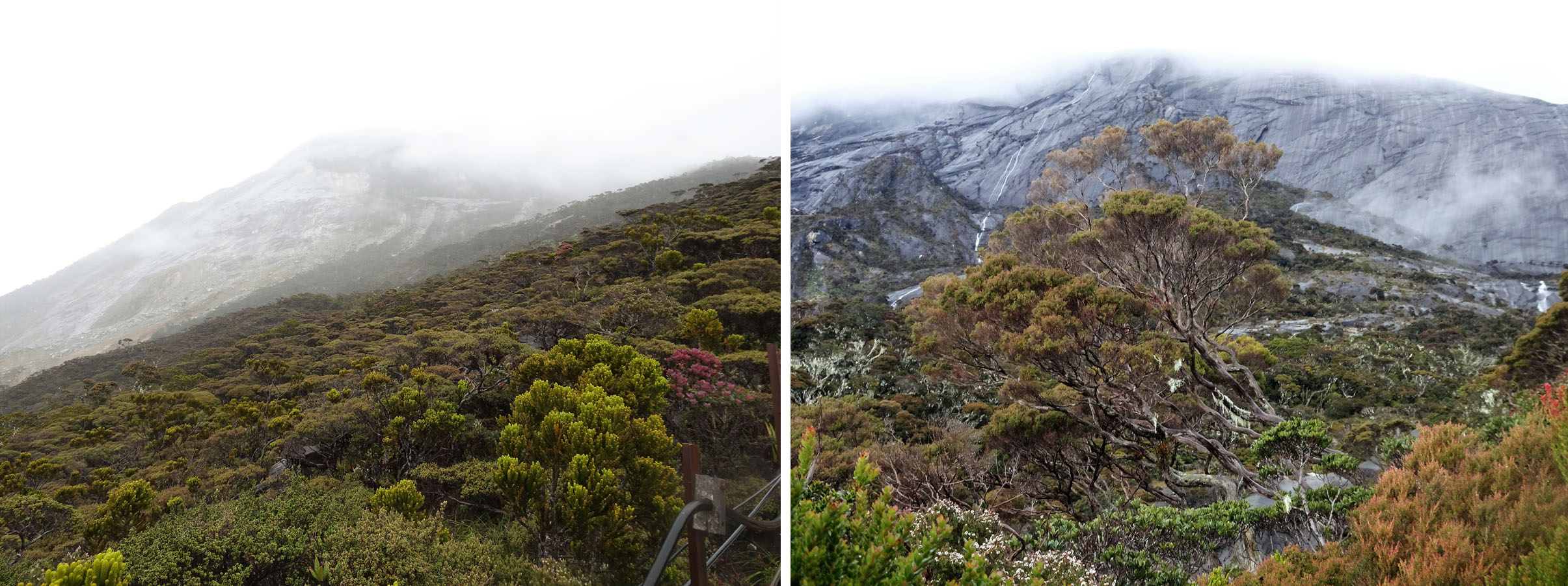
As we emerged above the treeline the upper slopes of Mt. Kinabalu became partly visible………….
When we arrived at the National Park headquarters, we completed some of the paperwork for registration to save time the following day when we were due to meet our guide and then it was farewell to Tony and Nu, who were staying at a hotel at the park entrance, whilst Ampai, David and myself were booked into an undistinguished motel a few kilometres away. We had all booked into a Kota Kinabalu hotel 3 nights hence, which was where we could reconvene hopefully after Ampai, David and myself had made it to the summit of Mt. Kinabalu.
We spent the balance of the afternoon at our hotel, although I did venture out for a walk along the road but as the cloud had come in saw nothing of interest and no views, but was reminded that in all mountain ranges a change of weather and loss of visibility can make any mountain a killer if one is disorientated and lost.
We ate an undistinguished dinner at our undistinguished motel with rice and noodles, the staples of the limited menu, and retired to bed wondering what the following day had in store for us and how David’s back would cope with the 1406m/4612ft ascent from the Timpohon Gate to the Laban Rata Lodge.
……….. as did our affable guide!
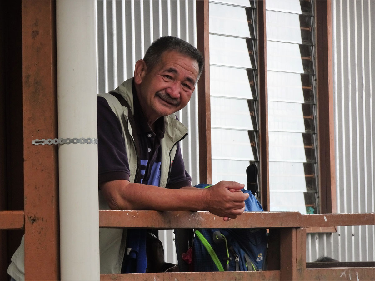
The following morning, we arranged a transfer back to the park administration buildings at the Timpohon Gate, where we met the Guide who had been allocated to our small group. ‘Dennis’ or Doinis Saibah to be faithfully accurate, was a small wiry man with brush-like grey hair and a military moustache who I assumed was in his 50s. He had been guiding on the mountain for almost 30 years, which meant the number of ascents of Mt. Kinabalu that he had made was measured in thousands rather than hundreds!
It is not necessary to join an organised group to climb Kinabalu, and indeed we had organised our trip independently, but it is compulsory to use a guide on the ratio of one guide for every 5 climbers.
Is a guide necessary?
Or should the question be, ‘why is a guide necessary?’
Mt. Kinabalu is a fairly benign mountain. It is not technically challenging, and it is just a walk to get to the summit. Use of one’s hands or climbing skills are not required.
However, weather conditions can change quickly in mountain regions and more so in tropical regions. Cloud can come in quickly, visibility is obscured, it is easy to become disorientated and lose the way and there are occasional fatalities, usually as a result of hikers leaving the trail for various reasons and then slipping in an exposed area. Tragically an earthquake struck the mountain in 2015 and the resulting avalanches and rockfall killed 18 climbers and the local guides performed miracles to form rescue parties and bring 150 stranded climbers down safely through the debris which had obliterated parts of the trail.
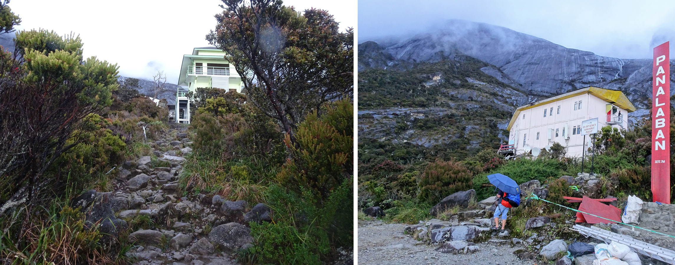
After the best part of 8 hours (!) we were finally approaching the Panalaban accommodation complex.
As well as providing much needed remuneration for local people and their families, Kinabalu is an iconic mountain which attracts a lot of inexperienced hikers and climbers, and it is always best to be safe rather than sorry!
So yes, it is necessary and justified to make the use of a local guide compulsory.
The morning sky was clear, and we had fine views of the mountain ahead and clearly we had a long slog through the trees before reaching the clearly visible rocky slopes above the tree line.
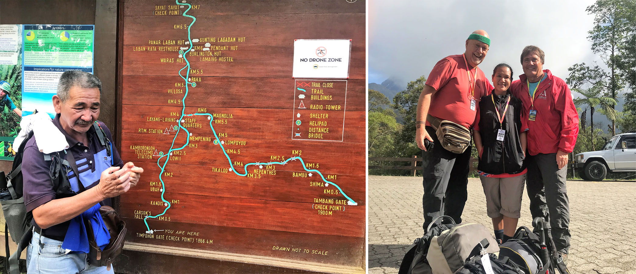
After collecting our packed lunch (included with the park fees), we took a few group pictures and had a look at the Notice Board with a painted map of our route.
One thing that was immediately clear from the map and Dennis’ briefing was that in many ways this was a very ‘user friendly’ operation, as there were shelters and water available pretty much every kilometre of the ascent.
Home for the next two nights.
And something very different was that in most mountain ranges of the world, distance is measured in time which depends on the condition of the route, the steepness or not of the gradient of descent and of course the distance. So, when people ask me how far I have walked in the mountains I will reply with a time because a single kilometre up a steep and exposed slope will take a lot longer than 3 km on a well graded trail that is almost level. The lateral distance on the ground is immaterial.
But here on Kinabalu it was distance rather than time that was marked on signposts and markers.
I was far from convinced that David was fit enough for the hike, which was nothing to do with his Parkinson’s but rather due to his limited mobility. It did not appear that the two massages he had arranged since arriving in Sabah had eased his pain or increased his mobility, but we were soon on our way so no turning back now – or so I thought!
The park entrance was at an altitude of 1866m and the Laban Rata Resthouse, our destination for tonight’s sleep, was at 3272m so I mentally divided our ascent into four 350m legs with planned breaks at circa 2200m, 2550m and 2900m,
Although we had arrived at the park headquarters by 8am, what with admin, meeting our guide, collecting our breakfasts and a briefing it was 0950 before we set off.

The Laban Rata Lodge is very comparable with an Alpine Mountain Refuge in Europe.
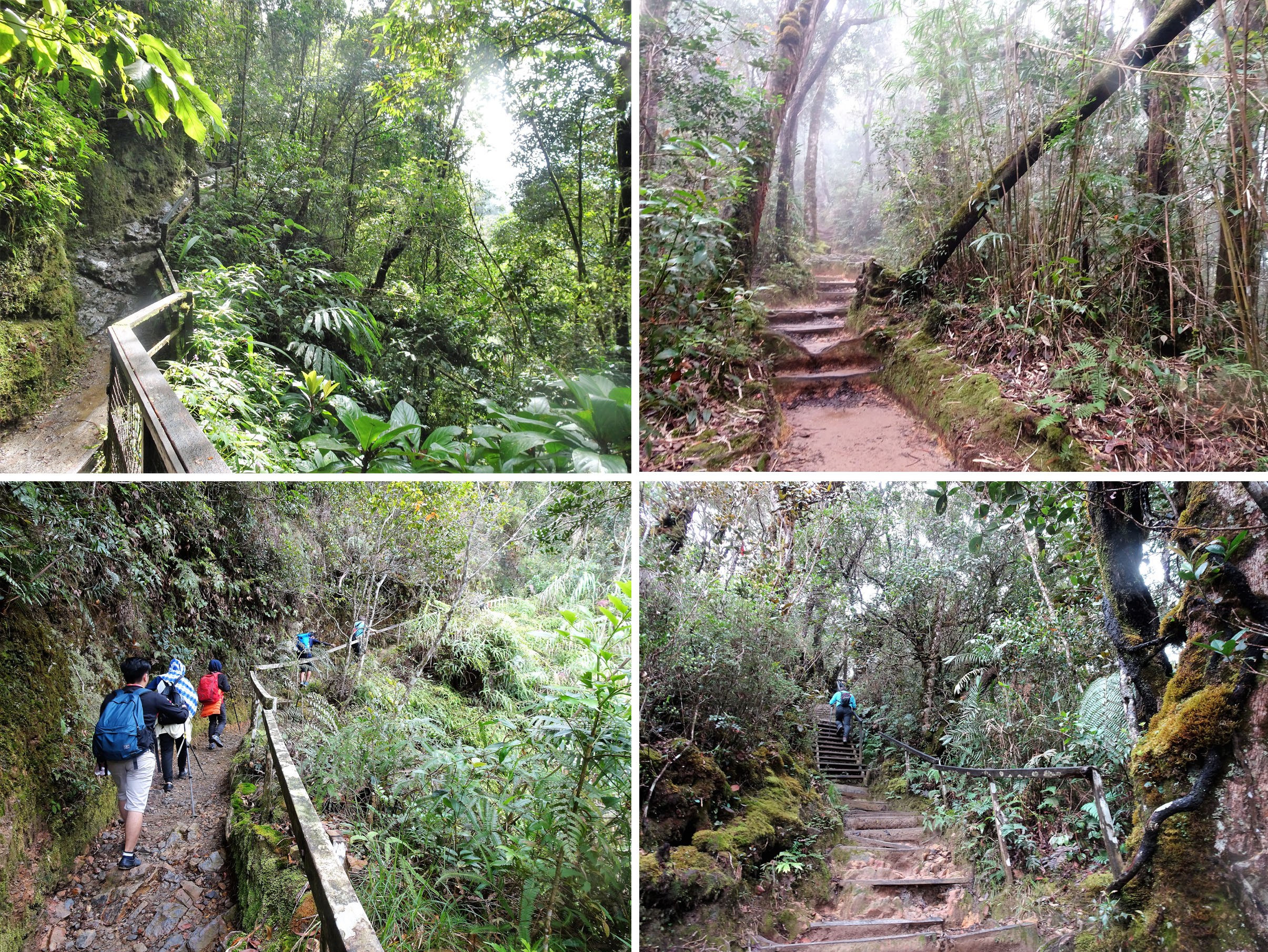
I sweat like a pig and often think I only have to look at a hill to start sweating and so within five minutes of heading off I realised my first error. The humidity was of course very high as we made our way up through the equatorial rainforest. Sweat was pouring off my forehead and my T-shirt would soon be saturated. Why oh why had I not brought a small hand towel tucked behind the sternum strap of my pack, so I could at least regularly wipe the sweat off my forehead before it ran into my eyes?
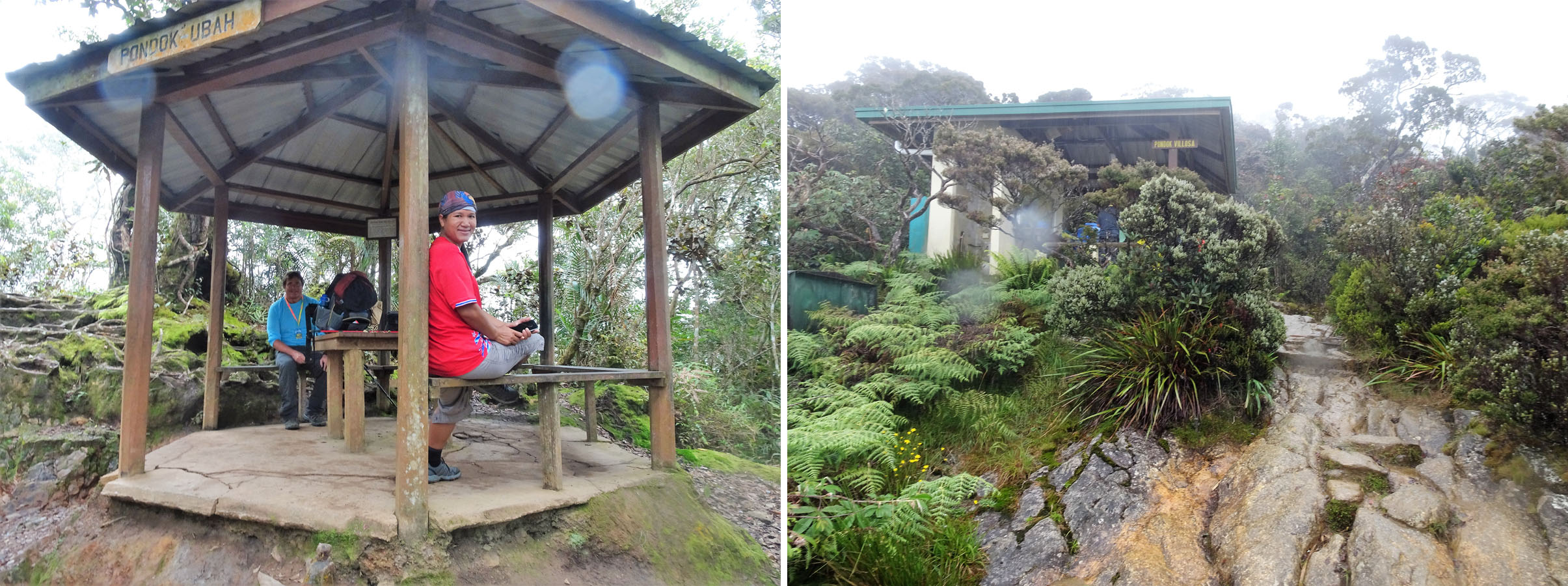
The Shelters were usually comprised a small circular pavilion and perhaps another shelter area, some toilet facilities, a tap and maybe some outbuildings possibly to house trail maintenance equipment.
After an hour and at our first stop at the Pondok Ubah shelter, I was chatting to a young couple from Sabah who asked how old I was. When I said 69, she laughed and said her mother was born in 1956, seven years after me!
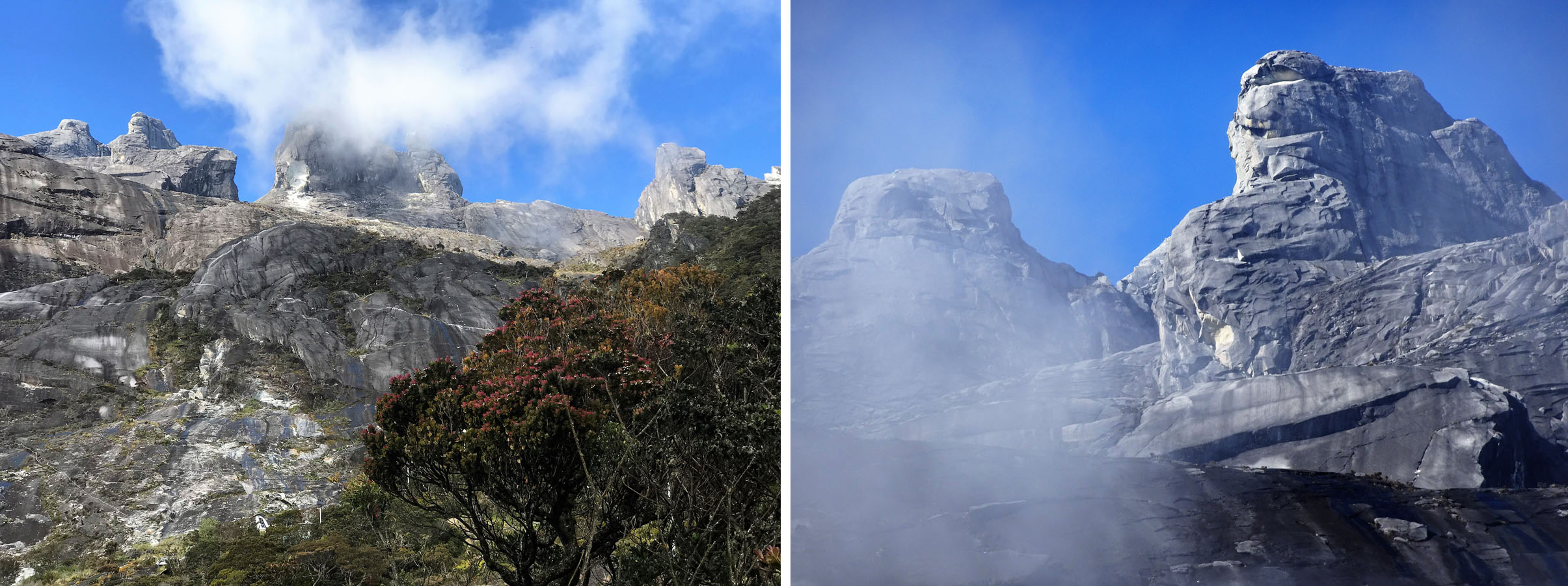
The upper slopes of Mt Kinabalu from the Laban Rata Lodge.
I guess this gave me an excuse for feeling tired and as we continued our ascent, I appreciated that I was clearly the oldest person that I saw on the trail, either ascending or descending. Indeed, most of the participants on the trail were young Malaysians who I would judge to be between 18 and 30. I got the impression that these were not necessarily regular hikers, but that an ascent of Kinabalu was in many ways a ‘Rite of Passage’ for those young Malaysians who could afford to fly to Sabah and pay the park fees.
So much for dividing the route into 4 sections and aiming for target stops every 350m of ascent. We were happy to take a break at each and at the second David said to me
‘Not exactly a stroll in the park, eh? Next time I say I want to come along make sure you talk me out of it.’
As he had a smile on his face, I knew David was joking (I think!) but his back was clearly causing him some discomfort, although he was also commenting how heavy my pack was. I don’t think it was more than 10kg or so, but I did have a couple of litres of water.
The route to the summit is clearly discernible.
We continued onwards and upwards, and I have to admit I was somewhat surprised that I was feeling quite tired and whilst one could hardly say it was hard going it was not as ‘easy’ as I expected. We were continually in the forest with dense foliage, there were no views and the trail continued over interminable sets of tree roots and steps which I think were the root (excuse the pun) of the problem.
This was indeed onwards and upwards with every step!
The steps were unrelenting and reminded me of the trail up to Busenalp in Switzerland’s Bernese Oberland (see here). Indeed, for almost three decades when I am hiking on a steep ascent, I often say to myself:
‘Keep going Michael. This is nothing like as steep as Busenalp.’
The Panalaban accommodation complex is the ‘base camp’ for the final ascent to the summit.
However, as I ascended the lower slopes of Kinabalu I was thinking:
‘This is arguably worse than Busenalp.’
I think it was because of the unrelenting humidity and the fact that the steps were often big.
The Inca Trail in Peru has lots of ascents that include long stretches of steps up steep slopes, but at least they are broken up with stretches of level terrain as the trail contours around hillsides.
I guess we should have been thankful we were in the shade and there was no sun overhead and after a lunch stop and as we gained altitude, we noted an increasing number of hikers already descending after having summitted earlier the same morning.
For some reason the title of Jack Olsen’s famous account of a tragic 1957 ascent of the Eiger ‘The Climb to Hell’ kept going through my mind!
We tended to walk individually at different speeds with the first waiting at a shelter for the others, and David had decided the best thing for his back was to keep going so he was usually ahead of me.
Dinner time at Laban Rata.
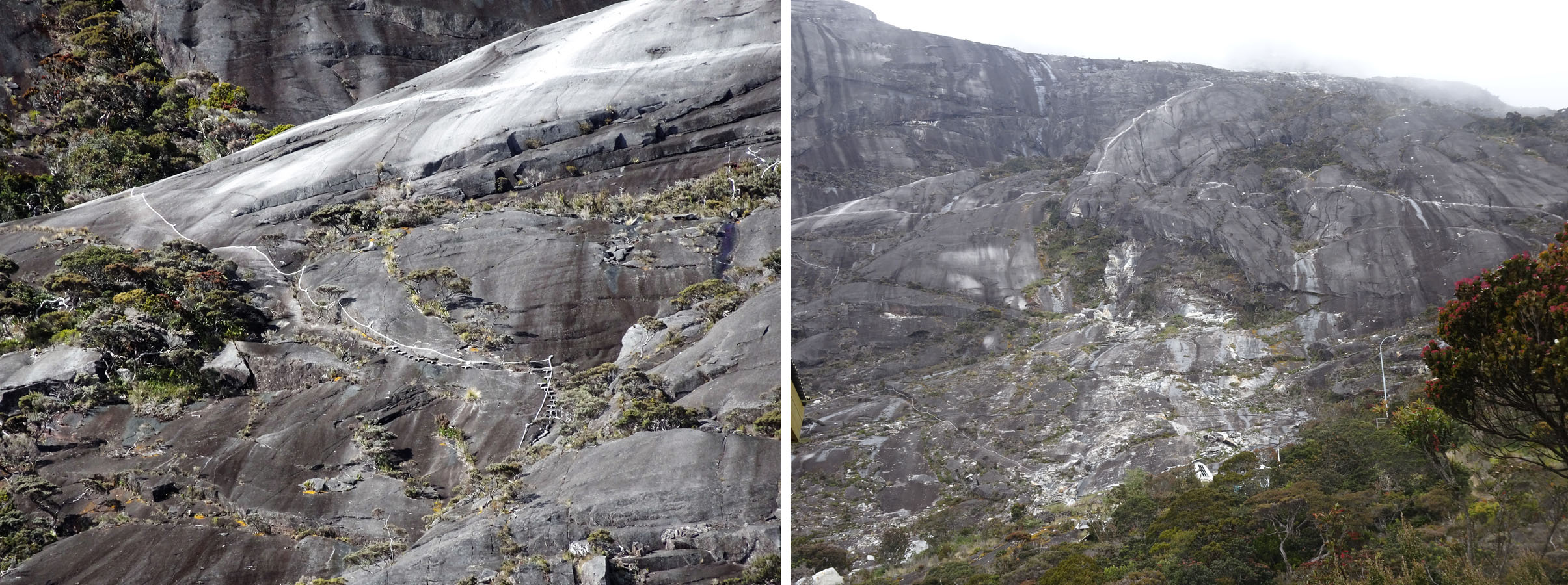
Parts of the trail were more eroded than others as a result of a combination of heavy footfall and rainfall runoff, and new steps and a handrail were in place where the trail was weathered.
As we were in the tropics we should not have been surprised when it started raining at around 2300m, early afternoon, so our plastic rain covers came out but as I was already saturated from sweat the benefit was questionable! So, the final 1000m or so of ascent was in the rain. Memo for future reference – Start earlier! (A familiar and usually forgotten Bromfield mantra over the years!)
By the time we got to Pondok Villosa, the vegetation was thinning out as were the hikers, as we were clearly one of the last and slower groups to set out, and all the descending hikers had now passed by and were well below us.
A sign advised us we had 700m to go to PL, which I assumed referred to some combination of the Panar Laban Hut, Lamaing Hostel and Laban Rata Rest House which are grouped in the Panalaban accommodation complex above the treeline.
And as the trees thinned, we were treated to our first views of the rocky upper slopes of Mt. Kinabalu since we departed from the Timpohon Gate and a lot of cloud!
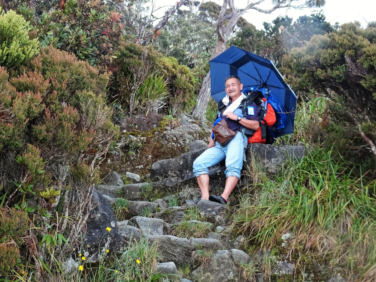
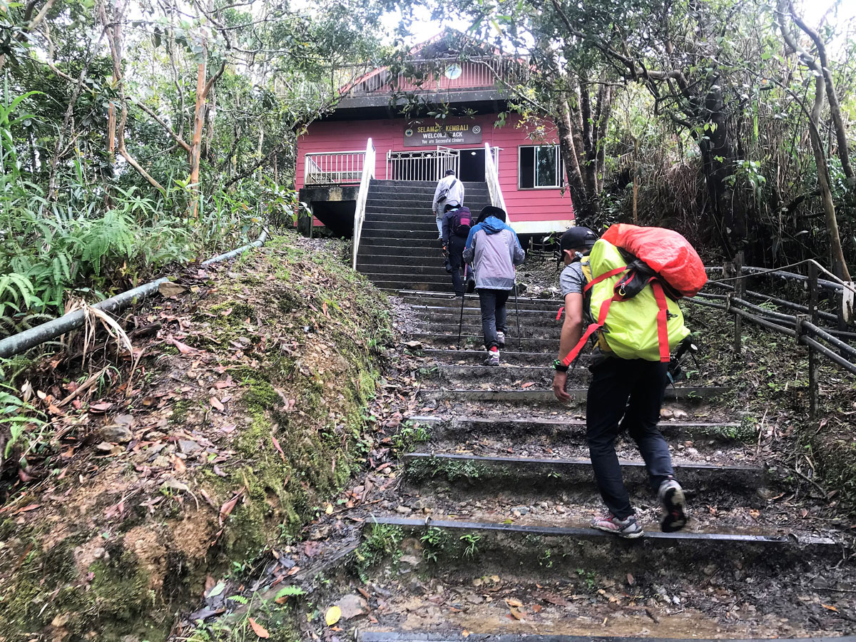
As we came around one bend in the trail, we found Dennis sitting beside the trail under an umbrella with a big smile on his face and our first views of the accommodation ‘complex’ and the Laban Rata Guest House ahead. We were soon beside a sign announcing we had reached Panalaban, 3272m, so we had climbed or rather ascended some 1406 metres or well over 4500ft.

Above the clouds.
However, as it was now 17:54 it had taken us over 8 hours and we were the last hikers on the trail!
David had a valid excuse with his back, but why on earth had I struggled up at a snail’s pace when I had told all and sundry this was no more than a walk in the park?
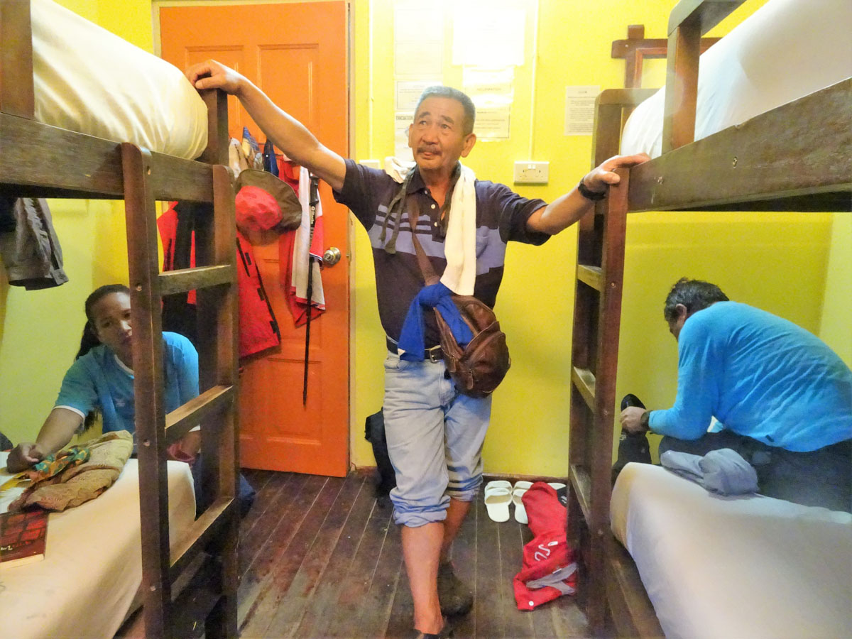
The set up was not dissimilar to an Alpine Hut, although the three of us were not in a dormitory as Dennis showed us to a small room with two pairs of bunk beds for the three of us.
Then it was to the communal dining room and to discover whether we would be allowed to continue the ascent as we hoped, or whether we had to follow the same guidelines as everybody else.
The standard program for climbing Mt. Kinabalu is that most people depart Laban Rata around 2am for the approximately 3 hour hike to the summit, and this means walking in the dark except for headlamps and torches. There is a check post approximately halfway at Sayat-Sayat and if hikers are not through there by about 0530, I understand they are turned around and not allowed to continue.
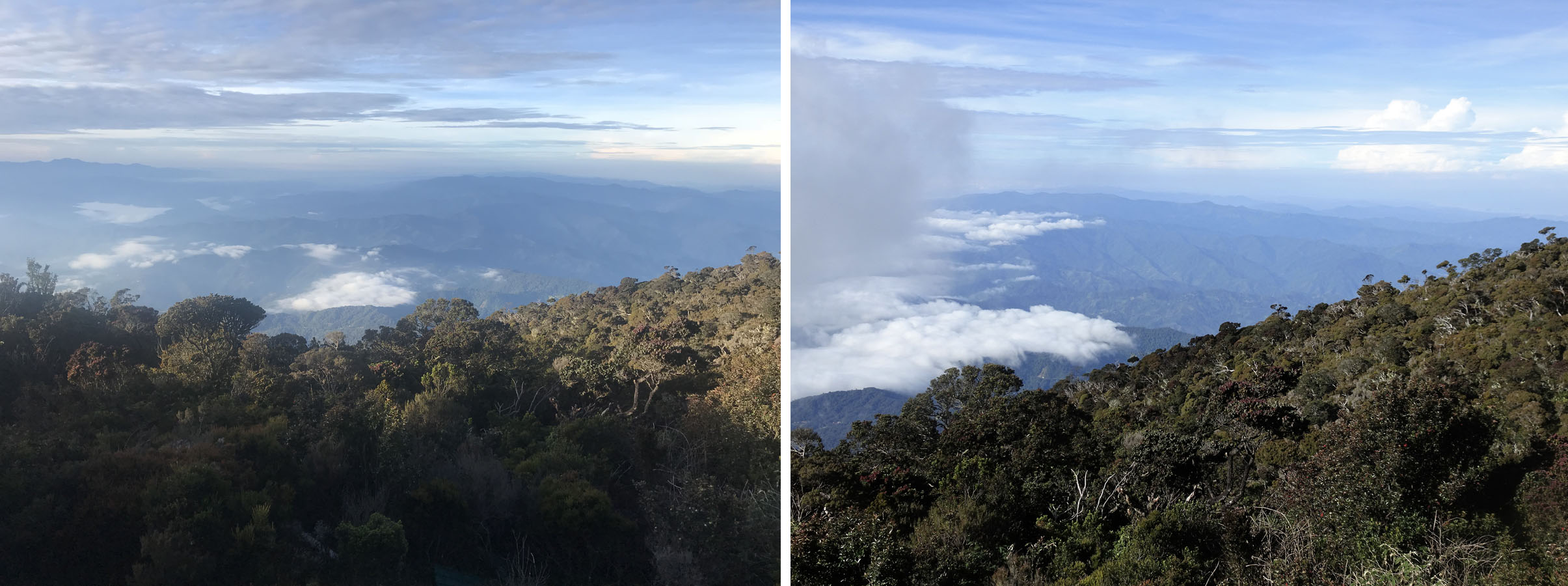
Morning over Sabah.
Most people arrive at the summit around 5 – 6am to see the sunrise and make their way back to the Panalaban area, and after a late breakfast or early lunch continue their descent and their Kinabalu expedition is a two day undertaking.
I have never been a sunrise person as that’s usually closer to the time I go to bed (!) but I can never get enough sunsets, and I had been keen all along to forget about the early start, leave around 0800, enjoy the views as we made our way to the summit, return to Laban Rata early afternoon and spend the afternoon relaxing or exploring the upper slopes of the mountain area around Panalaban, then spend a second night at the guest house and make a leisurely descent the following day.
However, all through the booking process I was unable to get a definitive answer as to whether this would be possible or not and I was referred from one department to another without getting a definitive reply or indeed any answer!
My motivation was not dissimilar to my plans when I had climbed Kilimanjaro with our daughter Lisa and nephew Daniel 12 years previously in 2006. If you ask most people about their Kilimanjaro experience, they will reply:
‘Great, except the last day was a real killer’
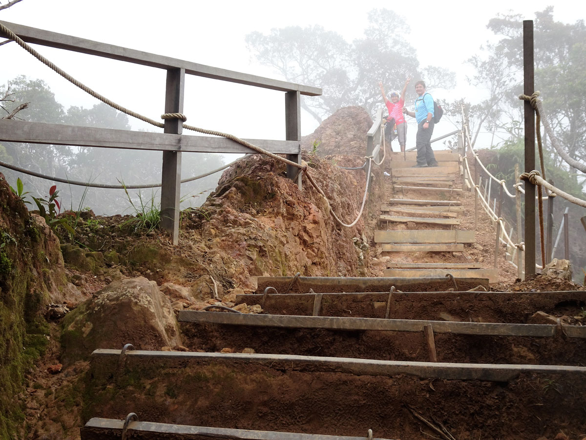
On our way back down.
and unsurprisingly so when the standard procedure is to leave the final Barafu Camp around midnight for a 5 – 6 hour 1000m plus climb in the dark to Stella Point on the crater rim, and then continue on to the summit for sunrise. It is then a 3 or 4 hour descent back to Barafu for lunch, another 3 – 4 hours descent to the trail head and a very long and exhausting 14 – 16 hour day.
When we climbed Kilimanjaro we left Barafu ay 8am, made the summit mid-afternoon, slept on the crater floor at 5800m and descended at leisure the following day after exploring the rarely visited Kilimanjaro crater floor. The porters were not exactly thrilled to be having to carry tents, food and fuel up an additional 1000m, but we had made it clear from the booking stage that was our plan. My nephew Daniel had a very uncomfortable night’s sleep because of the altitude and has never forgiven me!
However, there was no stumbling around in the dark, cold and windy night but rather a leisurely ascent where we could admire all the scenery around and below us, and we did not have a long day as we left the descent to the following day.
The same explanation was behind my proposal on Mt. Kinabalu.
So, whilst we were eating our dinner in the Laban Rata Guest House, Dennis went off to see the Senior Park Ranger to get permission for our hopefully later departure, which after all was the reason for our booking two nights in the first place.
Pondok Layang Shelter (2702m).
He returned to advise us we could leave at 5am and had to be through the check point by 8am, and when I was asked why we could not leave later I was told that if there was exceptionally heavy afternoon rainfall the streams could rise quickly and cut us off.
Unlikely, but it was what it was. So, by 10pm we retired to our bunks and after reading my Kindle I too, like the others, had a fitful night’s sleep and so it was not long after 5am we were making our way up a seemingly interminable series of wooden steps up and behind the Panalaban area.
I should reiterate at this point in the narrative, I am not an early morning person. I normally go to bed between 2 and 5am and sleep maybe 4 – 5 hours, but early morning and myself are not natural bedfellows – Well actually we are as I am always in bed at that time.
I love the mountains because as a Geographer I truly appreciate views and landscapes. I could see nothing.
I am not blessed with a natural talent for anything as I make my way through life, but I do have a fair amount of determination – if I set myself a target, however arbitrary I then have something to aim at.
As we climbed up, I could see nothing so could not focus on a tree or rock or point that I could aim to get to. I could see some isolated lights here and there ahead of us which I assumed were other late starters, but had no idea if they were a few hundred metres or a couple of kilometres ahead of us with no idea of scale or perspective.
Our guide Dennis.
I was probably tired after the previous day, it was dark, this was not what I had wanted to do. My mindset was wrong and whilst the reality was there was a mere 700m of fairly easy gradient to go and it would be light in 60 – 90 minutes I stopped and unilaterally said to the others:
‘I don’t feel so good, I am heading back to bed.’
In retrospect that was not very fair to the others and took them by surprise, but 20 minutes later I was back in my top bunk bed with the room to myself.
After an hour or so, as I was dozing, David turned up, but at least he had a legitimate excuse for giving up as his mobility was seriously impaired by a very painful back.
In retrospect, my giving up and turning around was not so fair on David, as I suspect I was a spur for him to keep going and he was probably thinking
‘If that fat bugger who is ten years older than me can do it, I am bloody sure I will’!
I said:
‘Well at least one of us will get to the summit’
as Ampai was a lot younger and much fitter than either of us. But two hours later, whilst still early morning, guess who had returned as well!
For many young Malaysians an ascent of Mt. Kinabalu is a rite of passage.
I had of course not taken into account that she was Buddhist and takes life as it comes and goes with the flow. She and Dennis had kept walking, watched the sun come up and she had taken photos and admired the views, but whether or not she got to the summit was of no consequence to her and enjoying the scenery and admiring the views was enough for her!
So, as we assembled back in the dining area for lunch with all those who had returned from the summit, I reflected that it had turned out to be rather more than just a stroll in the park and not one of us had made it to the summit. That was certainly not something I had seen coming!
Why had the climb been far more challenging than I had anticipated?
Was my pack too heavy?
Not really – I had carried a similar pack on a 16 day hike through the Alps 18 months earlier (See here ).
Was I not fit enough?
For sure it would have helped if I had been exercising more in the couple of months before our journey to Sabah. I am a lot fitter now four years later, as I have walked 5 miles a day more days than not for the last two years and in retrospect, I had hardly walked at all in the months leading up to Kinabalu.
Was I overweight? For sure as I am now 20kg/45lbs lighter.
And yes, the previous day had been tiring and I found the trail steeper than I had anticipated with lots of big steps, but I was hardly exhausted.

The lower slopes of Mt. Kinabalu are covered by dense equatorial rain forest.
Walking in the rain is not fun and I have never enjoyed walking in the tropics unless it is along the beach with cooling breezes. It is not a coincidence that although I have been an avid mountain walker for three decades and spent much of the last ten years based in Thailand, I have done very little mountain walking in Thailand or indeed in the tropics.
I love Nepal and the Himalayas but have never particularly enjoyed the approach hikes in the lower and warmer sub-tropical foothills of Nepal, or more recently the Cordillera mountains of the Philippines (see here).
Was age a factor?
I was 69 and had the altitude affected me? Much as we want to deny it, it is inevitable our performance deteriorates with age, and certainly more famous luminaries than me have been impaired by altitude with age; most notably Sir Edmund Hillary, the first to climb Everest (8845m) who was unable to visit schools he had built at heights of 3000m in the latter stages of his life.
Kev Reynolds the well-known British guidebook writer had to cross mountain passes on horseback, as he found the challenges of altitude became far more demanding with increasing years.
But in truth whilst I felt tired, I think that was due more to lack of fitness than the effect of altitude and indeed whilst some or all of these factors were significant, the reason I had quit was purely mental. All these small points, none important in themselves, had come together and I was not enjoying it, so I stopped.
We had paid for the second night’s accommodation, so we stayed at the rest house as planned and filled the afternoon with mindless chatter, reading and talking with other trekkers. We did not go out and do any further hiking in the area as in truth the Panalaban complex was more set up as a base camp for the summit ascent, than for exploring the surrounding area. But we took some pictures of the rocky upper slopes and the clouds below which rolled in obscuring the views over Sabah.
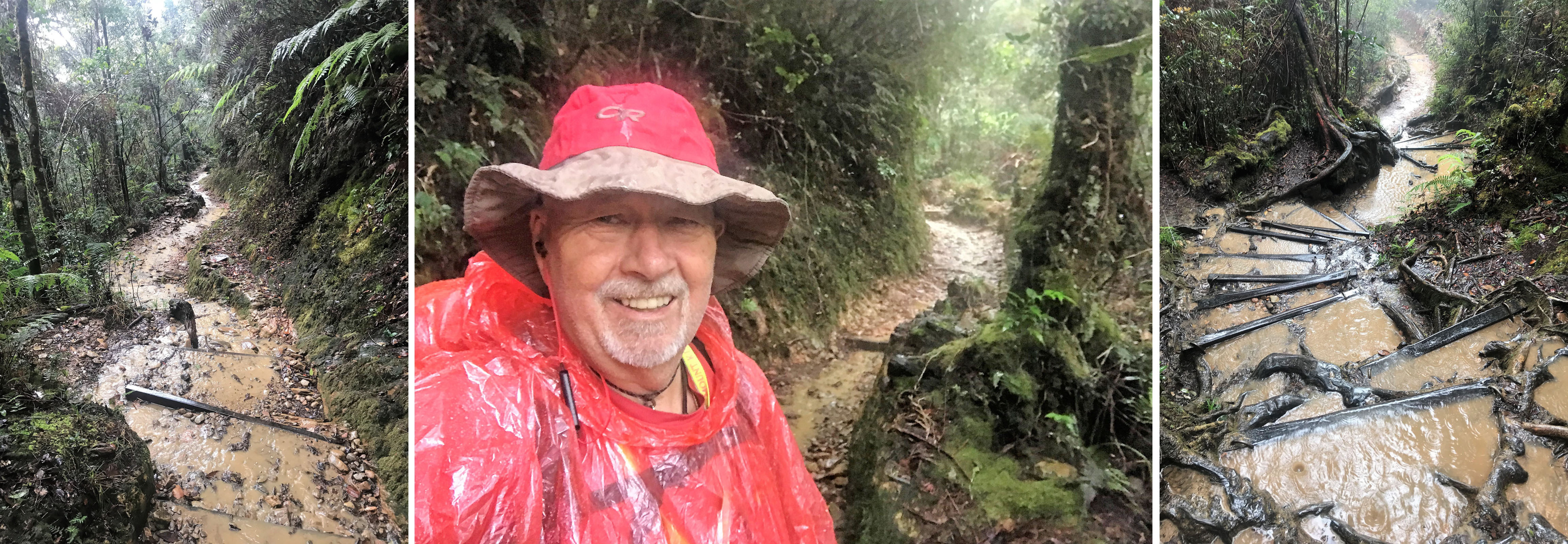
Heavy rain quickly turns the trail into a rushing stream!
The following day we had the rest house to ourselves for breakfast and were on our way down at 9am, after taking some pictures of the rocky upper slopes and the lowlands below dotted with some occasional isolated clouds.
As we descended, the cloud and mist were rolling in and we met hikers on their way up. We tended to stop at most of the shelters, to break up the monotony of the never ending descent over innumerable steps and by midday it had started to rain, and our plastic ponchos were out again, and the trail was transformed into a series of rushing streams and mini waterfalls.
We finally arrived back at the Timpohon Gate around 2:30pm, some 5 plus hours after we had departed from the Panalaban complex, and we said our farewells to the affable Dennis promising that when we returned for sure we would request for him to be our guide again. We grabbed some lunch in the cafeteria and arranged a minibus to take us back to the hotel in Kota Kinabalu to meet up with Tony and Nu, who had spent some time in Kinabalu National Park, as well as visiting one of the islands offshore from Kota Kinabalu.
Our mini expedition to Mt. Kinabalu was over but we had plans to explore some more of Sabah. So, the following day we all flew to Sepilok so we could visit the famous Orangutan Rehabilitation Centre. It was only after I returned home that I realised I had made the same trip with my wife and our children 21 years earlier!
With regular afternoon rain we soon understood why there were so many trailside shelters!
By this point it was obvious that David’s back was in need of a proper diagnosis and some urgent attention beyond a deep massage, however attractive the masseuse, and he changed his flight schedule to return to the UK as soon as possible, which he managed to do via a stop in KL two days after we arrived in Sepilok.
The remaining 4 of us continued to a Nature Lodge on the Kinabatangan River, where we made four river wildlife watching trips and were fortunate enough to see several orangutans in the wild.
Then it was time for Tony and Nu to return to Thailand and their golfing pursuits. Having known Tony for well over 30 years, I was well aware that amongst all the many differences between our personalities is his preference for shorter trips, and mine to maximise the time away and get as much bang from my buck once I have made the decision to go anywhere.
So, after Tony and Nu departed, Ampai and I continued to a second nature lodge on a different stretch of the Kinabatangan River that we had all to ourselves, where we viewed more orangutans, a zillion Proboscis monkeys and a series of spectacular sunsets, before making our way to the somewhat daunting port city of Semporna (or was it just the area where we stayed that was daunting?). We then transferred to Mabul Island for some spectacular snorkelling, which included seeing giant tortoises below us when we were snorkelling above the edge of the ocean reef.
Then, we made our way back to Thailand via three nights in Kuala Lumpur where in addition to some sightseeing I was able to retrieve Tony’s lost phone.
Finally back at the Park entrance.
And what about Mt. Kinabalu?
David has continually reminded me that we have ‘unfinished business’ there and have to go back. My initial thoughts that not really enjoying hiking in the tropics was the reason the trip had a disappointing conclusion for me were because I had just assumed it was an easy walk. I was not as fit as I could and should have been and as a result was not adequately prepared either mentally or physically.
My response to David was:
‘If we go back, we should go after a summer of hiking on the Alps or immediately after we do a Himalayan trek because we need to be properly fit.’
Indeed, 10 months later David and I completed a 12 day trek to the Annapurna Sanctuary (see here) in the heart of the high Nepalese Himalaya and higher than the summit of Mt. Kinabalu. So neither the altitude nor David’s back was a problem, but in contrast to Mt. Kinabalu I knew exactly what I was getting into having made numerous treks in the Himalaya, including an earlier visit to the Annapurna Sanctuary.
And back in Kathmandu after the Annapurna Trek, I commented to David that as long as I was fit and now knowing what bothered me last time, preparing for it probably meant that Mt. Kinabalu would and should be attainable for both of us.
But, another three years have passed, Covid has put most travel plans on hold. Although, I was able to manage one more Himalayan Trek in December 2019, pre-Covid, and spent much of September – November 2021 hiking in the Alps.
It has taken me over 4 years to get around to writing this account of our somewhat underwhelming visit to Mt. Kinabalu and that also means I am 4 years older! Any return visit to Mt. Kinabalu was always going to be more a result of David nudging me, rather than for my own aspirations given my aversion to hiking in the tropics (‘Jeez walking up mountains is hard enough without the heat and humidity’).
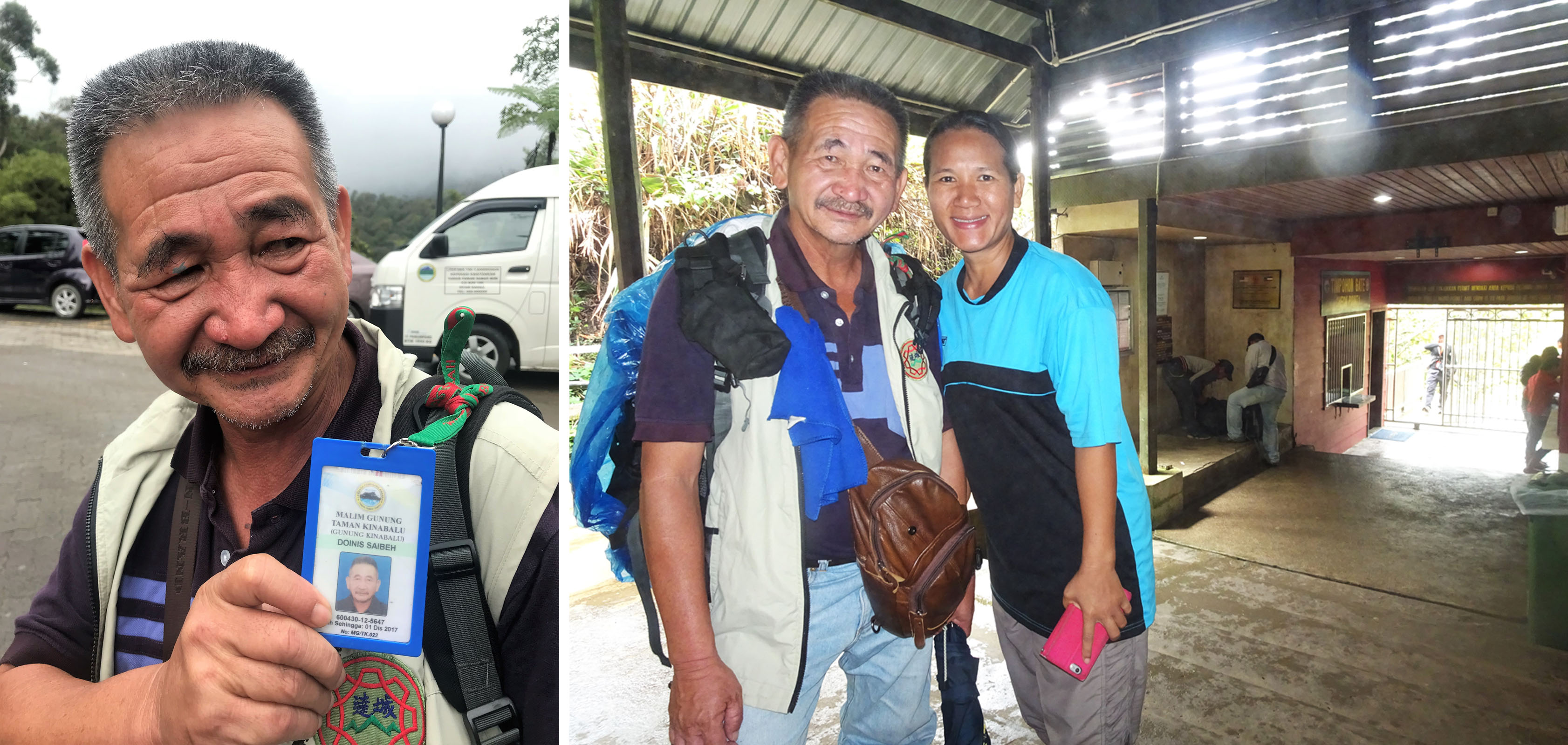
Farewell to Dennis.
On the other hand, writing this article has made me think – it really should not be that difficult. So what if I am 73 as I am now much fitter, have lost 20kg/45lbs and it should be fine if I am properly prepared?
David also has two new knees and has had surgery on his ankle, so he should be akin to a newly minted bionic man!
His back turned out to be a severe muscle spasm, probably set off by carrying a heavy bag around Thailand!
So, it’s really just a case of:
1 Make sure I am fit.
2 Going after an extended period of hiking in the Alps – October 2022 or 2023?
3 Be aware that the first day is a steep 1400m climb and think of it as four mini 350m ascents.
4 Start earlier to avoid the rain and have a towel to hand to mop your forehead.
5 Accept you have two hours in the dark on the second day – that’s 3 ‘Desert Island Discs’ podcasts to fill the time, and then you will be able to see all around you and where you are walking towards.
Unbowed and smiling. Will we be back to try again?
So, although returning to Mt. Kinabalu was not so high on my bucket list (and especially as after two years of Covid, any travel plans have been questionable at best), maybe it is now an option to be considered?
Over to you David!
© Michael Bromfield
